Well, yesterday turned out quite nice as sunshine broke through the clouds and had some staying power through the afternoon. Sure it was cool at the coast, but pretty typical for the time of year.
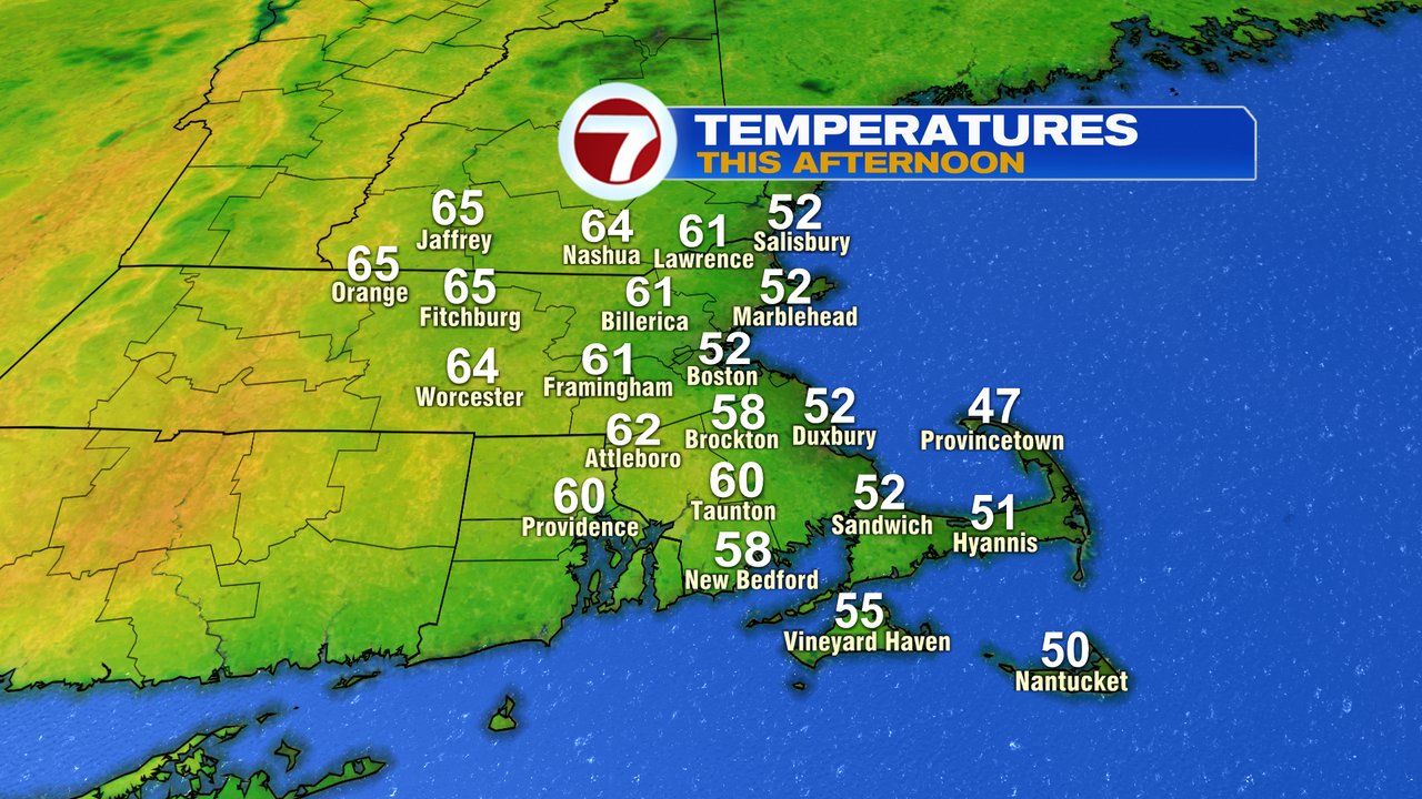
This morning, any few brief showers and sprinkles yield to developing sunshine as highs once again head for the low to mid 50s at the coast and into the low to mid 60s inland again. Overall, it’ll be another solid afternoon.
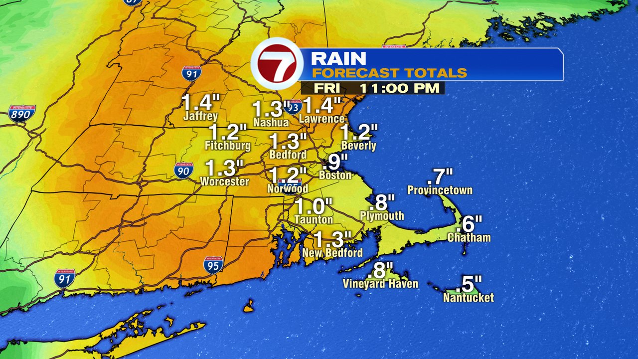
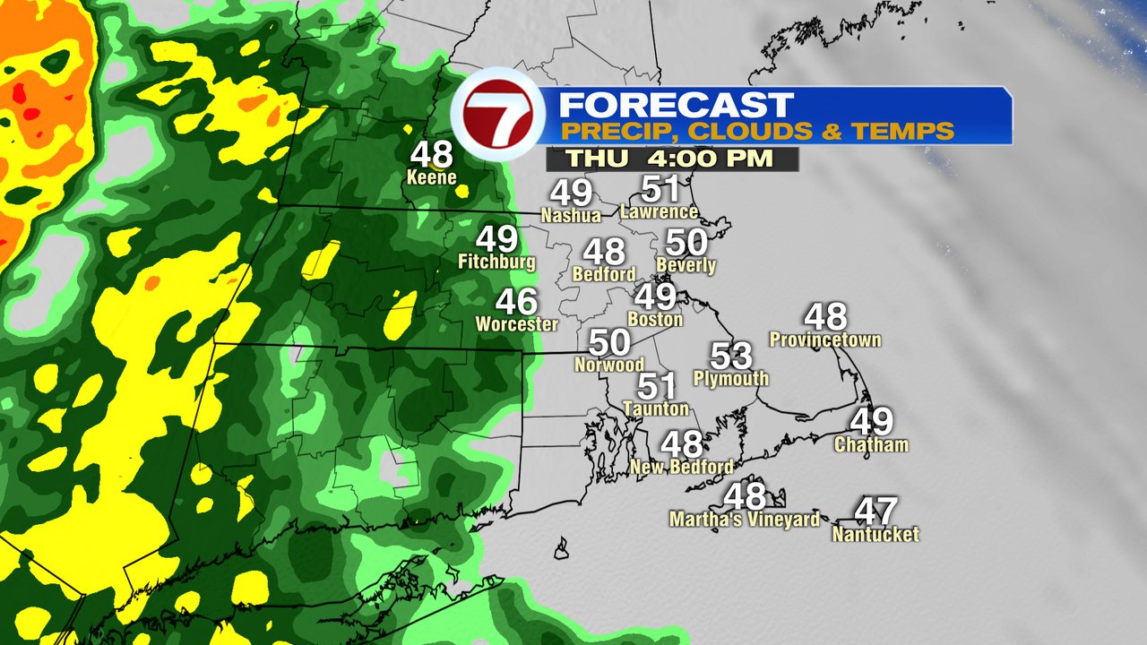
Tomorrow, the weather goes downhill with showers arriving west of 495 in the afternoon. Across eastern Mass, the rain starts by the evening as the storm kicks into gear. Winds increase overnight, gusting 30-40mph, strongest at the coast. As cold air works into the system, rain flips to wet snow across the higher terrain of interior New England. It’s a heavy, wet snow storm for the Berkshires and Green Mountains, where 6″+ is likely to fall. Across the Manadnocks, at least several inches of snow is likely, with some accumulating snow even down into the northern Worcester Hills.
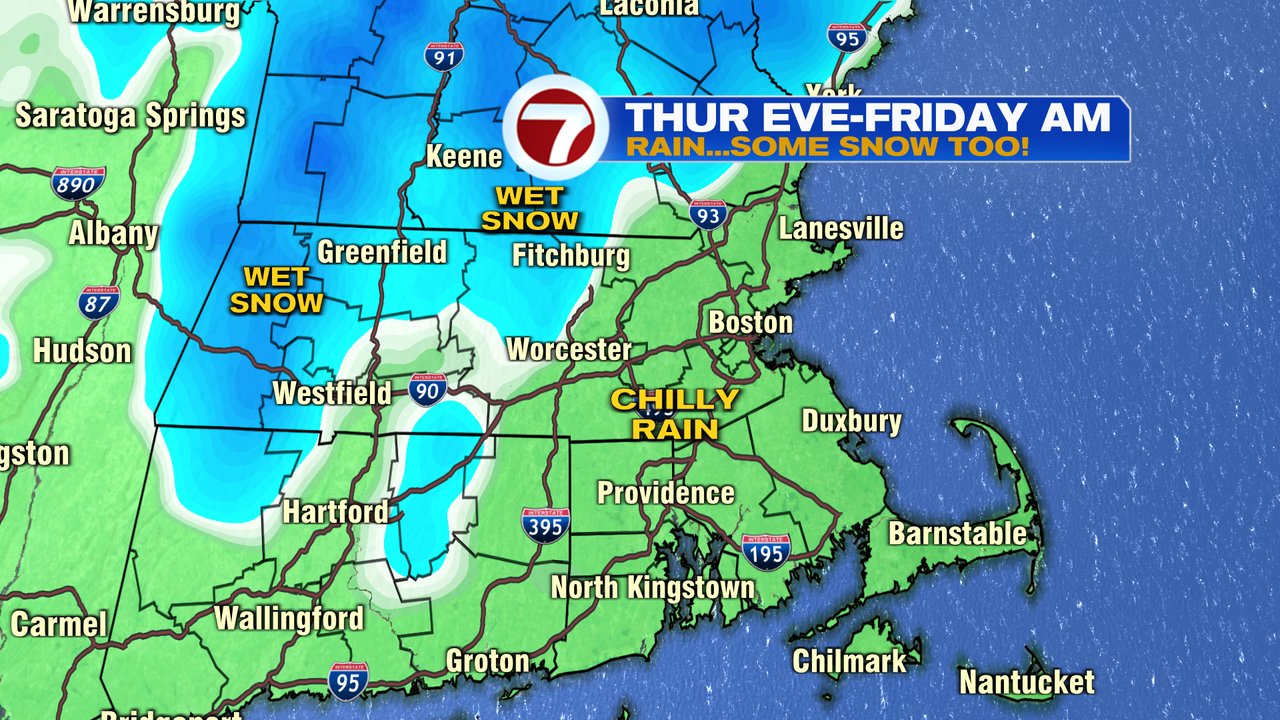
For many of us, it’s more about the cold rain and gusty wind. The rain will be beneficial, 0.75 – 1.50″ for much of the area. That rain tapers off by Saturday morning, allowing for a seasonably cool, but mainly dry weekend.