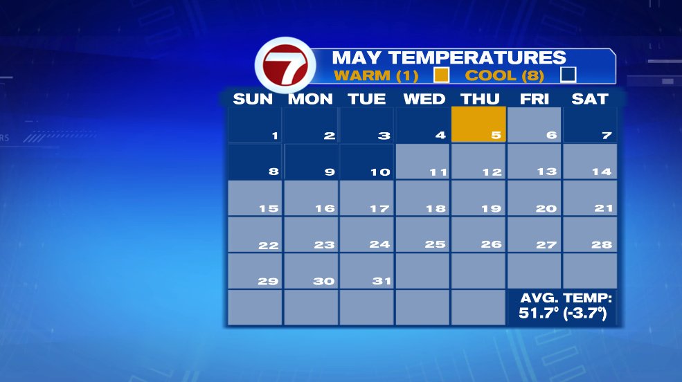
Chilly and windy seem to be the themes this May so far. In fact in the first 10 days of the month, there has been only ONE day that that above average. And before that? You have to go back to April 22nd for the last above average day before that. Spring in New England. Am I right?!
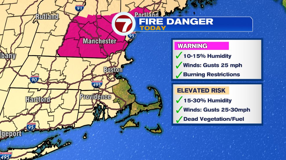
The wind has been more than just a nuisance for us, it’s been increasing our brush fire danger for the last several days. Those gusty winds combined with a lot of dead vegetation on the ground and extremely low humidity are perfect conditions for a fire to spark and spread rapidly. So be careful with any sparks, flames, grilling embers, cigarette butts, etc.
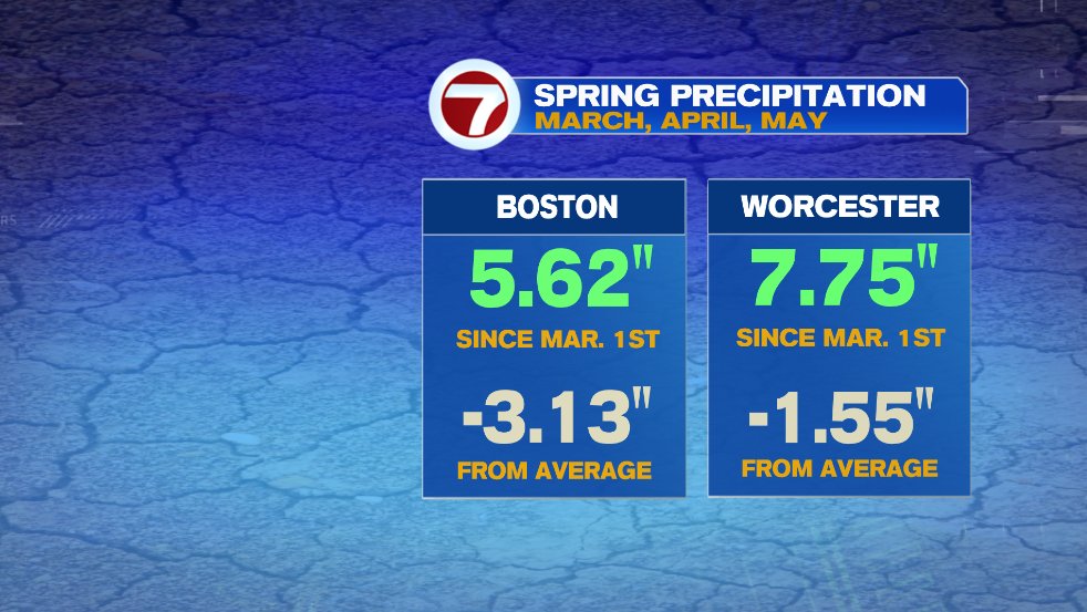
What we could use is one of those ugly gray days with a persistent light rain. In just the spring months (March, April, and May) Boston is over 3″ below average in the rainfall department! Things are a little better in Worcester, but still not great.
Tomorrow will bring more cloud cover and even some patchy drizzle or sprinkles on the coastline. But it won’t be enough to make any dent in the water deficit.
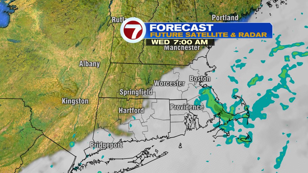
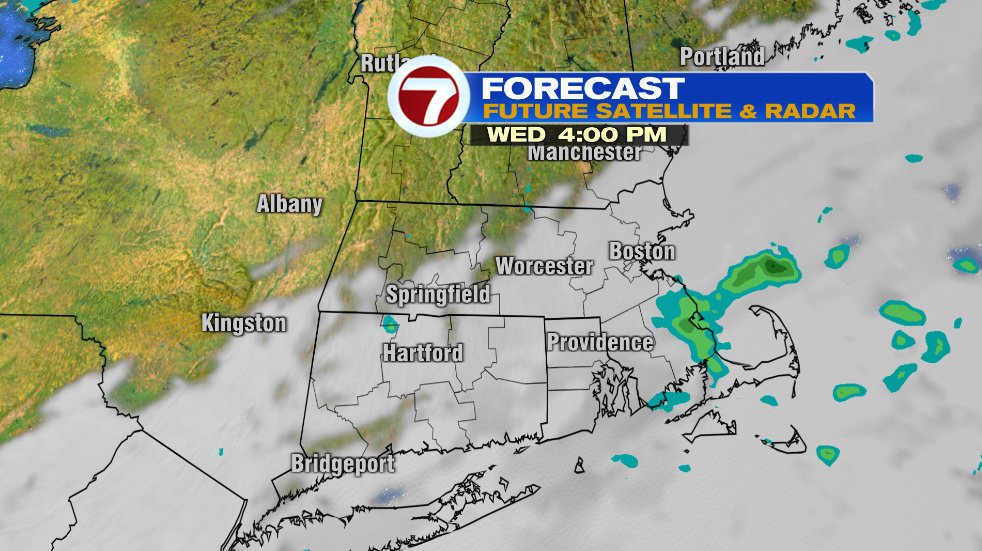
With the drizzle and sprinkle chance we’ll keep the cool and breezy conditions for one more day. Wind on the coastline will still be breezy but I think everyone will notice a big drop in the wind compared to the last few days. No, it won’t be dead calm, but it’ll be better. That wind will continue to push that cooler ocean air in from the northeast and keep coastal temperatures cool again for tomorrow. It won’t be a warm day inland, but it’ll be better than the coastline.
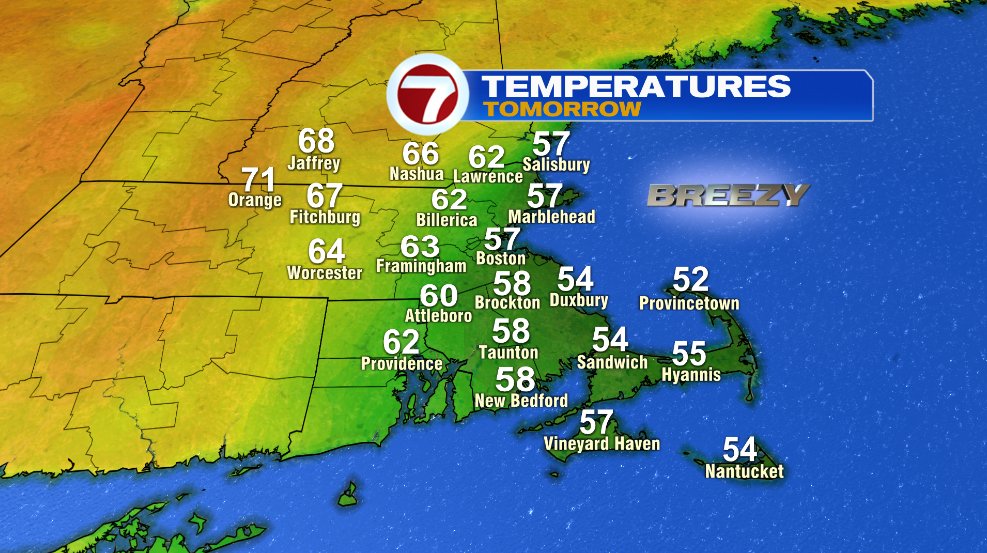
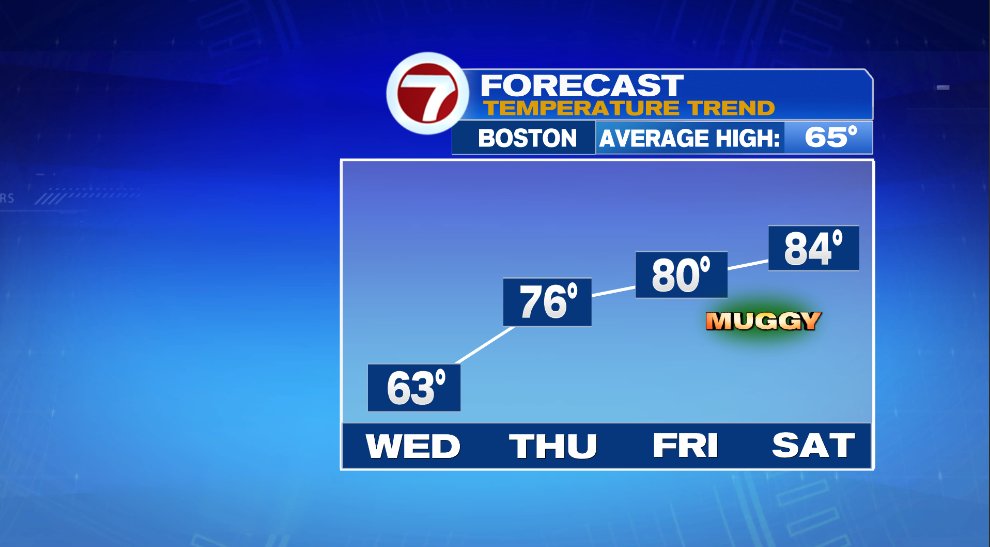
Once we get through tomorrow we’re going to turn things around big time and head straight into summer by the weekend. And it’s not just the temperatures that will be going up, you’ll probably notice a little bit of humidity in the air by the time we get to Saturday.