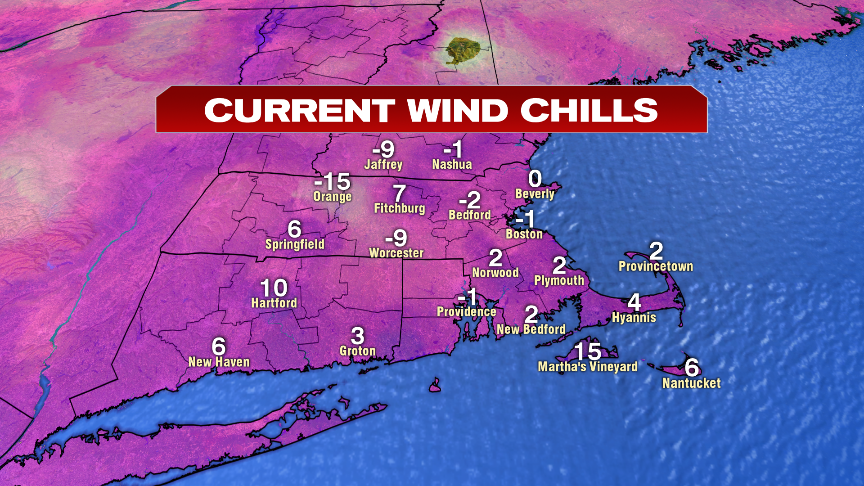
It’s another cold start with a stinging breeze this morning as wind chills run below zero for many towns and cities. Below is a sample of 6am chill that ran at -9 in Worcester and -1 in Boston.
Temps recover to the mid to upper 20s this afternoon under a partly cloudy sky, that on occasional, will produce a passing flurry or spot snow shower. With winds gusting 20-25mph today, wind chills stay in the teens, making it feel more like January than early March.

The trend is our friend though as highs tomorrow recover into the mid to upper 30s and then near 40 on Saturday. That will promote fantastic afternoons for the kids to hit the sledding hills or the ski slopes.

Despite the nice Friday and Saturday, Sunday does turn unsettled with a brief morning mix of snow/ice going over to rain showers.

Next week looks milder across the East Coast with temps near to above average here. That means lots of 40s and 50s for highs next week in Southern New England, with the mildest air likely late in the week. Unfortunately, when you see a pattern like the one below, it also promotes severe weather across the middle part of the country, so tornadoes and wind damaging thunderstorms will be likely at times there.

Have a good day.
https://twitter.com/clamberton7