Well we sound like a broken record in the weather department but today was another well above average day in Southern New England. But the end is near for this warm month as temperatures by the weekend may FINALLY dip below average a day or two.
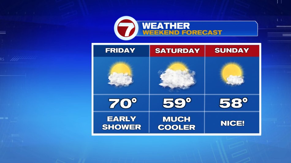
There’s cool air lurking. The first cool down isn’t extreme. The cold front stretching through the Ohio River Valley is more of a “cool” front as highs will only fall by about 5 degrees, sending us back to near 70 on Friday. It’s a narrow line of spot showers that will drift through early tomorrow morning — like 6 or 7am. So there’s a small shower chance early in the day otherwise we’ll finish out the work week mild and dry. But behind the center of low pressure (currently over Michigan) is a real shot of fall air that will arrive for the weekend.
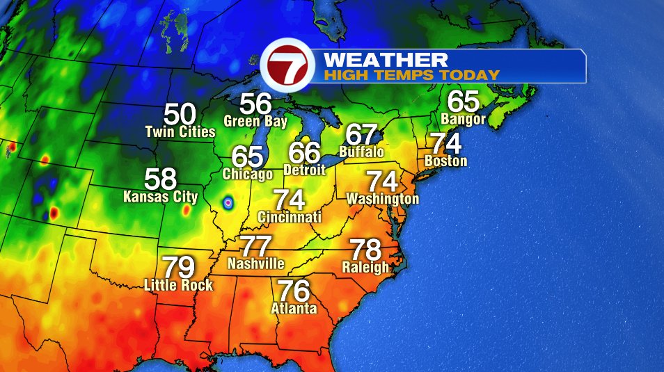
You see temperatures behind the first cold front today still climbed to the upper 60s. But behind the low, highs struggled to even make 50 in Minneapolis. You’ll see that reflected on our temperatures too. We’ll still be near 70 on Friday but then 50s for the weekend and next week.
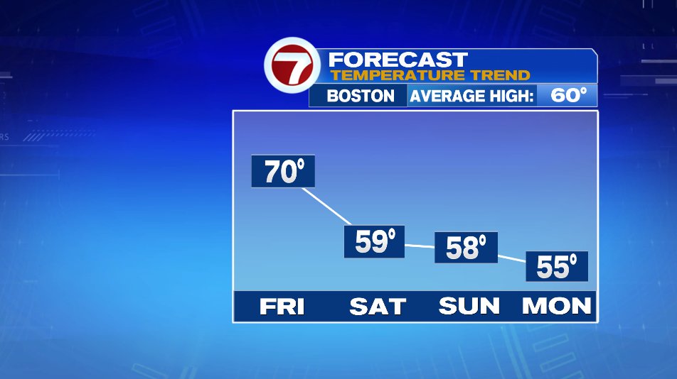
As mentioned above, there’s a small shower chance (and early in the day) on Friday and again maybe a spot shower on Saturday. But the chances are like 10% so it’s not much to write home about. The bigger thing you’ll notice is that temperature drop. Saturday will be a cloudier day with sun returning for Sunday.
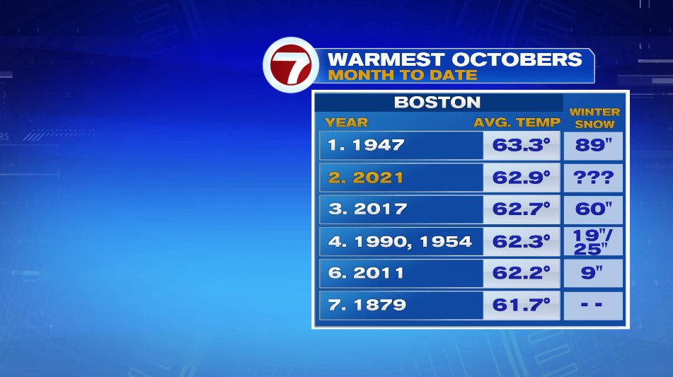
October to date is currently our 2nd warmest October on record. So we did a little research to see how those winters shaped up… and well about everything followed. 1947 was a blockbuster year with almost 90″ of snow! But other years like 2011 and 1990 didn’t even see 2 feet. So stay tuned for more winter forecast updates…. JR has his winter outlook that he posts in November!
