How about that weather yesterday?! Pretty much top 10 stuff with lowering humidity and temps in the low 80s during the afternoon as a mix of sunshine and clouds prevailed. Today, it’s a similar feel to the air as dew points stay in the 50s and highs head back up toward 80 degrees. Clouds will increase from south to north today with the sunshine becoming more filtered and faded out by this afternoon.

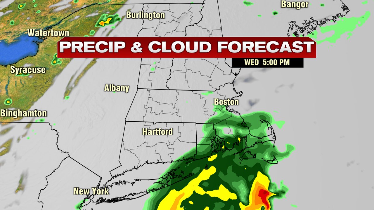
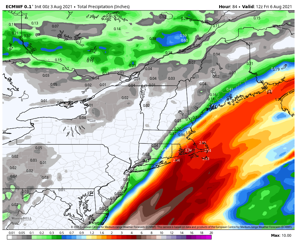
We start dry tomorrow, but the risk of showers does go up in the afternoon, especially across Southeast Mass. That start a period of unsettled weather at times through Thursday night. While it won’t rain the whole time from tomorrow afternoon through Thursday night, there will be locally heavy rain at times near and east and southeast of I-95. By the time the rounds of rain wrap up, 1-2″+ are possible across Southeast Mass with much lower totals likely northwest of I-95.
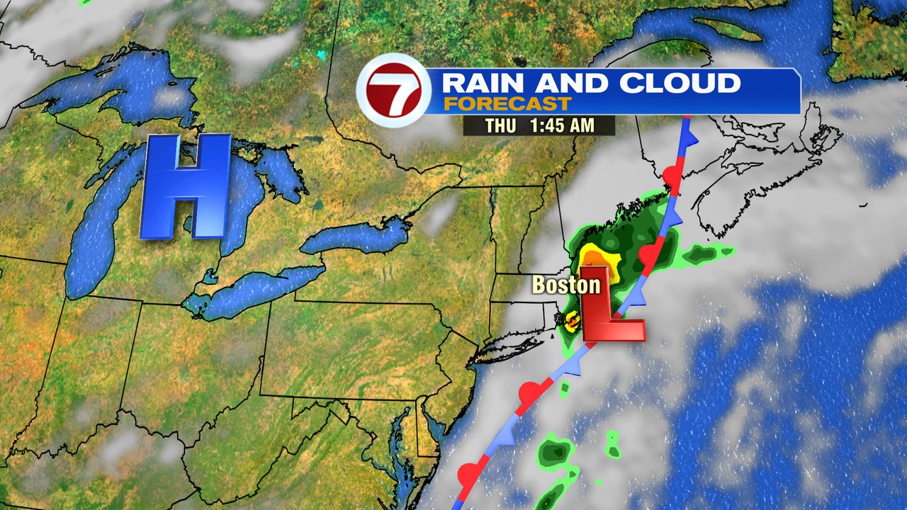
The good news is that as we end the week and head into the weekend, the pattern looks warm and mainly dry. Rain ends early Friday morning as sunshine returns by midday and temps warm into the mid 80s. It’ll be muggy too.
Warmth and humidity stick around Saturday and Sunday with highs 85-90. A few isolated storms fire inland Sunday afternoon, but much of the time is rain-free.