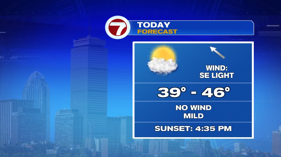
The headline says it all. Enjoy today. We’ll have temperatures in the 40s, a mix of clouds and sun, and no wind. It really is a beautiful winter day but it’s especially nice after a windy and cold week and more “ugly” weather Friday thru Monday.
We’re watching two different systems. One Friday and one Monday. The Friday storm will graze us and we’ll see fringe effects. The Monday storm is running right through New England.
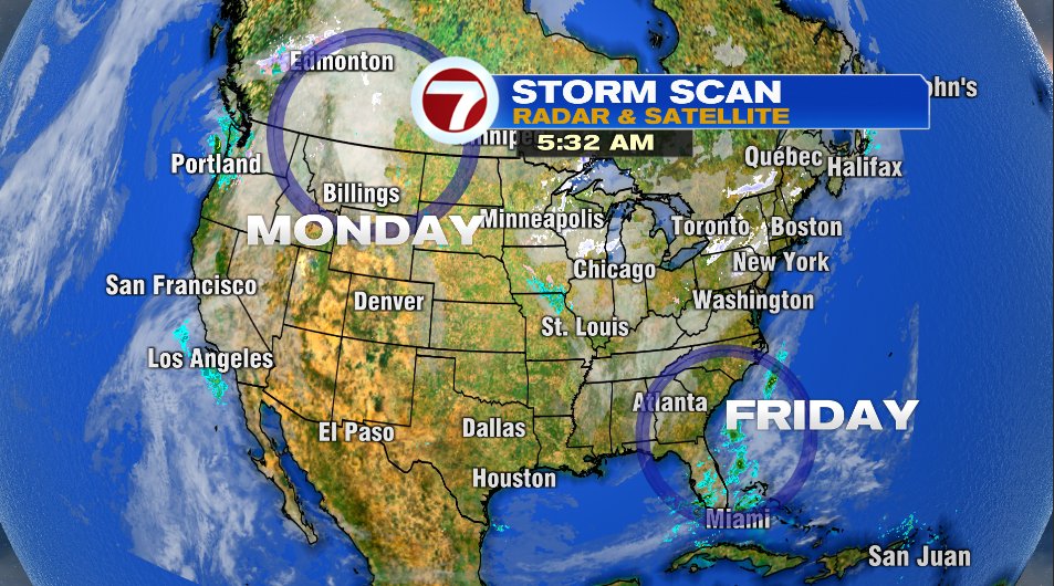
FRIDAY:
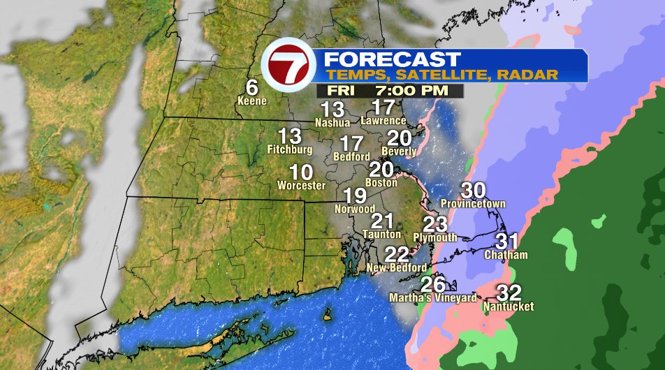
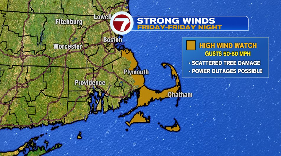
Friday is not bitter cold, but it will be windy. Those winds will be a cold wind and the “winds of change” that WILL bring in another blast of cold for the weekend. Anyway, that system will graze us offshore. It’s close enough that we will feel fringe effects from it.
- Windy conditions will be what most of us notice on Friday. It will be especially windy on the South Shore, Cape, and Islands where a High Wind Watch is in effect for wind gusts that could hit 60 mph.
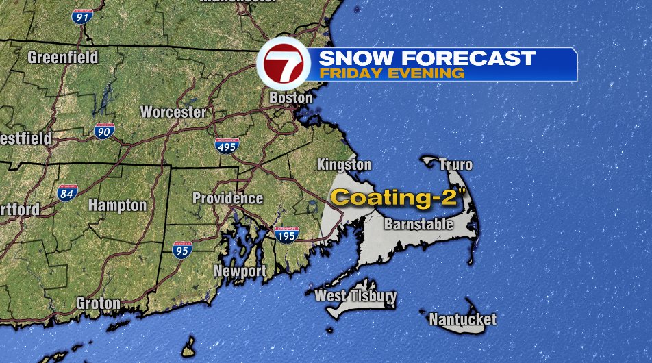
- While a lot of us along the coast may SEE snowflakes, only a few of us will see that stick. If you’re between Plymouth Bay and the Canal, you might get a coating of snow. If your on the Cape side of the Canal 1-2″ is possible. It’s not a blockbuster storm but if you have Friday evening dinner plans keep that in mind.
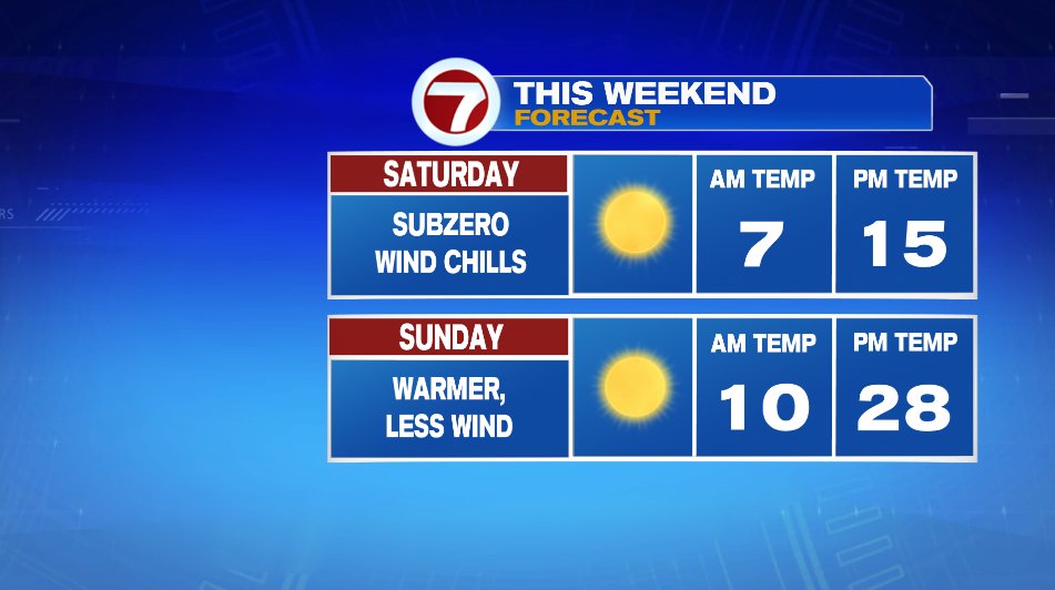
THE WEEKEND:
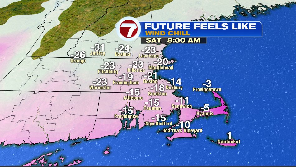
Behind that Friday system prepare for another blast of arctic air. This one, at least wind chill wise, will be colder than the one earlier this week.
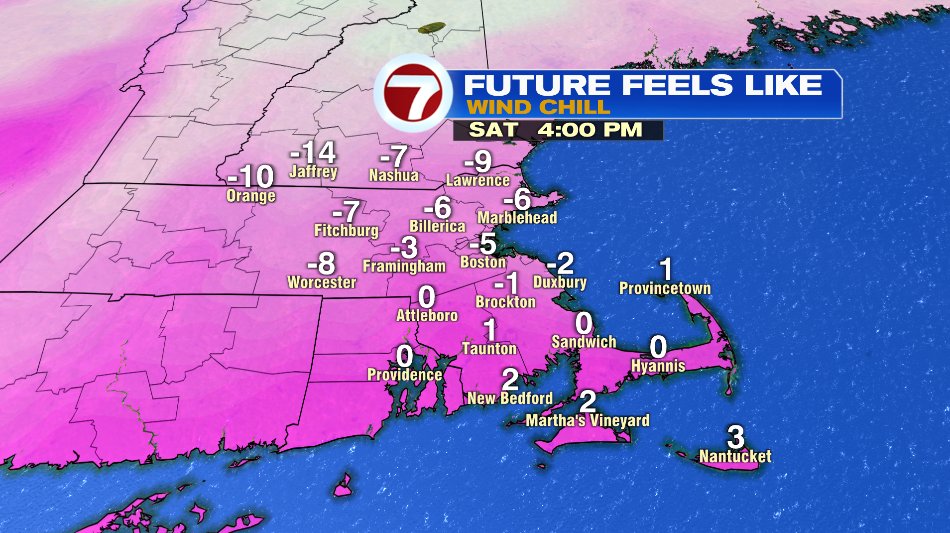
- Saturday: Sunshine, air temperatures in the teens. Saturday morning will have wind chills -15 to -25°. Saturday afternoon will have wind chills 0 to -10°.
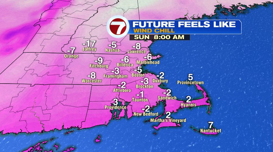
- Sunday: Sunny, warmer, and less wind. We’ll still wake up Sunday morning to wind chills slightly below zero.

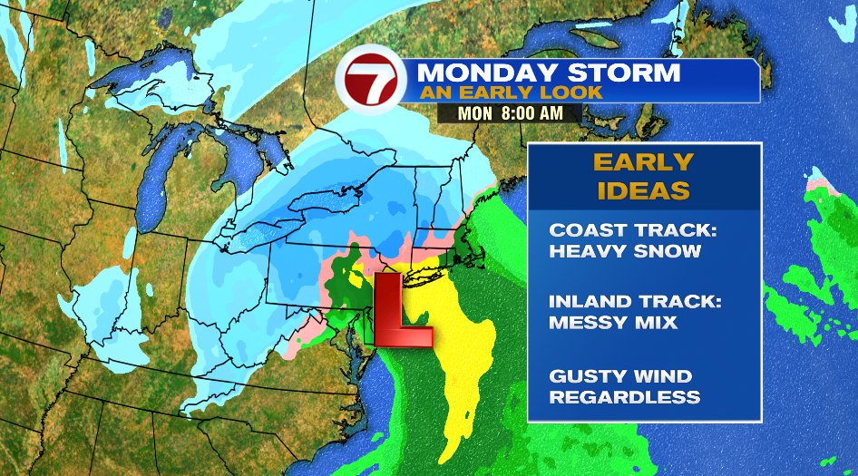
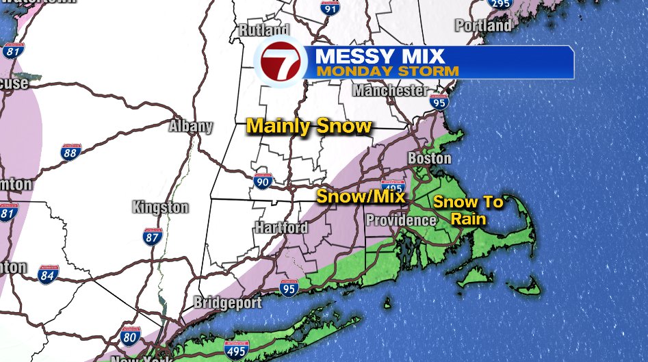
MONDAY:
Monday’s storm still looks on track timeline wise, but the trend has been a more inland storm, thus a “warmer” storm, and more of a “messy mix” scenario versus all snow and heavy snow. That said, we’re still five days out so that could change, but that is the TREND so far.