A cold front continues to slide southward, traversing the region today. A spot shower cannot be ruled out through the afternoon today, but these do not appear to become severe.
A few of these could be heavier downpours, but these should hold off until around dinnertime, for SE MA and the Cape, so overall the bulk of the daylight hours will be dry.


Heading to the beach? An onshore breeze will kick in- keeping temperatures slightly cooler than the highs inland.

This evening, heads up, it’s the last 8PM sunset of the year, at least until mid-May of 2020.

Tonight, the cold front clears the area and moves out to sea, ushering in a much less humid airmass, mainly clear skies, AND much cooler temperatures. A great night to turn off the AC and open the windows as lows slip back into the mid to upper 50s for southern NH, and central MA, around 60 for those in the Merrimack Valley and within the 495-corridor.

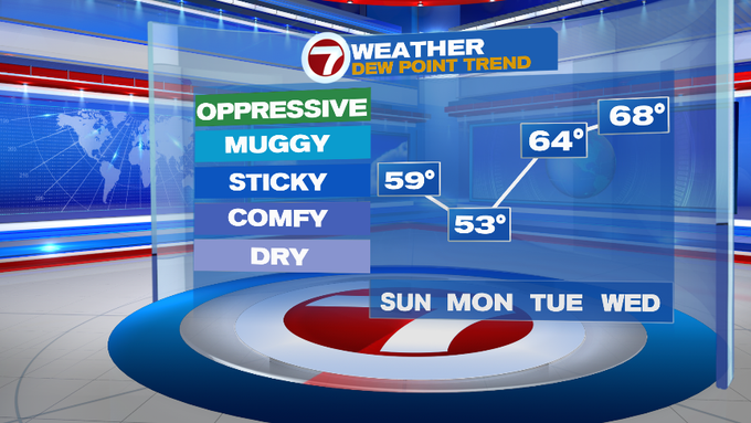
Cue the picture perfect start to the work week with highs into the upper 70s to low 80s, mainly sun-filled skies and low humidity.

It’s the pick of the work week since dewpoints will be on the rise along with the shower/storm chances by midweek.

Thunderstorm chances stick around for Thursday afternoon before drying out by Friday. Dry conditions seem to prevail as we head into next weekend, too!
