There’s a lot to cover in the blog tonight, we’ll start with the Super “Pink” Moon happening tonight! First, let’s set the record straight… the moon will not be pink. The full moon each month has a different name, generally relating to nature in some way. April’s moon is the pink moon because of pink wildflowers that start to bloom with the warming weather.
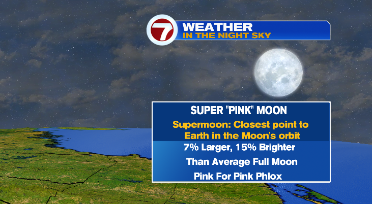
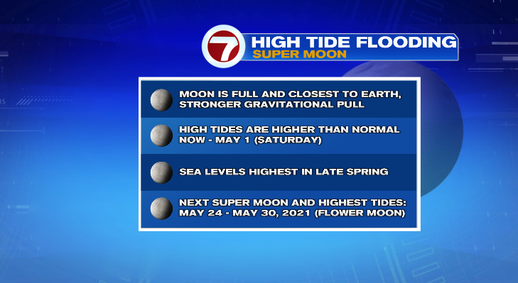
Skies will stay clear tonight so sky gazers and photographers will get a good look at the Pink Super Moon tonight! But there are “side effects” to Super Moons, especially in the spring seasons. Moons become “super” because they are closest to Earth in their orbit. And because it’s closer, they have a stronger gravitational pull.
Yes, the moon pulls things toward it just like Earth does. But because Earth is so much bigger the gravitational force dwarfs what the moon does. But that little bit of extra pull from the moon “pulls” the ocean water toward the moon ever so slightly which creates higher high tides! (Sorry for the physics lesson).
So if you live on the coast, high tides will be higher for the next few days. And it’ll happen again in May for our next Super Moon, the “Flower” moon at the end of May.
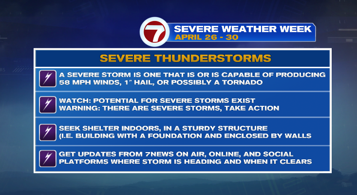
Before we get to the forecast, one other thing to touch on is Severe Weather Awareness Week! And today’s topic: Severe storms.
A few important things to note: watch versus warning. A watch means conditions are right for strong to severe storms to develop. A warning means a storm is currently severe or a current storm has the capable of being severe at any moment (per the criteria on the graphic below). When a warning is issued, be sure to seek shelter in a sturdy structure. And one thing not noted below, is to make sure you know what COUNTY you live in. Warnings are issued for COUNTIES not CITIES. So find out what county your city is in.
Ok, now on to the forecast.
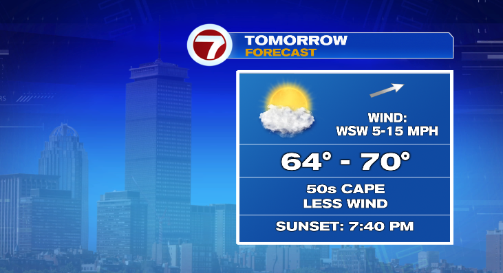
Tomorrow looks great, it’s the pick of the week. A few clouds but still some sunshine. Temperatures in the upper 60s. It will be just breezy enough to hold off the sea breeze without being obnoxious like it was today. Unfortunately for those of us on the Cape, that slight southwest component will cool us to the 50s tomorrow afternoon.
The second half of the week is more unsettled, however no day is a complete washout. There are a series of weak areas of low pressures that will slide through the area. None of them are powerhouse storms or all day washouts. But each one will throw a few showers our way each day for Wednesday, Thursday, and Friday. Right now it looks like the wettest day will be Thursday.
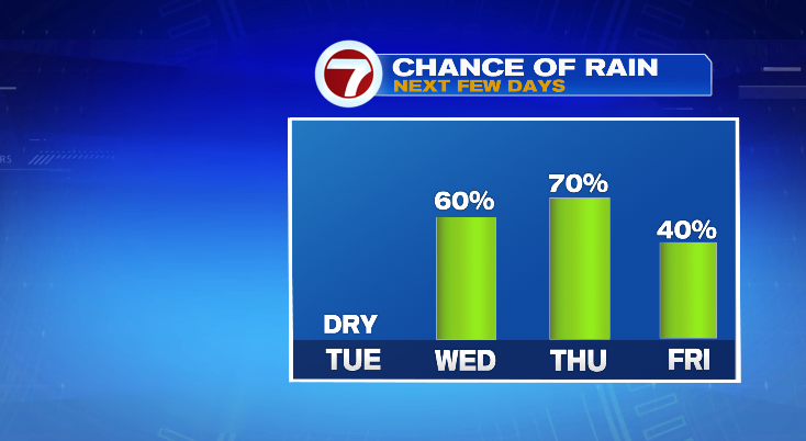
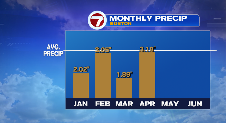
The rain is welcomed. We are now below average for rainfall for every month so far in 2021. As we head toward the end of April, a few tenths of an inch over those three days may actually pull us to coming out right about average and (fingers crossed) maybe slightly above average.