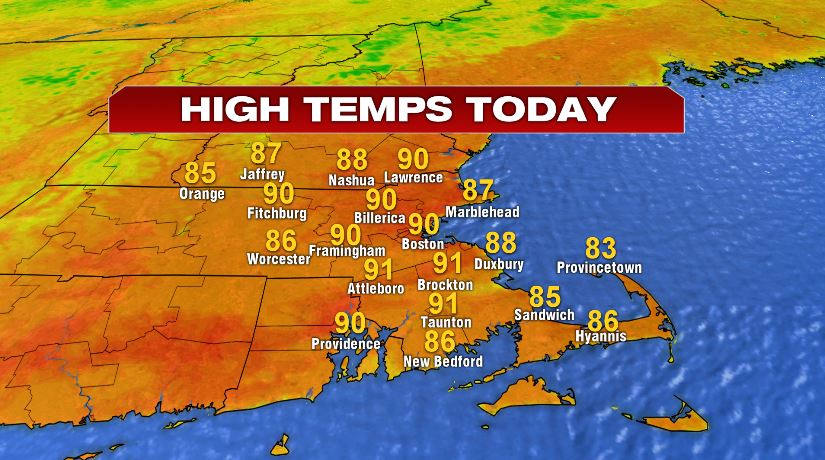
The heat and humidity back in full force today. Highs today will climb to near 90 for a lot of us and that doesn’t account for the humidity. With the storms that pop up this afternoon, they’ll be very isolated, only affecting about 10% of us. That said, if you do get hit by one of them, expect a good downpour with all of the moisture/humidity in the air today.
If you’re heading to Gillette tonight, we’ll have to watch for the pop up storm through the late afternoon and early evening. We’ll get a break and then more rain pushes in as we head to the midnight hour. That rain will likely linger into your Friday morning commute.

The overnight showers are associated with a cold front and man will we feel it after today. Highs will fall from near 90 today, to near 80 on Friday. Remember we’ll have morning clouds/rain Friday with sun developing in the afternoon. Saturday is by far the pick of the weekend with highs in the mid 70s and a lot of sunshine. Sunday, however, will feature a lot of clouds, perhaps a sprinkle, and temperatures will struggle to hit 70°.

If by chance on Sunday we don’t make it to 70°, it would be our coldest day since mid June! The last day we had a high temperature stuck in the 60s was June 13th… 70 days ago! That goes for Boston, Norwood, and Bedford.
