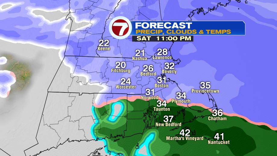
7Weather- A fast-moving system drops a couple to several inches of snow tonight, and then it’s dry with some sun Sunday.
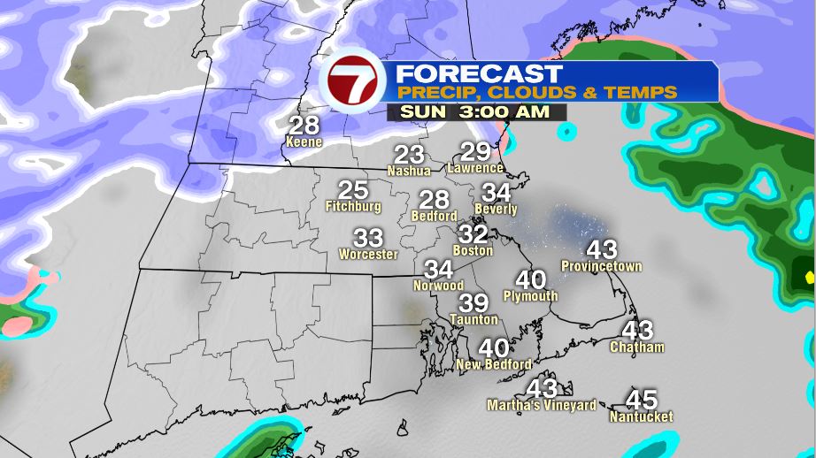
Steady snow continues until 11 PM tonight for areas south of the Pike, and until 12-1 AM for towns north of the Pike. Most of the precipitation is out of the area by 3 AM .
There haven’t been any changes to the snow map, with the higher accumulations north and west of I-495.
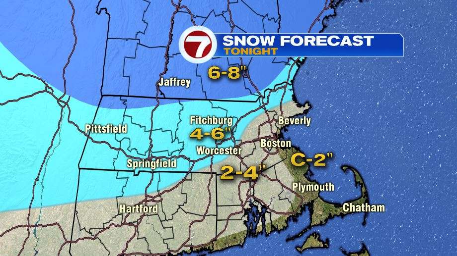
Travel will be poor outside of the city for several hours tonight. It’s not a whole lot of snow, but just enough to make travel difficult.
Back roads will be snow covered by sunrise Sunday in Worcester County, southern New Hampshire, and the Merrimack Valley. Main roads will be slushy in the morning.

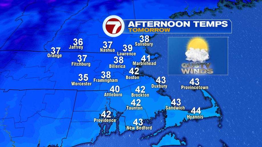
Sunday temperatures are looking good. We’re not talking a blast of cold air behind this system. Highs make it into the upper 30s to low 40s.
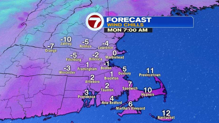
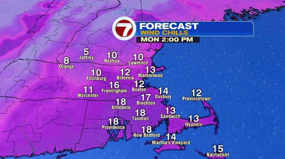
The cold blast of air comes in to kick off the week. Monday morning wind chills will be around 0º in Boston, and 5 to 10 below zero in Worcester County, southern New Hampshire, and the Merrimack Valley. The afternoon feels like temperatures will be in the teens.