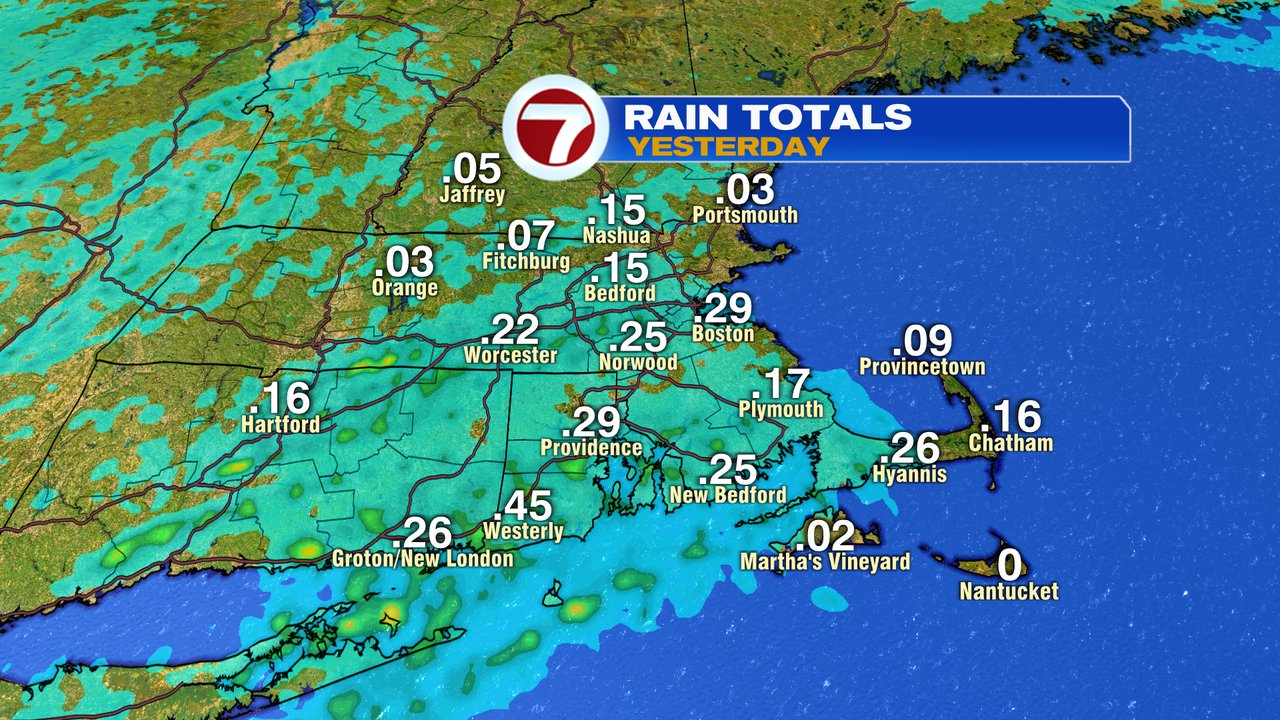
A nice day yesterday ended with a few early evening downpours quickly moving across the region, producing a quick 0.25″ of rain for some lawns and gardens. In it’s wake, the ground is a bit damp this morning, but the overall theme of the day is to dry out and allow for another nice afternoon as temps rebound into the low 70s.

Tomorrow, we’ll take it down a notch, maxing the highs out in the upper 60s. While a spot sprinkle can’t be ruled out, much of the day is dry, and we’ll be good to go for outside recess or out on the ball fields for the kids.

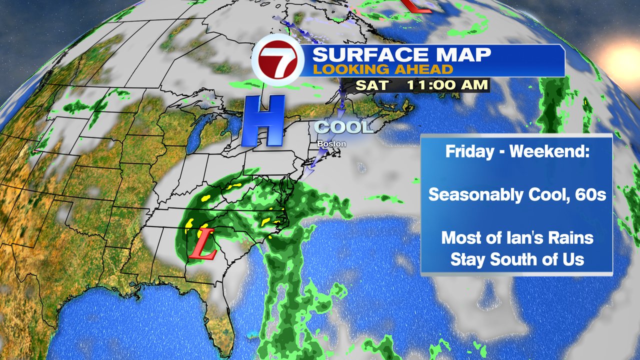
The continued theme of quiet and dry weather rolls on through the end of the weekend, into the weekend, as temps cool off a bit, but stay near seasonable levels (60s). Rain from what’s left of Ian may get close to the South Coast this weekend, but the bulk of it appears to move in across the mid-Atlantic this weekend.
Hurricane Ian is a category 3 storm this morning, over western Cuba. Ian is expected to move north, then northeast toward the west coast of Florida, making landfall either late tomorrow or tomorrow night, perhaps near Tampa. The cone for the projected path extends from Fort Myers, to the Big Bend area of Florida, since any wobble to the east or west would alter landfall location. That leaves a large area of the west coast of Florida prepping for the hurricane.
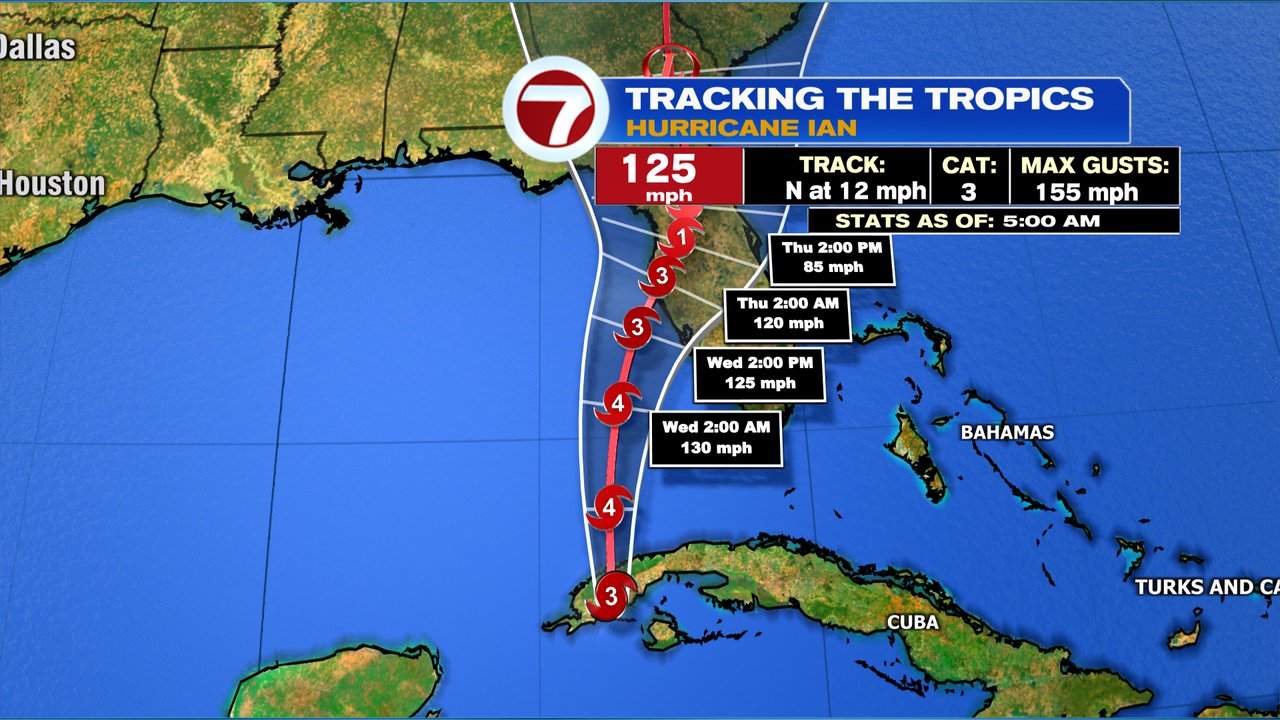
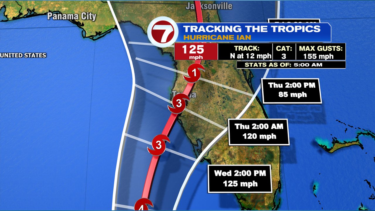
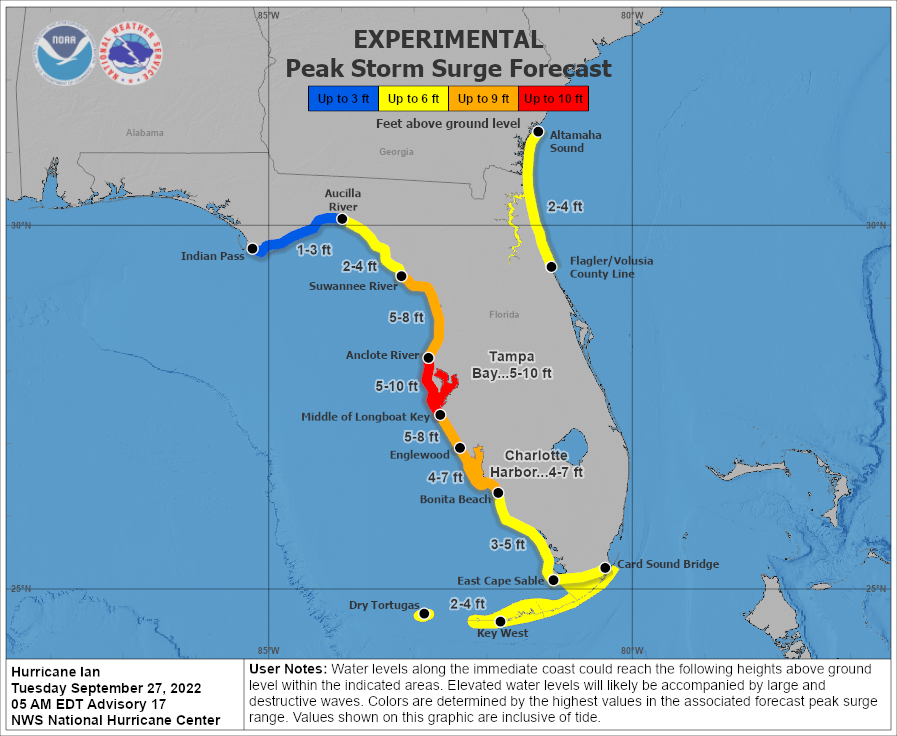
Winds tend to headline the hurricane, but with shallow waters along the west coast of Florida, storm surge will likely become a big issue, with a 5-10 foot rise in the ocean. If the track is over or on the northwest side of Tampa Bay, storm surge damage will be very high there. A track just south of Tampa, would leave Tampa out of the worst case scenario, but you’d see a higher surge and more damage farther south from Sarasota down, toward Fort Myers.
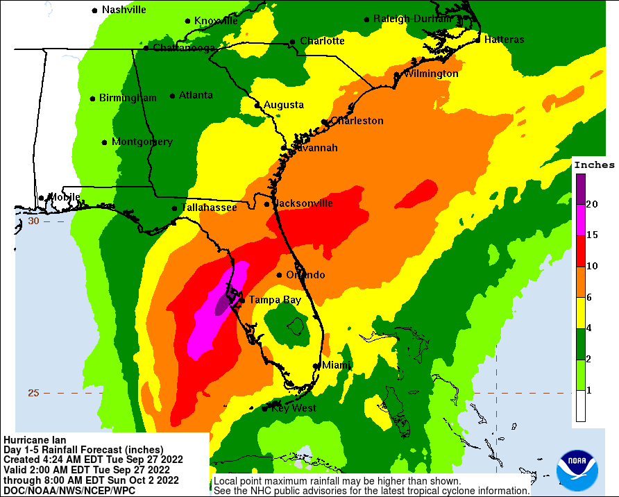
Flooding rain will also be a concern with this.