

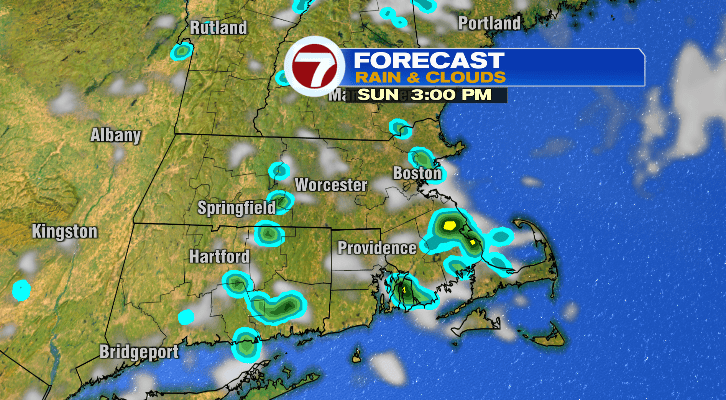
The second half of your weekend is going to be just as gorgeous as our weather more recently, for the most part.
First, overnight tonight into Sunday morning lows will get down to the 50s.

We do have a low-end chance for a spot shower Sunday afternoon, primarily between 1-7 p.m. However, we aren’t getting downpours and that chance for rain should not be enough to have anyone canceling any outdoor plans. Otherwise, highs will be warm in the mid to upper 70s. Dew points will be sticky in the low 60s.

Sunday evening will be spent in the 60s with overnight lows into the 50s. Skies will be dry and clearing out.

After that, we’re looking at a long stretch of more dry weather. Monday morning will start cool in the 50s but we will be in the mid 70s with cooler temperatures at the coast closer to the low 70s for the afternoon. It will also be mostly sunny. Tuesday will be a copy-and-paste kind of day compared to Monday.

Wednesday, another spectacular day with partly sunny skies and highs in the mid to upper 70s after morning lows in the 50s. Our next chance for rain comes Thursday. Right now, it’s pretty low so we will have to wait and see what happens over the next few days. Thursday afternoon temperatures will top off in the mid 70s.
Friday we’ve got a shot at the upper 70s and even low 80s in spots with bright skies. However, temperatures will drop a lot for Saturday with a high of 70 and lows Saturday night into Sunday morning back into the 40s.