7Weather- The National Weather Service is out surveying damage of a radar confirmed tornado that passed over Cape Cod on Tuesday.
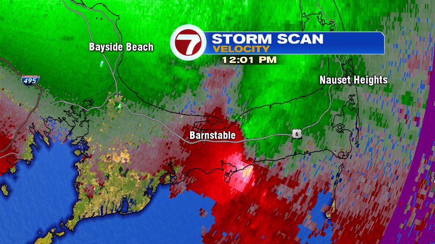
The storm started as a Severe Thunderstorm Warning at 10:45 AM on Tuesday morning. Soon after, at 11:13 AM, a Tornado Warning was issued for Dukes and Barnstable Counties.
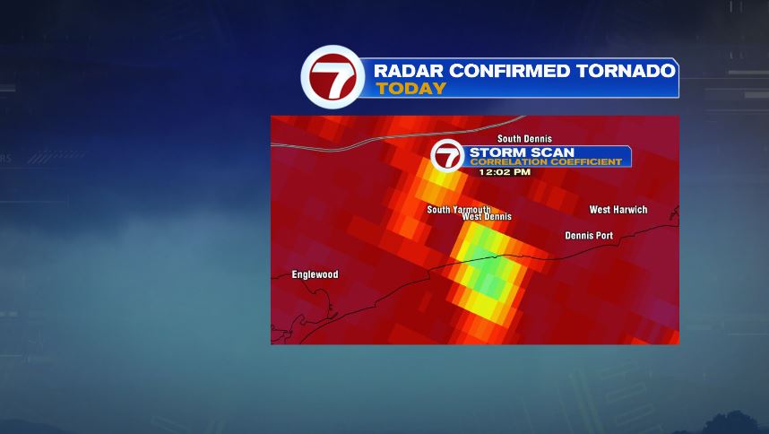
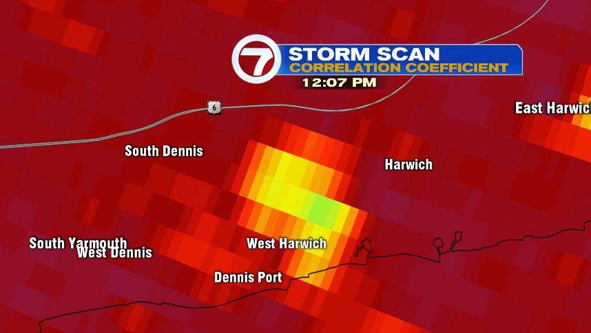
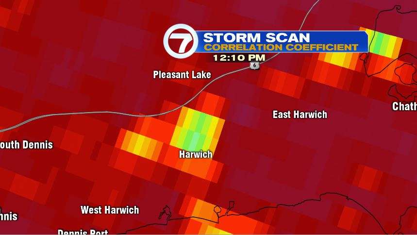
There was obvious rotation, indicated by velocity on radar from 11:13 AM through 12:00 PM, but then around 12:01 PM, the NWS confirmed the tornado using a different product on radar, correlation coefficient.
This product (shown below), confirms TDS, or a Tornado Debris Signature. This product sends out horizontal and vertical pulses from the radar, helping us indicate the size and shape of precipitation.
In a tornado warned storm, it helps us indicate debris from a possible tornado. The radar was telling us that there were big objects flying around, way bigger that precipitation.
The images below shows us where the debris was located. At 12:02 PM, it was near Yarmouth, which is where widespread damage was reported. By 12:07, the signature moved northeast, towards West Harwich. A few minutes later, near the center of Harwich, where many lost power Tuesday afternoon.

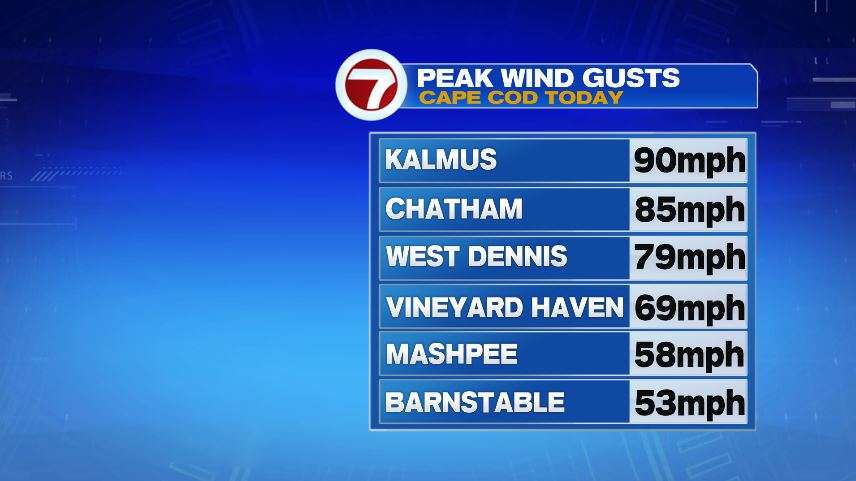
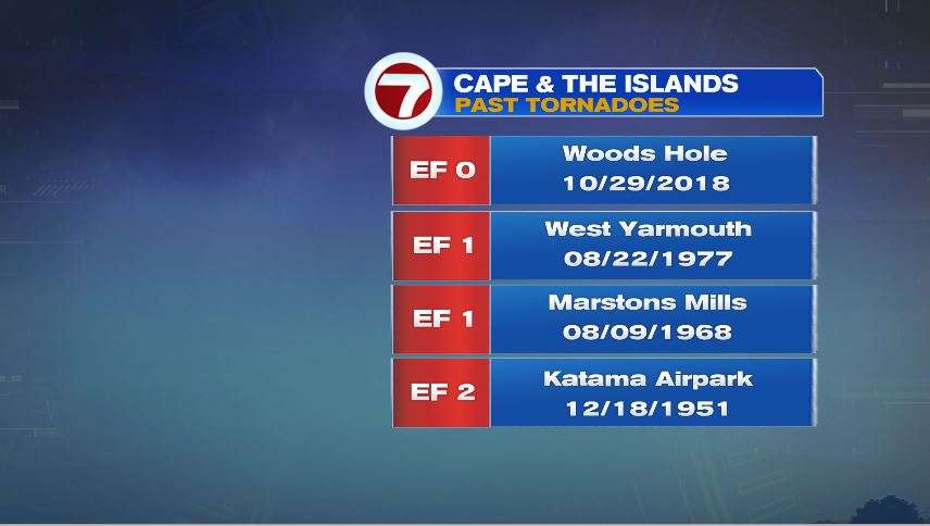
Kalmus, just west of Hyannis Port, recorded a wind gust of 90 mph! Tornadoes on the Cape & the Islands are not common. We did have an EF0 last year, but before that the previous tornado was back in 1977.