Back to work, back to school, and back to tracking some rain and snow this morning as a wave of low pressure rides by and sends in some gloomy weather to kick off the workweek. Although some wet snow has fallen northwest of 495, the change to rain there is fairly quick, and accumulations are relatively minor. Just watch for a few slick spots on untreated surfaces near/northwest of 495 early. Air temps will rise above freezing before ground temps do, so a slippery driveway/sidewalk is possible even if the thermometer reads mid 30s.

Temp tomorrow run a few degrees cooler as more scattered light showers move in.
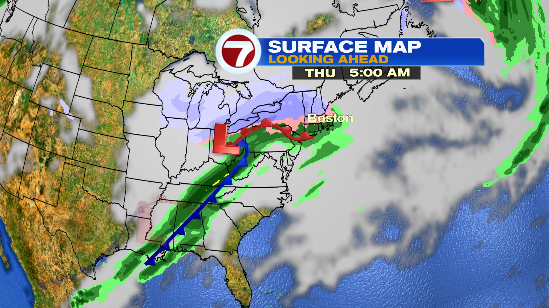
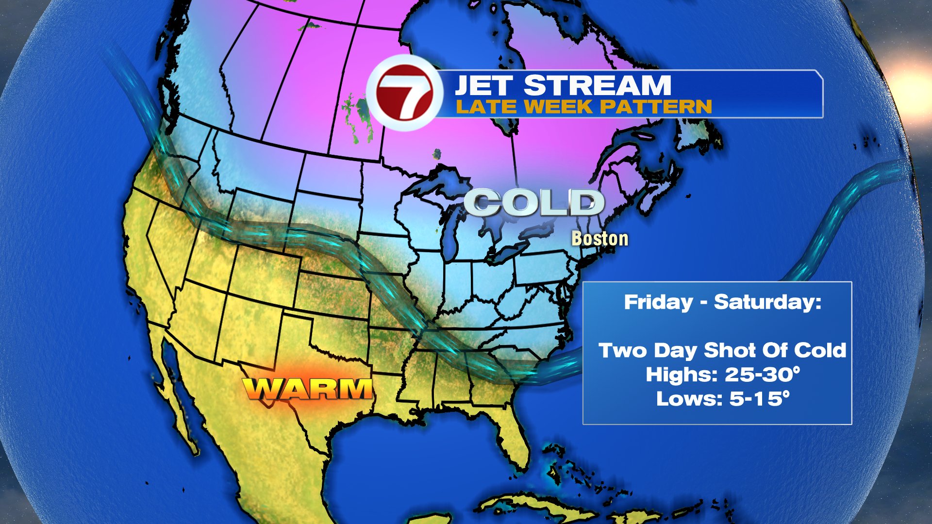
Wednesday is the pick of the week with highs in the 40s and sunshine returning. Then Wednesday night into Thursday, snow/mix moves back in before changing to rain. Behind that wave of low pressure, a cold shot of air comes in for Friday and Saturday. Expect a chilly Valentine’s Day date night with temps back in the single digits and teens Friday night.