
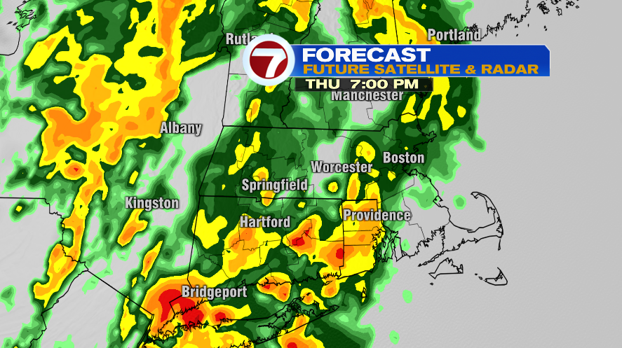
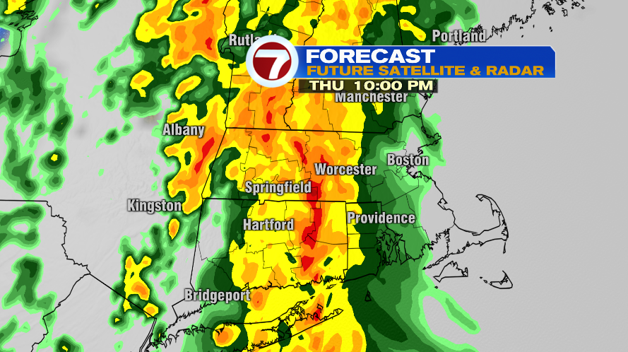
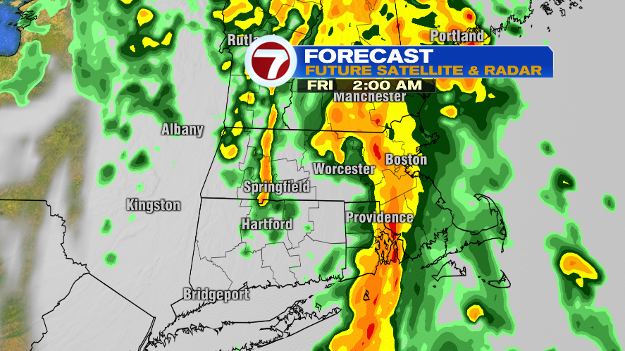
Today was a beautiful day in New England but changes are coming as soon as tomorrow which will send the sunshine packing for a couple of days. Temperatures, however, look to stay decently mild. Below is a timeline of future radar screenshots beginning tomorrow morning and lasting about 24 hours through Friday morning. The takeaway is this: the earlier in the day it is, the more likely you’ll find dry hours. A few spotty sprinkles or an isolated shower before noon, will give way to scattered showers in the afternoon and evening, and finally just rain and downpours in the late evening and overnight into Friday morning.
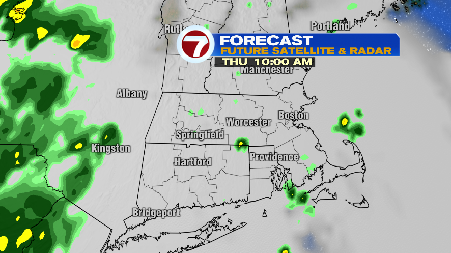
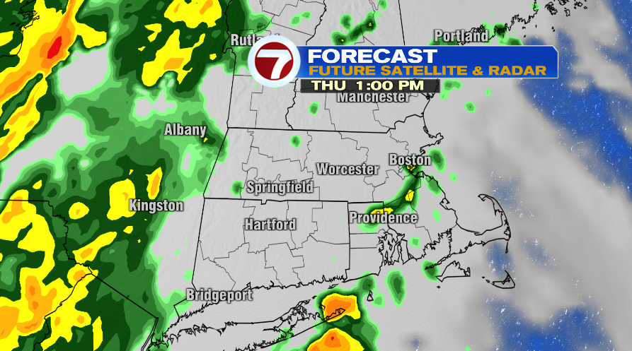
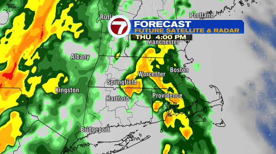
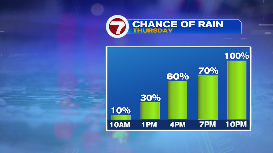
Another way to look at Thursday is with the percent chance of rain. Notice the percentages increasing in the afternoon and evening. What isn’t depicted in the percentages is how heavy the is or could be. In the morning it looks like a sprinkle or a lighter shower is possible. Past the noon hour, even though the rain chances are scattered (more than the morning but still scattered) some of those rain showers could be pretty heavy rain.
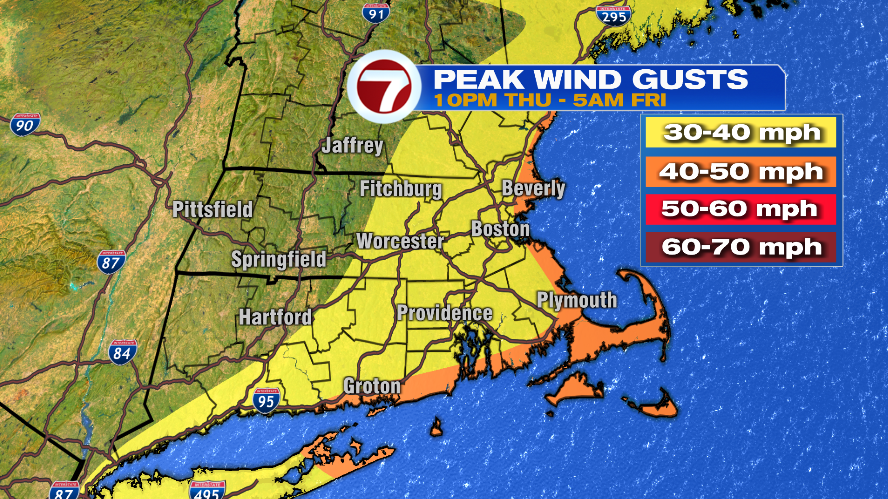
The line of rain and downpours that comes through during the overnight hours will also bring gusty wind along with it. Gusts on the coastline could gust 40-50mph but most likely on the lower end of that scale. Inland posts will likely see wind gusts in the 30s. We’ve definitely seen worse before in New England but it will definitely be noticeable. As of now, there are no advisories in effect for the wind.
Rainfall amounts will be up there too. Most towns will likely see 1-2″ of rain over the duration of the event. It’s possible that areas along and east of I-95 see over 2″, especially if the system is slow to move out during the day on Friday — more on that below.

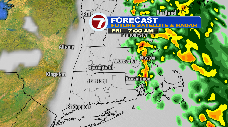
Up until this afternoon, most indications were that this line would keep on trucking as it slid through New England and out to sea. Now for the first time a few (not all) are suggesting that the line of showers might stall out over the area on Friday. If that happens it would of course keep the rain and the clouds around for the day on Friday. It does look like no matter where you are, Friday will be a cloudy day with maybe a little window of sunshine right before sunset in our far western spots like the Worcester Hills and the Monadnock Region.
It is possible that if the showers hold on, it could just be an all day rainy day for the 95 Corridor and the Cape on Friday. As I said before, tomorrow we’ll get a better look at that and give you a better idea of what to expect on your Friday afternoon. Regardless, it does look like it’s all out for the weekend and we’ll have a dry Saturday and Sunday in store.