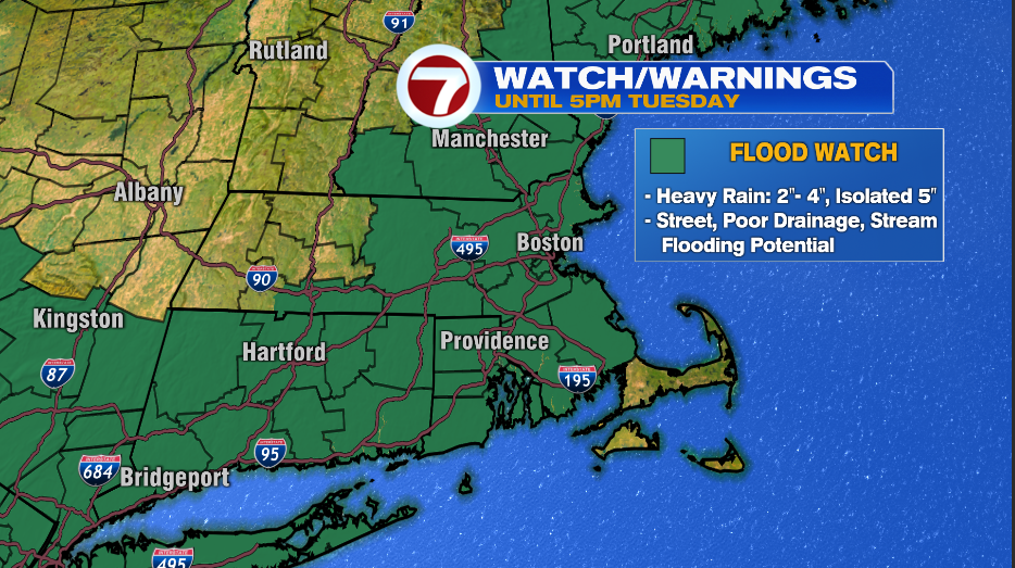
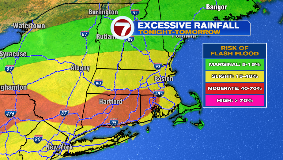
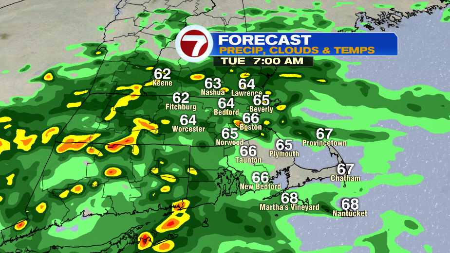
7Weather- A Flood Watch is in effect for most of Massachusetts and southern New Hampshire until 5 PM Tuesday. A storm total of 2-4″ of rain likely with pockets of 5″ possible.
The highest risk of flash flooding is down in Connecticut and Rhode Island, but there could still be isolated pockets of flooding in Massachusetts and southern New Hampshire tonight through Tuesday.
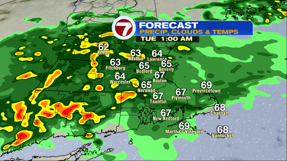
Light rain fills in this evening and then pockets of heavy rain develop as we approach midnight. There will be periods of heavy rain tonight and into early tomorrow morning that could lead to isolated flash flooding.
You’ll want to give yourself extra time if you’re commuting Tuesday morning. Check in with the Today In New England team to see if there are areas of flooding across the region.
Even if you don’t see reports of flooding near you, you’ll still want to give yourself extra time. Ponding on the roads and ongoing showers will slow down the morning commute. Take the rain gear with you!
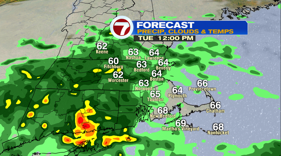
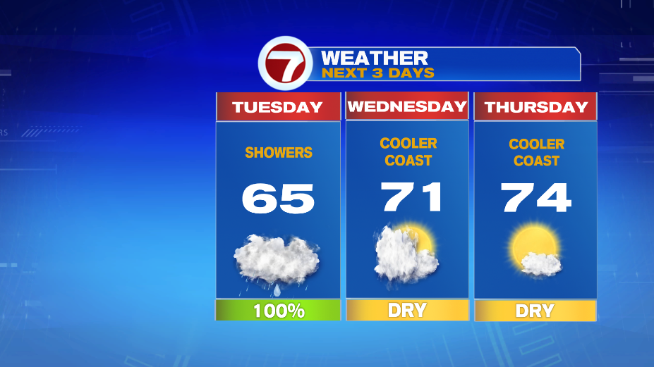
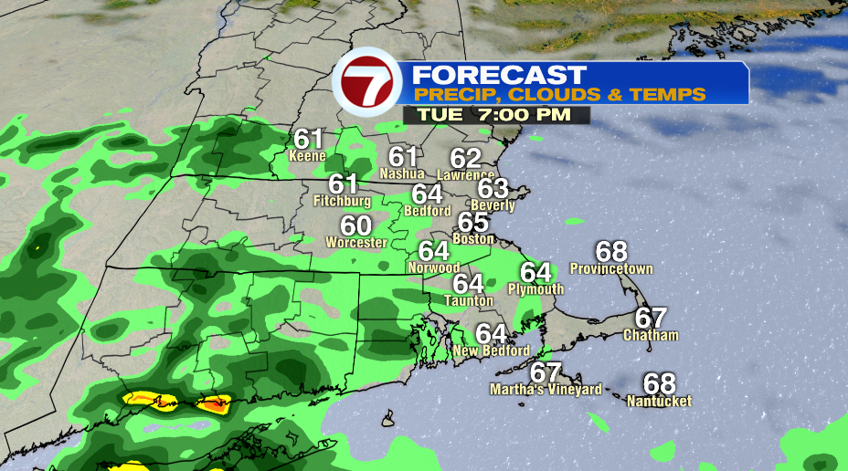
The “pockets of heavy rain” should be ending between 12-2PM Tuesday with only light drizzle left for the Tuesday afternoon/evening commute.
Skies will be slow to clear on Wednesday so temperatures will struggle to get into the low 70s. We might not see full clearing until late in the day and closer to sunset.
Thursday has highs in the mid 70s and skies are mainly sunny. It’ll be a beautiful, September day.