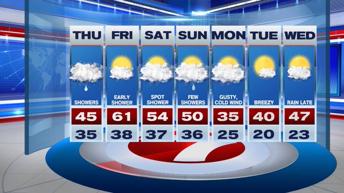
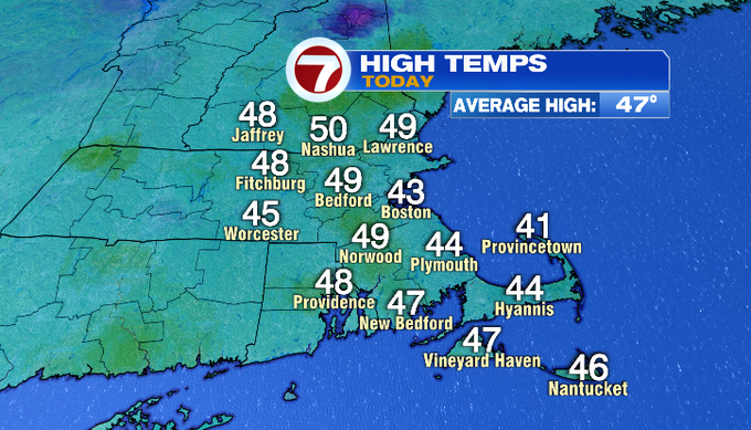
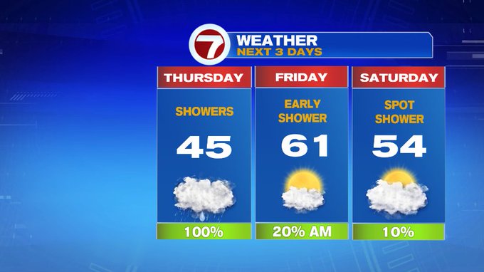
Today was another dry day, but it was unseasonably cool as highs were several degrees below average for this time of year. Tomorrow will be another chilly one, but it will be coupled up with showers for much of the day.
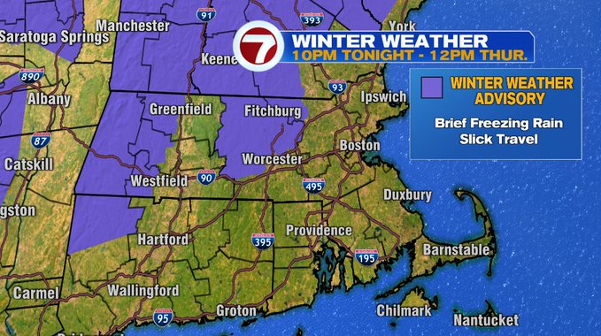
A Winter Weather Advisory has been issued for northern Worcester County, NW Middlesex County as well as portions of the Monadnock Region of southern NH from 10pm tonight through 12pm Thursday due to brief freezing rain mixing in that could make for some slick travel overnight ahead of tomorrow morning’s commute. The threat for some slick travel is mainly for the higher elevations.
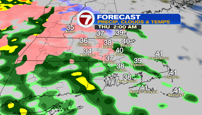
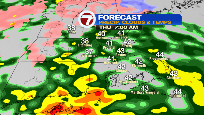
Tonight, the precipitation holds off until after midnight. Lows will dip into the 30s.
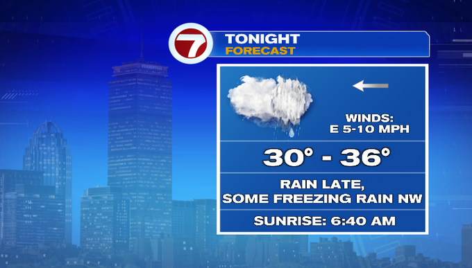
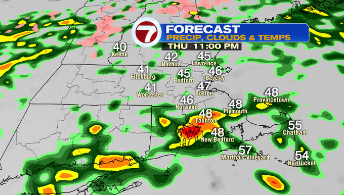
For the rest of the region, it will be a wet morning commute as the rain showers slide in after midnight tonight and sticks around for most of Thursday.
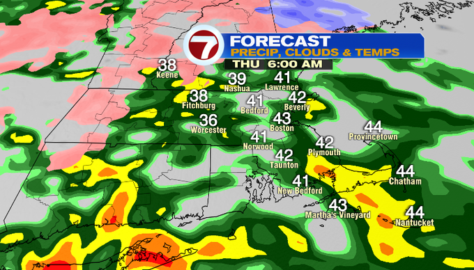
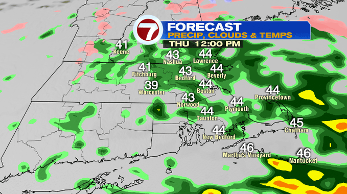
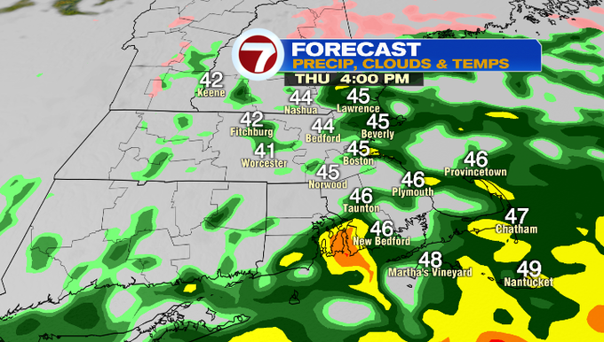
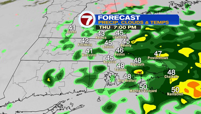
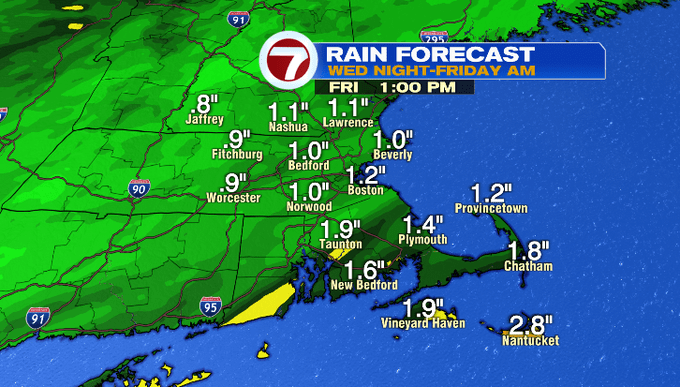
Overall, we’re looking at close to an inch of rainfall for most locations with a few spots approaching 2″, especially where the heaviest of the rain tracks.
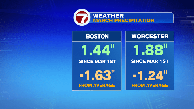
We do need the rain. Both Boston and Worcester are over an inch below average for March precipitation.
A few lingering showers will be with us early Friday morning. We’ll have a partial clearing of the skies and temperatures rebound into the low 60s in the afternoon.
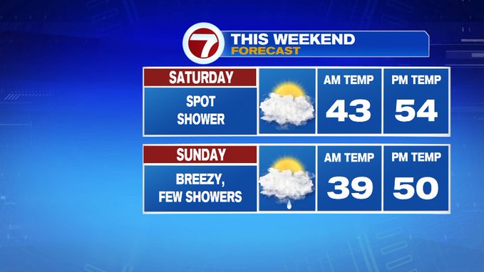
For the weekend, it’s not totally dry, but it’s also not a complete washout either. For Saturday, a spot shower is possible while Sunday has a better chance with a few showers passing by.
We turn much colder to kick off the work week with highs in the 30s Monday alongside a gusty, cold wind. Thankfully, temperatures rebound through midweek.