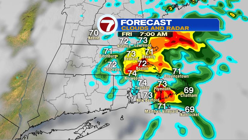
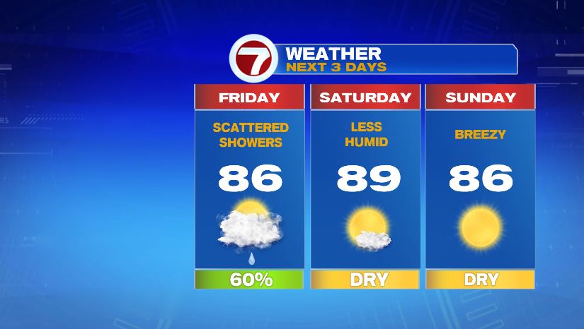
Rain is the theme of tonight’s blog. Rain close to home and rain moving in along the Gulf Coast. We’ll start with tonight’s rain that will likely provide some downpours and rumbles of thunder and also linger into the morning commute.
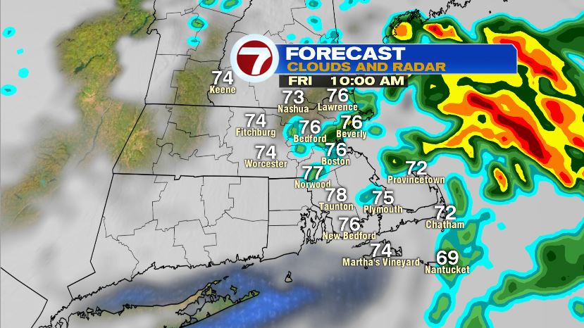
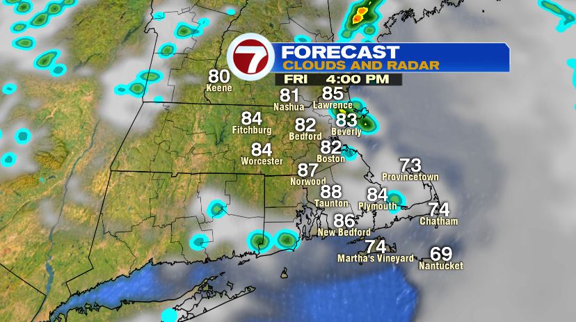
Most of the rain should hold off until after midnight. At that point it will move in and pick up in intensity right during the morning drive. If your commute is during the first part of the drive, there’s a better chance it’ll be slow and wet. The heavy rain will stick around until mid morning before tapering to scattered light showers. So while the afternoon is not totally dry, you’ll be able to find some dry time between the showers to run a few errands if need be.
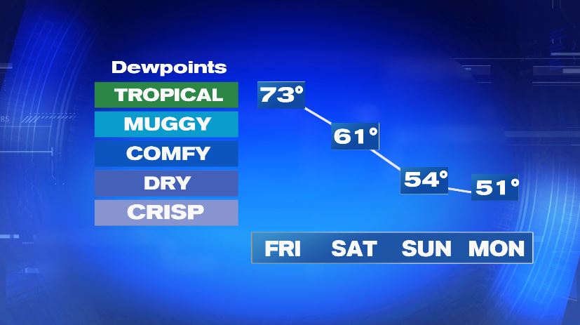
The front that is causing these showers is technically a cold front, but it won’t bring in much for cold air. While technically it is a cold front, it will act as more of a less-humid front. Saturday morning may still be a little sticky but it’ll be much more comfortable by the afternoon. And beyond that, Sunday and Monday will have virtually no humidity! While there isn’t humidity, there will still be heat with temperatures staying in the 80s with sunshine all weekend long.
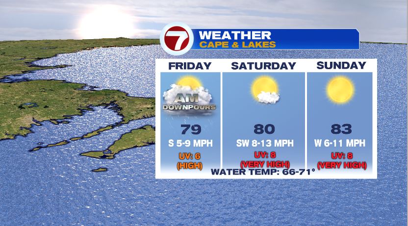
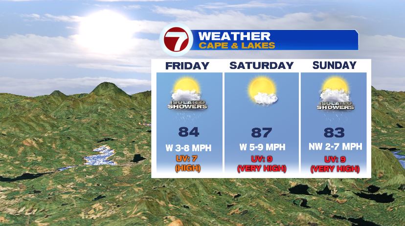
If your weekend getaway plans take you out of Boston, the weather on the Cape and in the Lakes Region looks great. Scattered showers will affect all of New England on Friday but Saturday and Sunday on the Cape will bring back the sun with temperatures near 80. If you’re heading north you’ll encounter warmer air. Once you shake the showers on Friday, the sun will be back on Saturday with temperatures in the upper 80s. Sunday is not totally dry across Lakes Region but rain chances are very small so you shouldn’t cancel your trip over it.
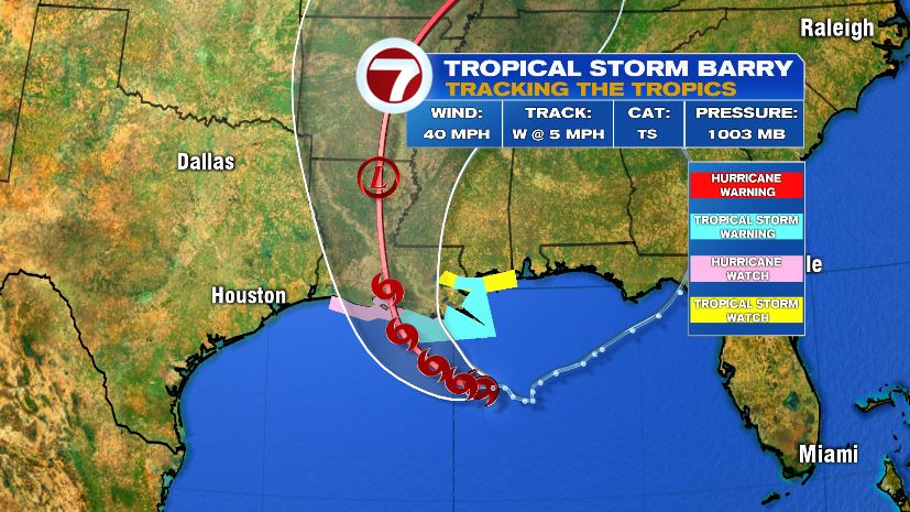
So that wraps up the rain close to home. But more rain is expected along the Gulf Coast as Tropical Storm Barry pushes north. The storm itself is not all that strong (at least by Hurricane standards — winds are only to 40 mph at the moment). The bigger impacts will be flooding. Rainfall amounts could add up to one to two feet in some spots and that does not account for the storm surge which could add additional feet to the water levels. And to add salt to the wound, the water levels are already high from a wet spring/early summer, so there isn’t much leeway for added water. The National Hurricane Center says the storm could briefly become a Category 1 Hurricane before making landfall in Louisiana on Saturday morning.