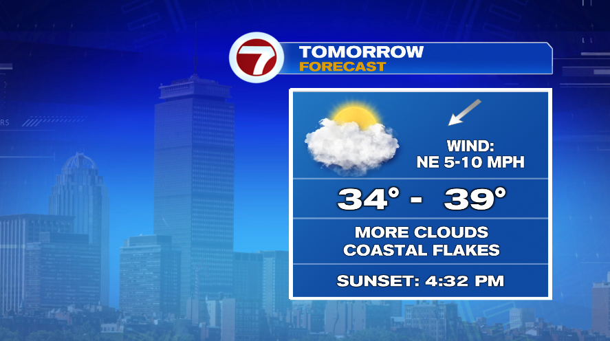
Today shaped up to be a pretty nice day out there! Temperatures climbed to the 40s for most of us with sun emerging this afternoon after morning cloud cover. We have one more quiet day tomorrow before changes arrive for the end of the week. Tomorrow will be cooler than today and also cloudier, especially on the coast line. It’s possible that a few snowflakes come out of those clouds on the coast but don’t worry they’re just festive winter snowflakes.
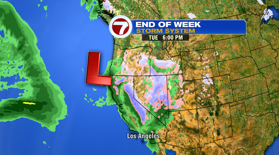
Our next storm system (Thursday and Friday) still has a lot of ground to cover! It’s currently coming ashore on the West Coast, pummeling California with even more rain.
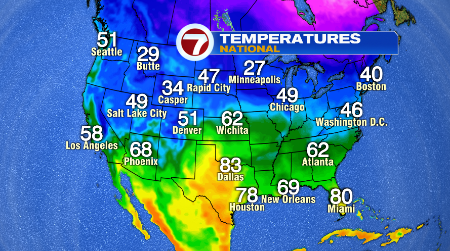
As that area of low pressure makes its way across the country, it’ll be lacking one thing (at least for snow lovers) and that is any sort of cold air. Temperatures today across the country were incredibly mild with no bitter cold air anywhere to be found. Even by Minneapolis standards, today was a nice winter day with temperatures in the 20s there.
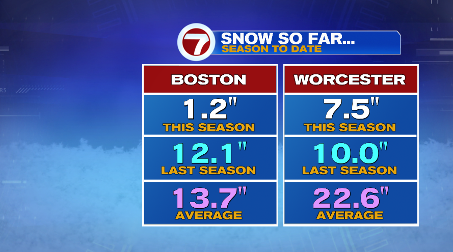
Snow lovers this has not been the winter for you. To date, Boston has picked up barely 1″ of snow the entire season! And the sad part is Ski Country hasn’t been much better. Yes, they have seen a lot more snow than us, and of course they’ve been able to make snow. But still, they’ve seen their fair share of rain storms there too and snow numbers (at least from Mother Nature) are significantly below average for snowfall to date for the season.
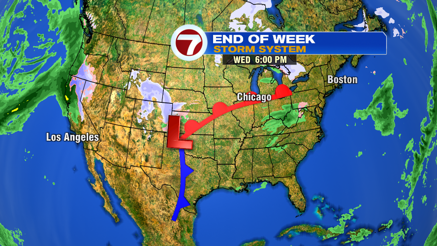
Anyway, back to our storm for Thursday and Friday. Overnight tonight and through the day on Wednesday it will make its way across the Rocky Mountains. Storms and mountains don’t mix well. The mountains essentially “rip apart” storm systems. So this area of low pressure will cross the Rockies and then have to gather itself back together through the day Wednesday. Below is the storm tomorrow evening.
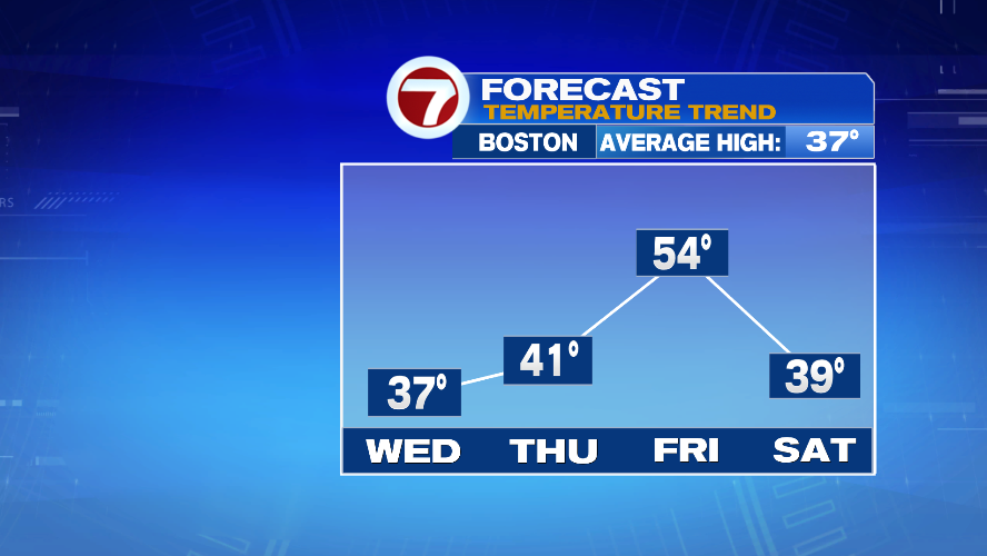
As that warm front pushes toward the northeast it’ll will drag warmer air in with it. Of course it will, it’s a warm front! The warm air down in the southeast part of the country will surge northward. Now, we’re not talking 60s but we’re talking a lot warmer air which will kill any snow chances for us with this system. Thursday won’t be overly warm, but the push of warm air will shoot up Thursday night and through the day on Friday and send temperatures to the 50s to close out the week.
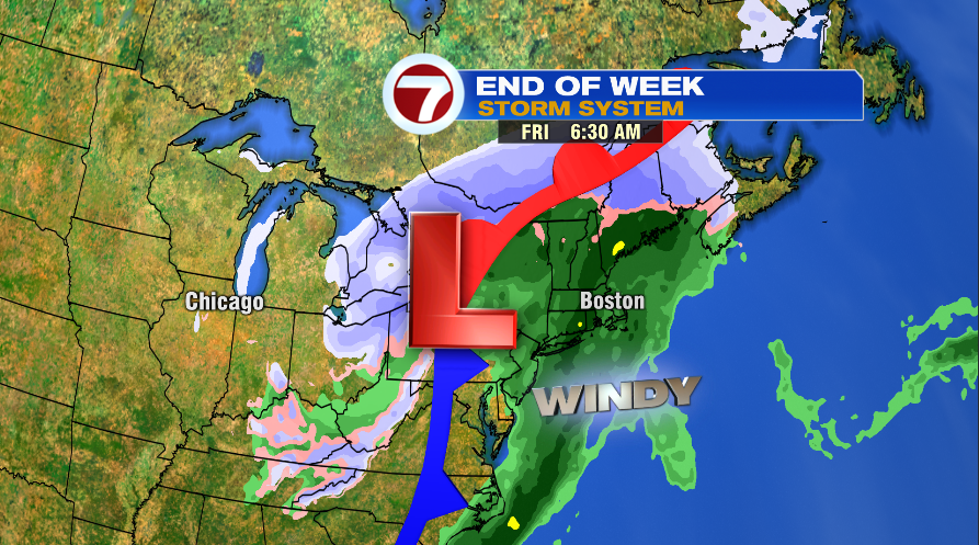
With temperatures in the 30s for much of the day Thursday (the 40s won’t arrive until closer to sunset) the first few initial showers with this system may actually fall as a mix of rain and snow showers. The best chance for any snow showers will be outside of 495 and in the hillier terrain. Not much will come out in terms of snow, and even if you’re lucky enough to pick up a slight coating on the grass, it will QUICKLY get washed away with the rain that will soon follow.
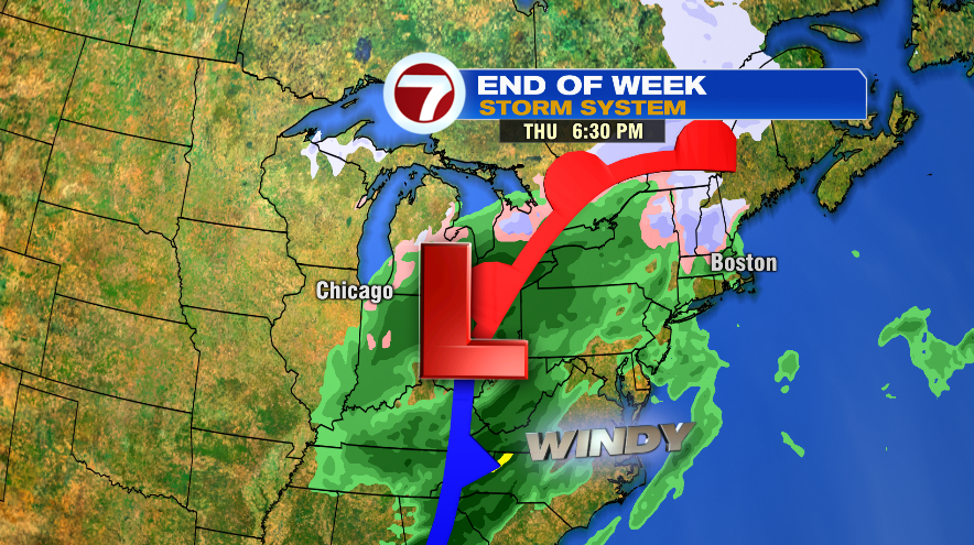
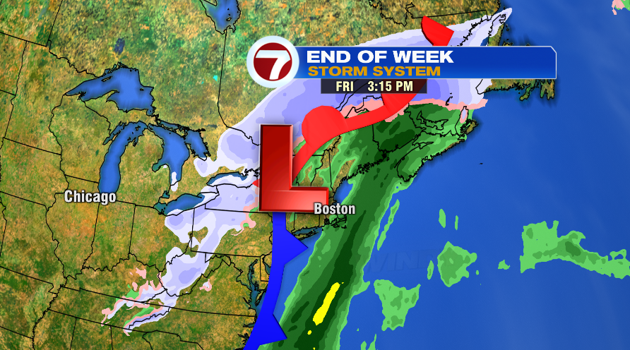
The bulk of the storm will be here Thursday night and Friday morning. It will bring rain (heavy rain) and some gusty wind as well. The wind isn’t Nor’easter level wind or damaging wind, but you’ll notice the wind pick up Thursday night and Friday morning. There’s good news though compared to yesterdays’ blog! The storm now looks to be more progressive, as in it keeps on moving. So I think we’ll dry out in the afternoon on Friday! There could be a spot shower Saturday and a few snowflakes Sunday but the weekend looks significantly drier than it did yesterday.