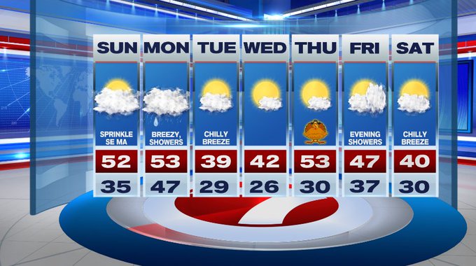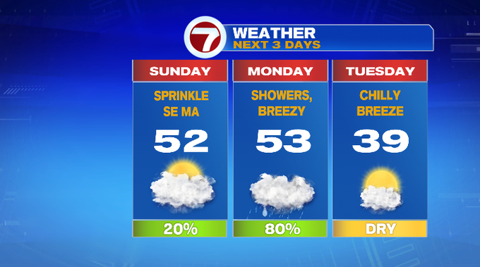
Aside from a few sprinkles for SE MA and the Cape and the Islands today, the rain holds off until tonight for the rest of the region.
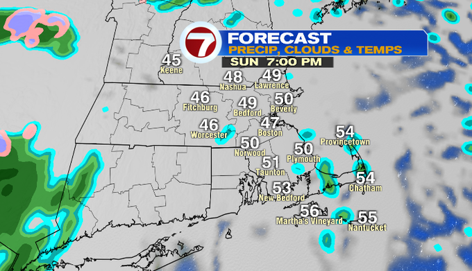
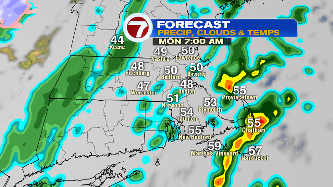
Today, under mostly cloudy skies we’ll see highs stretch into the low to mid 50s.
Tonight, the showers move in around 10pm and we could even see a few heavier downpours for the Cape late tonight into tomorrow morning.
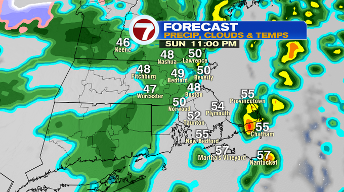
The showers will remain scattered across the region through midday tomorrow before the showers start to shift out through the afternoon. By 2pm, the back edge of the rain should be around Boston and SE MA, with showers lingering through sunset for the Cape and Islands.
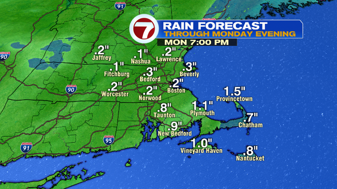
Overall, we’re looking at a quarter of an inch to a half inch of rain for much of the region, with locally higher amount where some heavier rain showers trail over.
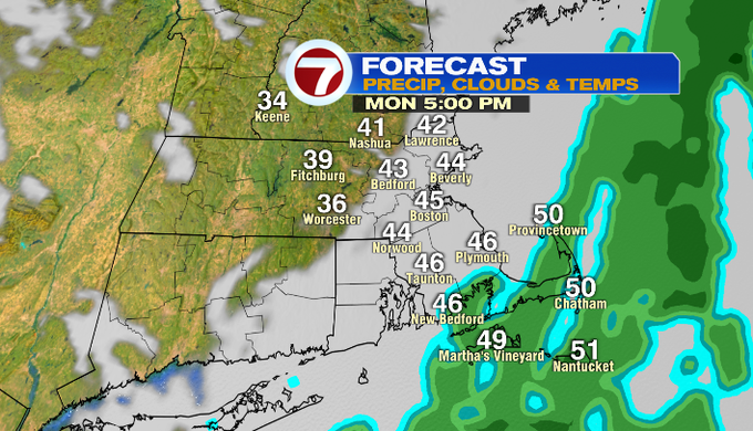
We’ll see a gradual clearing of the skies Monday evening from west to east as the slide out to sea. With that clearing, temperatures will plummet.
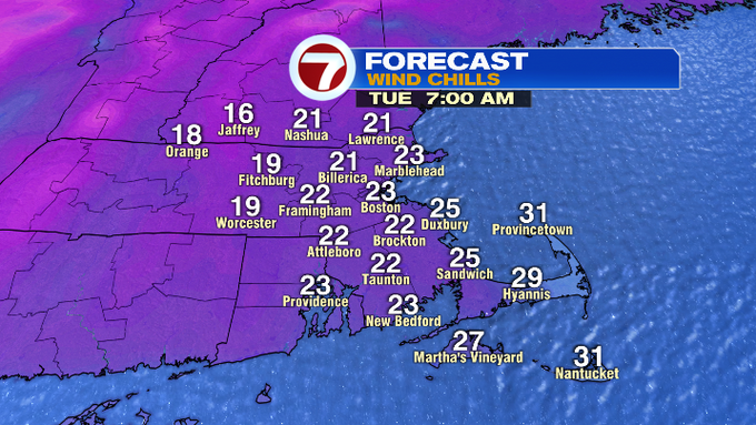
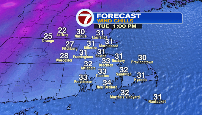
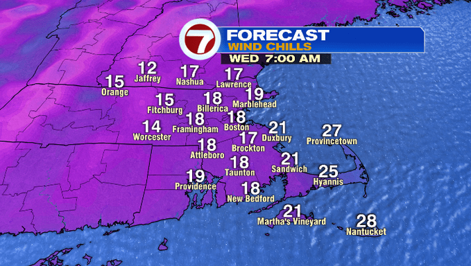
Colder air moves in for Tuesday and Wednesday along with a chilly breeze, dropping wind chills into the 20s for much of the day Tuesday, while Wednesday morning’s feels like temperatures will be in the teens before they moderate in the afternoon, so be sure to plan to bundle up both of those days.
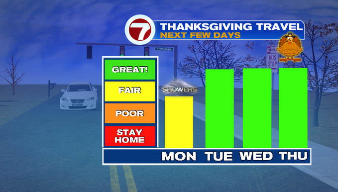
As far as the Thanksgiving travel forecast for southern New England, aside from the showers tomorrow, it’s smooth sailing Tuesday, Wednesday and for Thanksgiving on Thursday.
Speaking of Thanksgiving, seasonable air returns for the holiday with highs into the low 50s under mostly sunny skies.
Looking ahead to Black Friday and Small Business Saturday, high temperatures drop back into the 40s under partly cloudy skies. An evening shower is possible for Friday.