The stretch of dry weather comes to a close today as showers develop early this afternoon inland, and mid to late afternoon closer to the coast. While temperatures run in the 40s to low 50s today, they’ll drop tonight, and even be cold enough to support snow across the higher terrain.
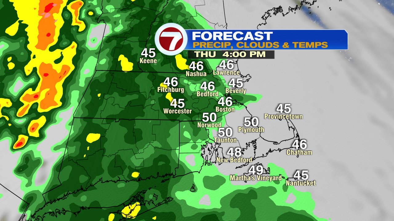
As upper-level energy from the Midwest, connects with a developing low off the mid-Atlantic coast, that coastal low gets drawn up toward Southern New England, increasing the precip and wind tonight. As the intensity of the storm increases, cold air gets pulled down from northern New England as well as from aloft. That helps rain flip to a heavy wet snow inland, especially across the higher terrain. Across the central and northern Worcester Hills, accumulated snow will start after midnight and likely linger into tomorrow morning. While inside 495, mainly rain is expected, at times, flakes could mix in at times tomorrow, but accumulations will be limited.
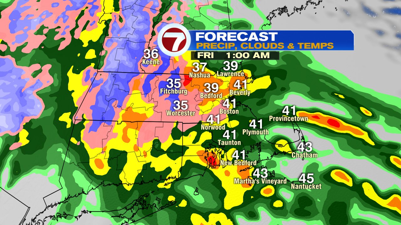

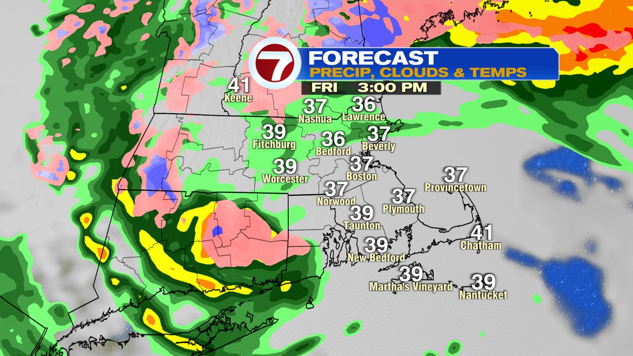
The highest totals are likely in northern Worcester County, north and back through the Greens and Berkshires. With that said, these Spring storms that cut-off from the atmosphere can be fickle, so keep checking back for the latest forecast in how this storm is developing. If the surface low stays farther southeast and just offshore, then lower terrain locations could see more snow in the mix.
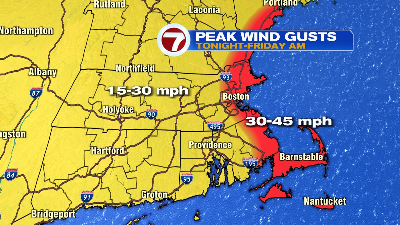
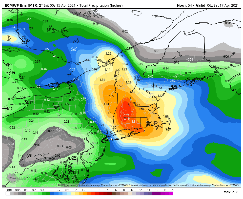
Winds pick up at coast tonight and gust 30-45mph through the day tomorrow out of the northeast. One beneficial aspect of this storm will be the amount of moisture as 1-2″ of liquid equivalent (water equivalent of snow/rain combined) that falls. We’ve been quite dry over the last 6 weeks, and this will put a decent dent in that precip deficit for now.