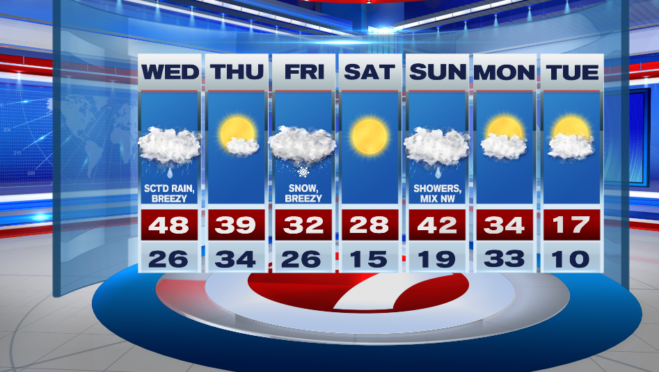
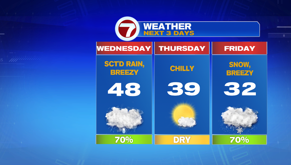
7Weather- Clouds move back into the area and we’ll have scattered showers Wednesday. Thursday is dry and then snow moves in Friday.
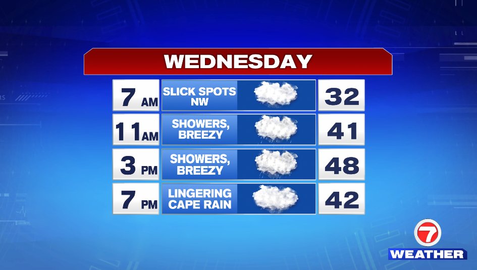
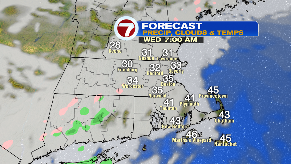
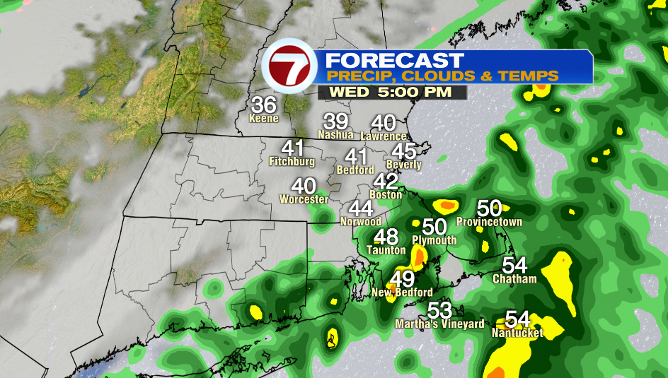
Patchy drizzle may develops throughout the morning commute tomorrow. There could be slick spots with temps near freezing NW of Boston. Temps warm up mid-morning and scattered showers move in. Highs will be anywhere from the low 40s to the low 50s. It will also be breezy with a SSW wind at 10-20mph.

The sun returns Thursday! Temperatures start in the low and mid 30s and we don’t move much from there with highs in the mid and upper 30s.


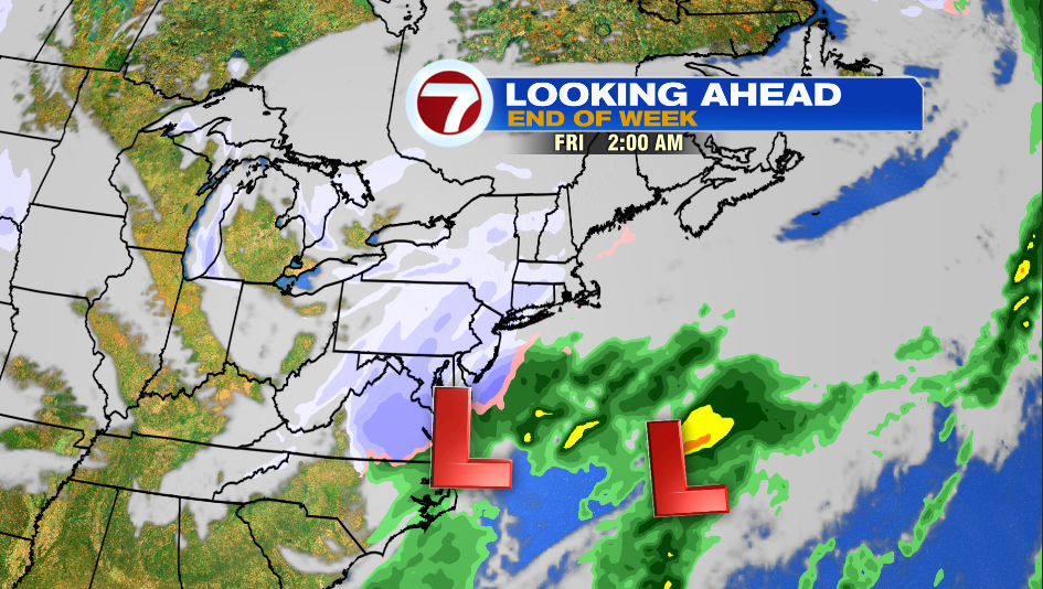
Clouds are back again Thursday night and then we’re talking the chance of snow Friday. The low pressure system that brings snow into the area doesn’t exist yet! It will start to develop near the Louisiana/Texas border Wednesday night and then it gets to us Thursday night. For these reason there is still uncertainty with this storm.
As of now it looks like snow arrives after 2AM Friday and will be around until mid-day Friday. Plowable snow is likely. You should plan for poor driving conditions for the Friday morning commute.
It clears up on Saturday and it is cold in the upper 20s. Showers move in Sunday. For most areas it is plain rain but there could be a quick wintry mix initially for inland locations. Look at that bitter blast on Tuesday! Highs only reach into the teens.