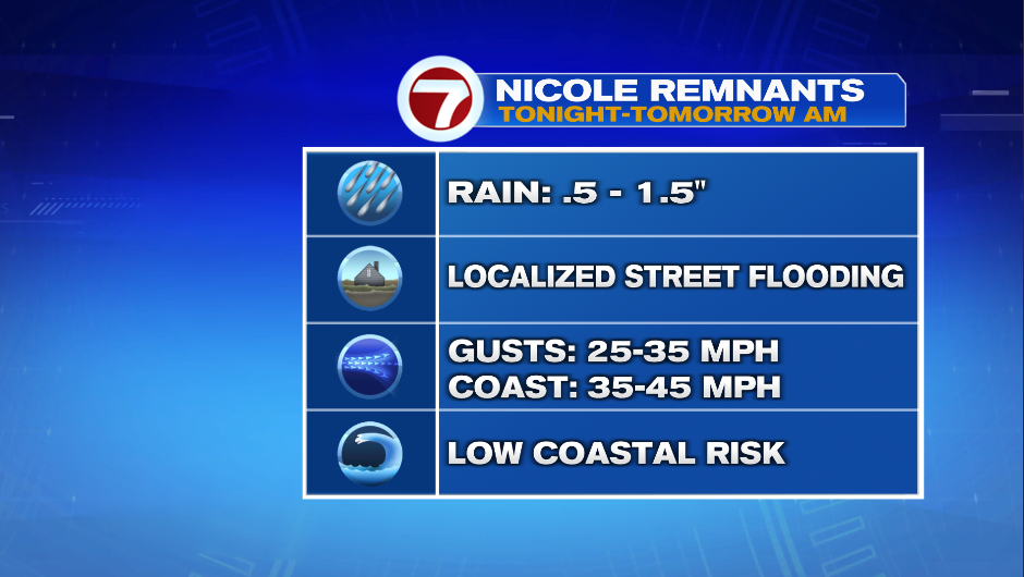
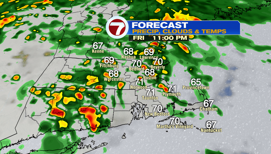
7Weather- We’ll have rain and wind tonight into Saturday morning.
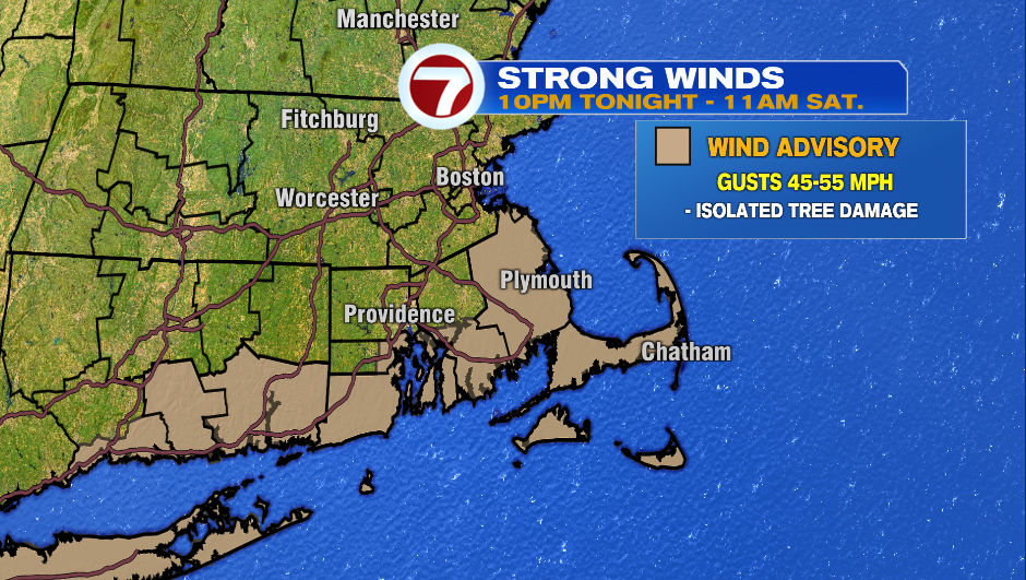
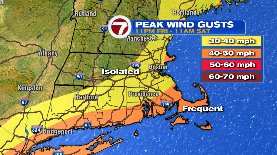
Our windy window will be from 11PM tonight – 11AM Saturday. The orange zone in the map below will see isolated tree damage, which could lead to isolated power outages. If you’re in the yellow zone you should secure outdoor furniture/holiday decorations.
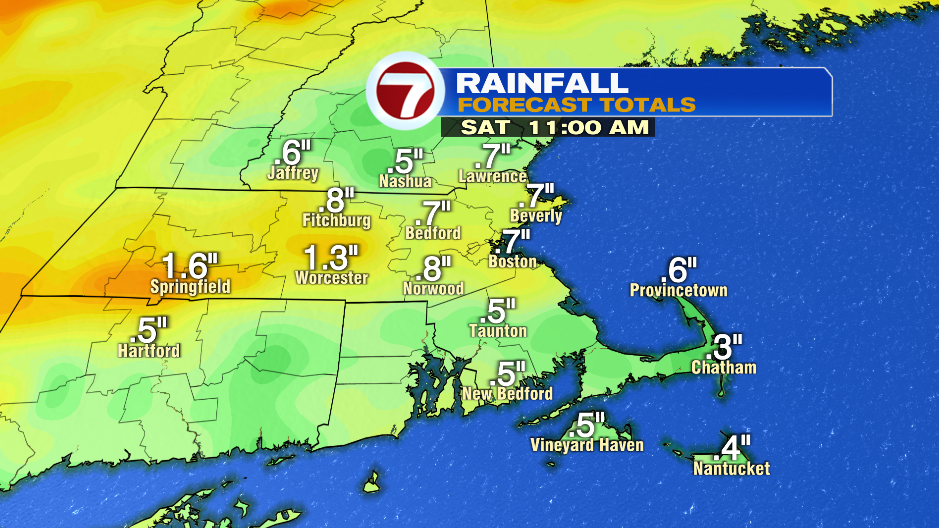
We’re expecting 0.50″-1.50″ of rain with localized street flooding possible due to leaves clogging drains. The better chance to get closer to 1.50″ will be in Worcester County. There will be on and off showers tonight with pockets of heavy rain every now and then.
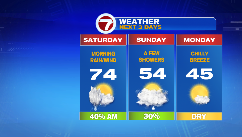
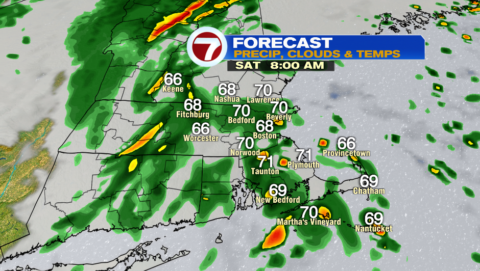
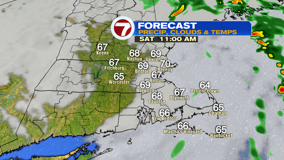
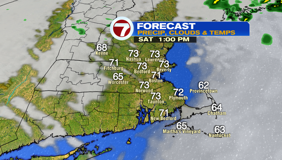
One last round of rain moves in throughout Saturday morning, but the wet weather is out of here by 10AM. Skies clear up and it ends up being a nice afternoon with highs in the low and mid 70s. Keep in mind that there will be a little bit if wind left over in the afternoon.
Sunday isn’t a dry day, but it also isn’t a washout. It’s a day where there will be a few showers hanging around the region. It’s a lot cooler with highs in the mid 50s.
You’ll feel the chill on Monday with highs only reaching into the mid 40s. A breeze will make it feel chilly.