For the 22nd time this year, Boston cracked the 90 degree mark yesterday as the high temp hit 92. Today, the forecasted high of 95 would be good enough to break the record of 94. Combine the fact that the dew points run in the 70s, and the heat index will push to near 100, which has prompted the heat advisory that’s in place.


In addition to the heat, we’ll throw in some scattered storms this afternoon, mainly between 3-8pm. The storms will be scattered, so not all towns will see them, but the ones that do form will be capable of gusty winds and localized downpours. One or two of these storms may reach severe limits, producing damaging wind gusts so we’ll keep an eye out for that and for localized street flooding in any storm that does produce a quick 1-2″+ of rain.

Behind a front, there’s a dramatic temp drop. Highs tomorrow reach the low 70s coast and mid to upper 70s inland.

We stay cool and dry through the weekend as a refreshing air mass holds down the fort. Overnight lows Saturday and Sunday night will even feature a few mid to upper 40s in the burbs.


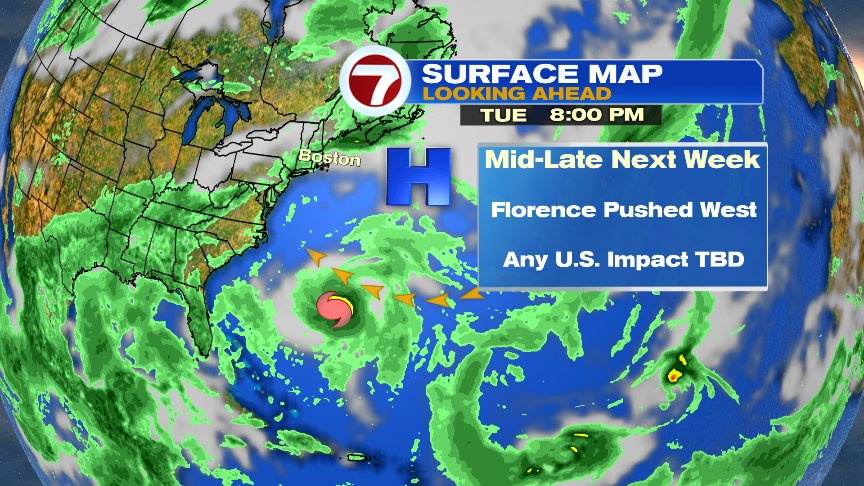
The tropics have become quite active and Florence will be the one to watch over the next 8-10 days. Florence is now out over the open waters of the Atlantic for some time to come, but will likely get steered back toward the U.S. coast in a week or so. Way too early for specifics/impacts, but it’s certainly something worth keeping a close eye on.

Have a good day.
@clamberton7 – twitter