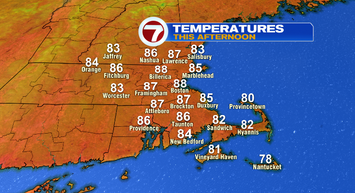
Finally summer is coming back! Heat and humidity will be the story today with temperatures in the upper 80s for many of us!
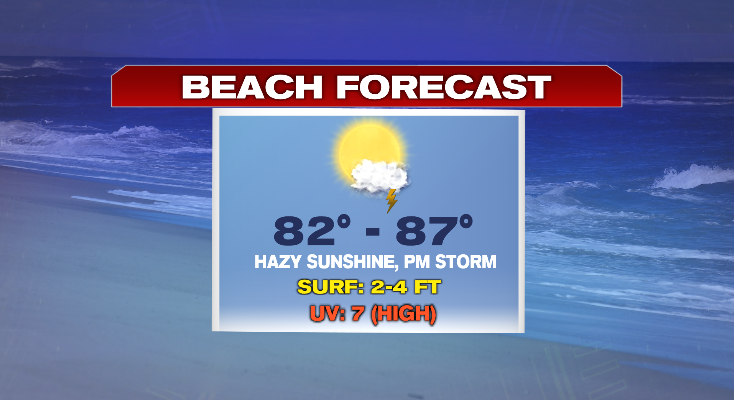
Beach day? Yep looks great! There is the smallest chance of a pop up storm this afternoon/evening but that chance is so incredibly small so don’t let it alter your plans today. High tide happens this morning and low tide is about 2pm so there will be plenty of beach space to go around!
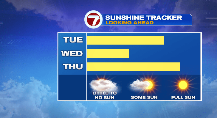
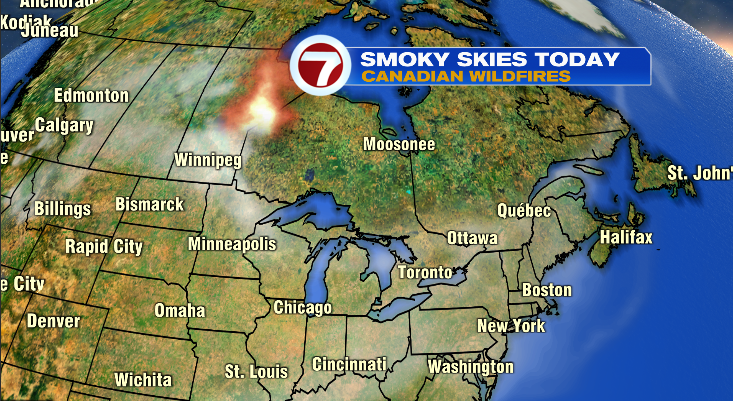
While today is dry, it’s not crystal clear blue skies. We’ll have the hazy or filtered sunshine — but let’s not get greedy. At least we’re not talking rain. That haze in the sky is actually smoke coming from the wildfires in Canada and the Pacific Northwest.
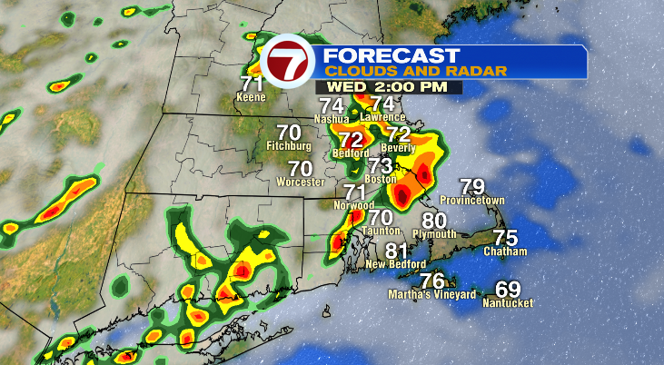
Showers and storms are back for Wednesday. They will be scattered so it’s not an all day rain, but unfortunately some of the storms could be strong or severe and produce some good downpours. Of course rain is not what we need or want right now but downpours could make the ongoing flooding situation be the topic of conversation again Wednesday evening.
Once we get through Wednesday, I cannot stress how FANTASTIC Thursday, Friday, and Saturday look!!
- Thursday will be mostly sunny with a slight breeze and low humidity. Temperatures in the upper 70s.
- Friday is partly cloudy with a small chance of a spot shower. That chance is like today… super small so don’t alter your plans because of it. Temperatures will climb to the mid to upper 70s.
- Saturday is all about the sunshine once again. We’re back to the upper 70s inland and a touch cooler on the coast.