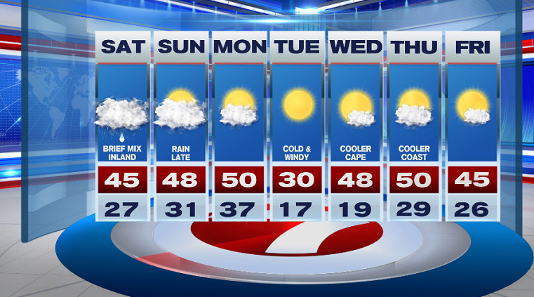
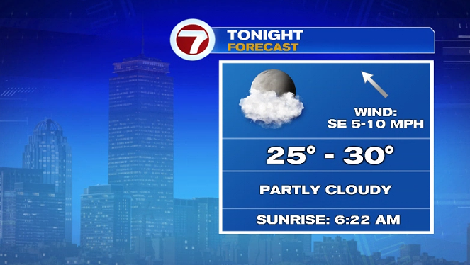
The final Friday of February 2021 brought sunshine, less wind and a bit of chill with highs in the upper 30s. This evening, we’ll see mainly clear skies with temperatures dipping into the lower 30s.
Overnight, temperatures dip into the upper 20s with increasing cloud cover late ahead of our next system.
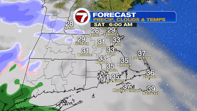
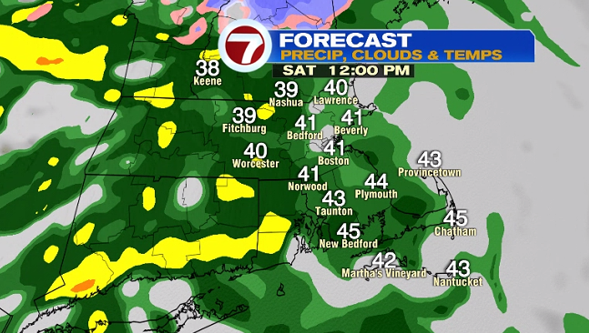
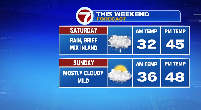
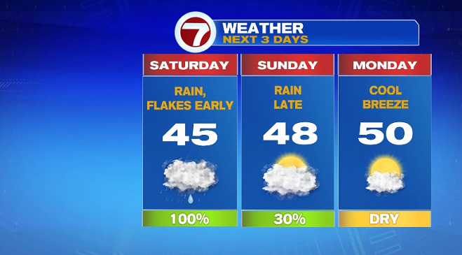
That next system will bring a few flakes early, especially inland and higher elevations between 6AM and 9AM, before quickly changing over to just rain as temperatures rise into the 40s.
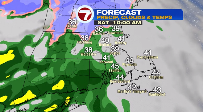
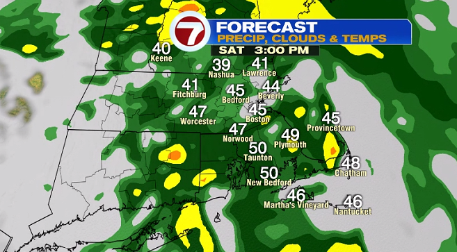
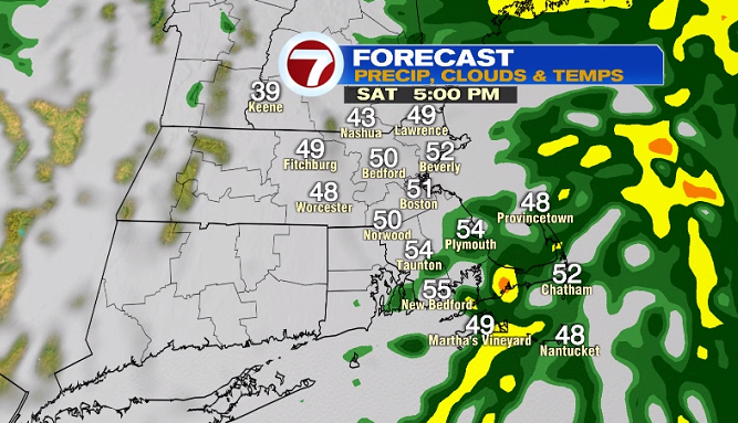
The rain remains steady through Saturday afternoon, and pushes out around dinner time.

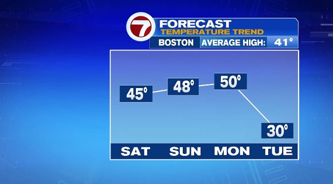
Dry conditions persist Saturday night into Sunday morning. It will be mainly cloudy and mild for Sunday with highs in the upper 40s.
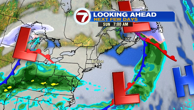
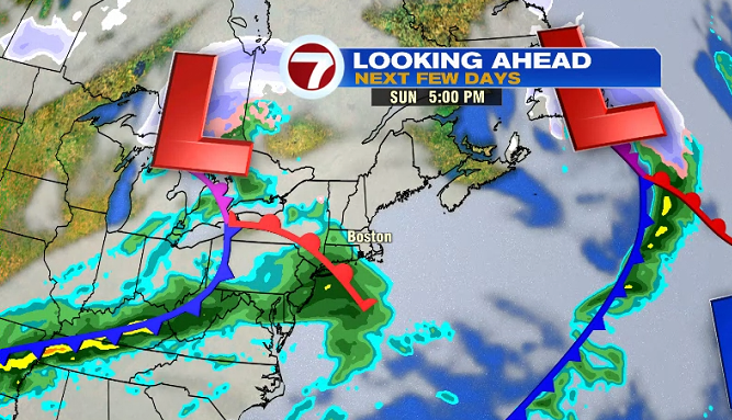
The daylight hours are dry Sunday, as another system swings in Sunday evening after sunset.
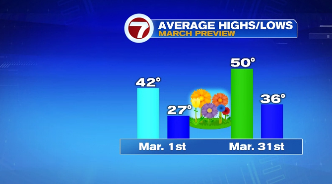
To kick off the week and the month of March, it will be unseasonably warm with highs near 50° (which is typically the normal high for the end of the month).
Heads up, the warmth on Monday doesn’t stick around for Tuesday. We have a big temperature swing with highs only reaching 30° Tuesday (with morning lows likely in the teens).
It will be cold and windy Tuesday but at least we have the sunshine. Temperatures moderate back to the upper 40s to near 50° the rest of the week.