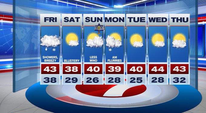
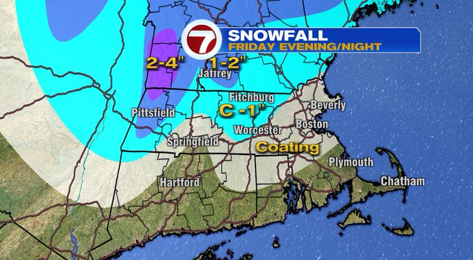
We’re tracking our first measurable snowfall of the season for parts of southern New England, or at least some festive flakes for the day after Thanksgiving.

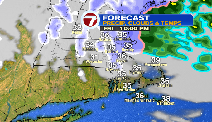
We have a cold front approaching southern New England from the west, which will usher in the colder air needed for that changeover to snow. As for the timing, the rain could changeover to snow for western MA / Berkshires by the early afternoon, mid to late afternoon for interior southern NH and the RT. 2 corridor, then later this evening for areas within the 495-corridor to the eastern coast of MA and the Merrimack Valley.
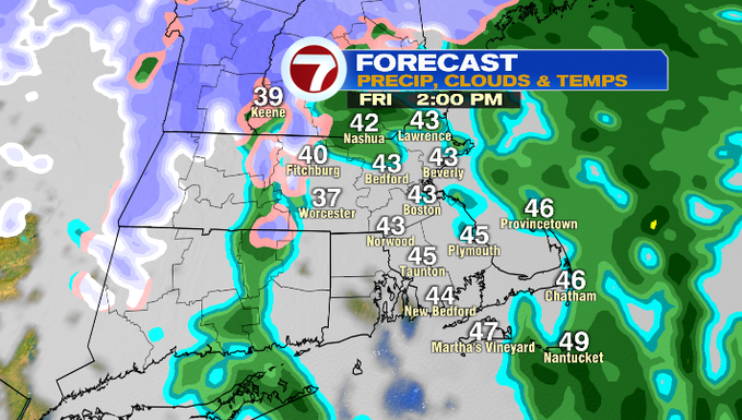
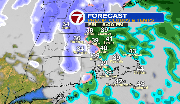
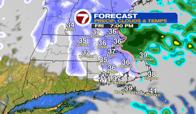
It will likely be festive flakes for Boston to areas south and east, but for the RT. 2 corridor, Worcester Hills, and the higher elevations of southern NH, VT, and the Berkshires, we’re looking at around an inch or two of accumulation. With that snowfall, gusty winds could make for some tricky travel with reduced visibility at times.
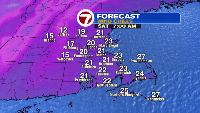
The snow showers lift out as early as 11pm tonight. Even though the snow exits, the cold and the wind is here to stay for Saturday.
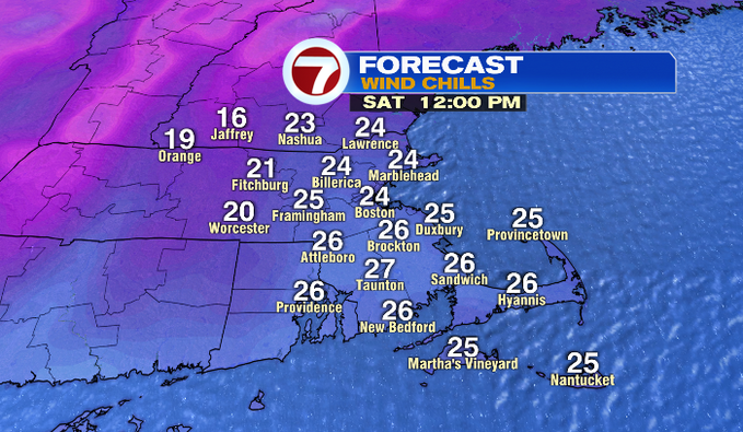
It will be a blustery start to the weekend with wind chills into the teens to low 20s, and those wind chills will likely be in the 20s through much of the afternoon as high temperatures only stretch into the upper 30s.
Less wind settles in for Sunday with highs around 40 under partly cloudy skies. We’ll see increasing cloud cover later Sunday ahead of a system that dives in Sunday night into early Monday. At this point, it looks to be a weak system and could just bring a few snow showers, but we’re not looking at much accumulation.

After that system exits early Monday, we return to a quiet stretch for the rest of the week.