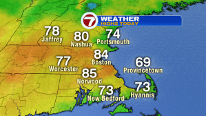
Today finally looked and felt like summer. High temperatures today stretched into the low 80s from Boston to Norwood, to Bedford and Nashua!
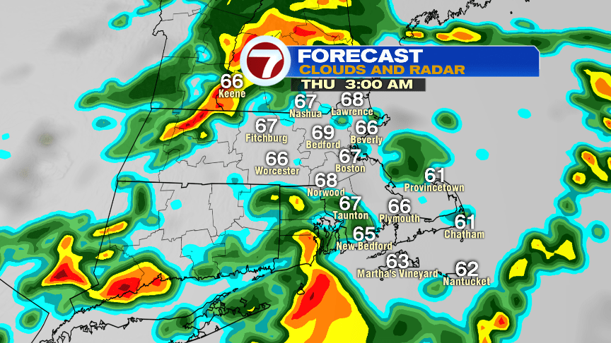
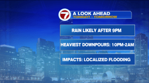
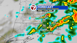
A line showers with embedded thunderstorms/downpours will continue to slide in from the west tonight. Timing brings in some scattered rain after 9PM, with the heaviest downpours around midnight through the early morning commute Thursday. The main impacts will be localized flooding and reduced visibility due to heavy rainfall. It will also be relatively mild and muggy through the overnight as the rain moves through.

Scattered rain will continue to be with us through at least midday Thursday.

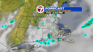
Thursday will not be a washout, but it most certainly will not be as nice as today.

By at least 6PM tomorrow evening, we could see a clearing of the skies, but that will be after most of our daytime is over.

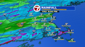
Overall, depending on where the localized heavy downpours set-up, we could see anywhere between a half of an inch to over an inch of rainfall, with higher amounts expected for spots.
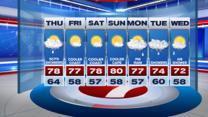
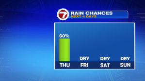
After tonight and tomorrow’s bout of tropical-like downpours, we get a respite from the rainfall just in time for the weekend (and if you’re starting your weekend early…Friday is included in that statement).
The weekend looks picture perfect from this angle with highs surrounding 80° (just slightly cooler at the coast). As we start the following work week, unsettled weather returns, with some scattered rain likely Monday evening, lingering into Tuesday and early Wednesday.