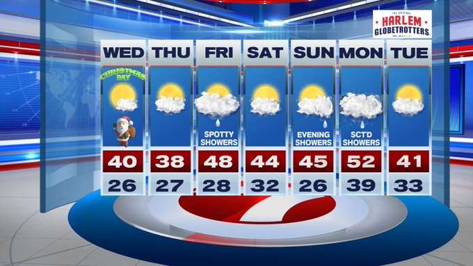
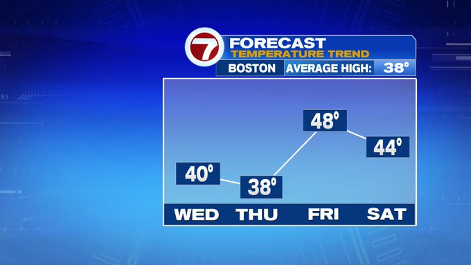
Well, it looks like Santa brought us seasonable and sun-filled skies to kick off our Christmas morning. Later on today, we’ll see a few more clouds, otherwise expect mainly sunny skies through midday with highs around 40°.
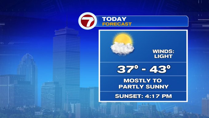
And it will feel nice since winds are relatively light and calm.
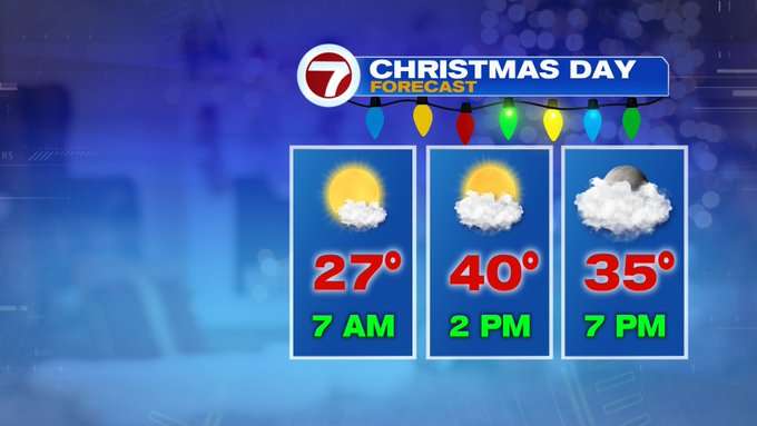
Tonight, temperatures only slip back into the 20s to low 30s under mainly cloudy skies.

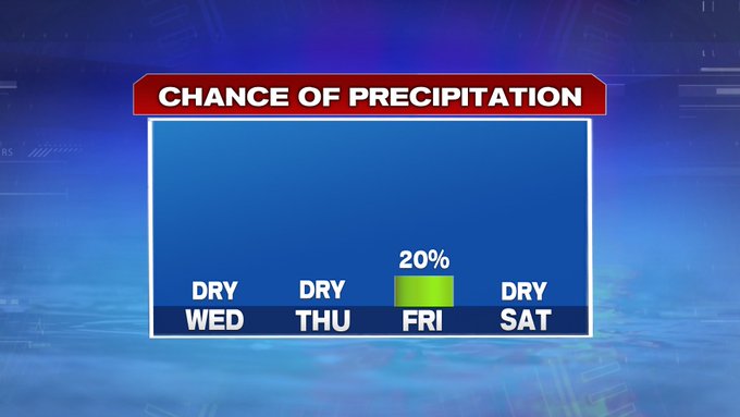
Looking ahead to the next few days, our next chance for a spotty shower is Friday midday into the afternoon as a system passes to our north
We will also see a warm-up Friday with highs into the mid to upper 40s, before a cold front sweeps through late Friday night into early Saturday.
High pressure takes over for the first half of the last weekend of 2019. A few more clouds build in Sunday ahead of our next system that brings showers Sunday evening and into Monday.


It will be a warm start to the work week when highs stretch into the low 50s, but that warm-up also brings rain for most of the day. Drier conditions prevail for New Years Eve and highs closer to normal.