After a wet and chilly end to the work week, we’re tracking the return to sunshine to kick off the weekend.
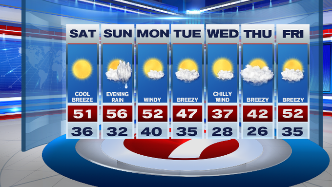
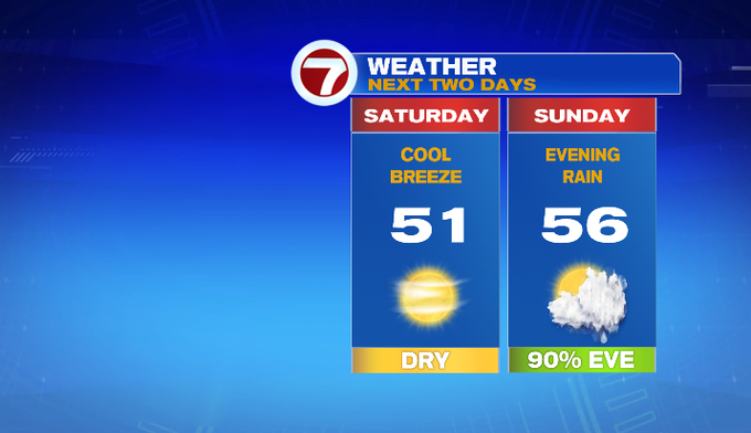
Not only are we tracking the sunshine, we’re also tracking the seasonable high temperatures for both weekend days, which is nearly 20 degrees lower than last weekend (the unseasonably warm 70s we felt last weekend are out of here).
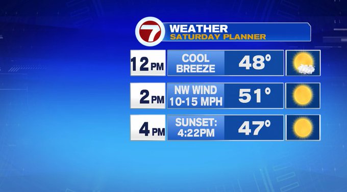
Today, highs will stretch into the low 50s with a cool breeze out of the northwest from 10-15 mph.
Tonight, under clear skies, temperatures will slide into the upper 20s off to the northwest and in the low to mid 30s farther southeast and closer to the coastline.
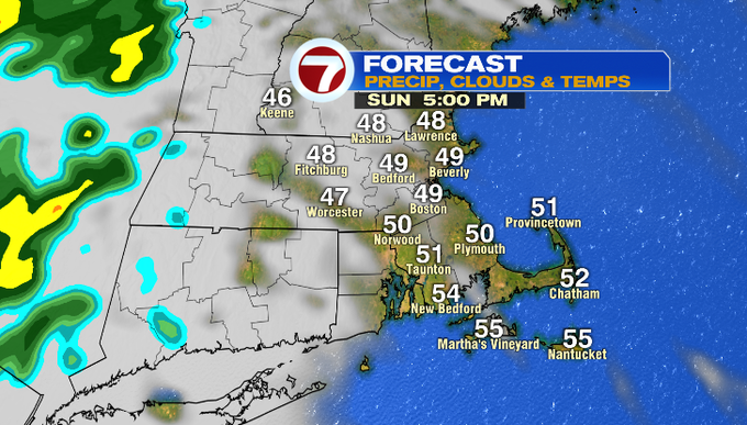
Tomorrow, we start off with sunshine with increasing clouds through the afternoon ahead of front that will bring evening rain showers to the area.
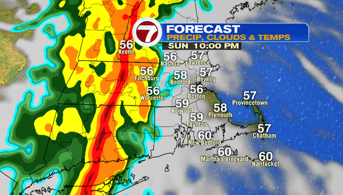
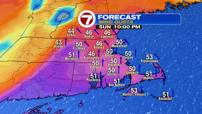
Embedded downpours are possible as the line marches from west to east from 9pm to 11pm, accompanied by gusty to damaging gusts (some of the weather models indicating a narrow band of 50 mph gusts Sunday night). We will certainly keep an eye on how strong the winds could get as we get closer.
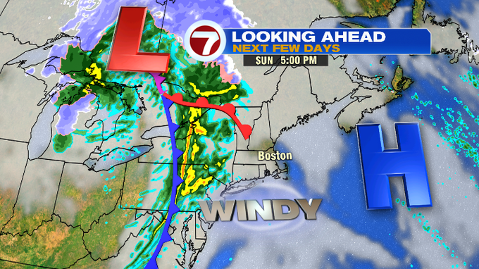
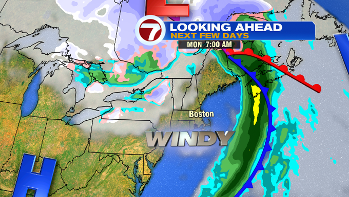
The rain is out of here by Monday, but the wind will stick around with gusts in the 30 MPH range.
We’re in for a cool down midweek with highs only in the upper 30s Wednesday before rebounding back into the low 50s by the end of the week.