
If you have outdoor plans on this Sunday, you’ll certainly notice the windy conditions. A few locations have already received 40 MPH gusts (including Boston), so be sure to hold onto your hats this Sunday afternoon.

High temperatures are much more seasonable for this time of the year – into the upper 30s, but we’ll likely see wind chills stuck in the upper 20s for most of the afternoon.

We go from clear skies at 7PM this evening to mainly cloudy skies just 12 hours later for the Monday morning commute. Overnight lows likely slipping into the 20s.


We are in an active weather pattern, as another system skims to our north, with a trailing warm front Monday, that will provide spotty snow showers for central MA into the afternoon hours tomorrow.

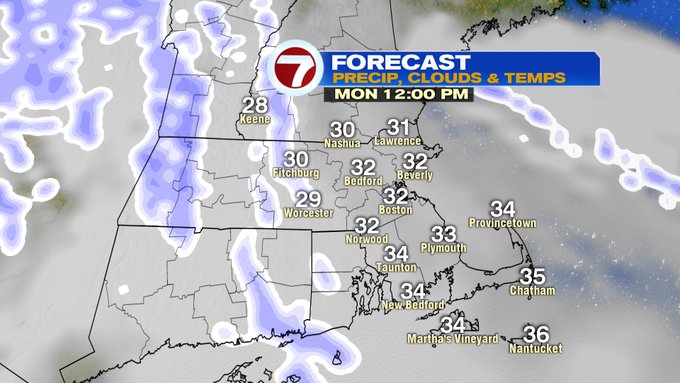
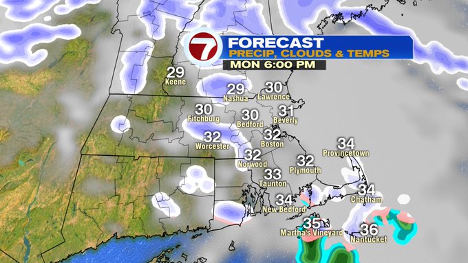
It’s not just the midday hour that we will be tracking the snow showers. There’s also a chance for a few more by Monday evening’s commute. Again, not everyone will see them, but just a heads up to be aware of some slick spots on your Monday travels. Highs Monday will be in the mid 30s.
Another pair of systems will bring some rain/snow mix late Tuesday into Wednesday. The bulk of Tuesday will be dry, it’s Tuesday night when we see the return of a rain/snow line along the immediate coast, snow inland into early Wednesday morning before this system moves out. The system to our northwest could bring a few spotty snow showers Wednesday midday.


Finally drier conditions, but colder Thursday before warming up Friday. Friday evening we’ll see the return of some rain showers that will continue into Saturday. Next Saturday looks to be the warmest in the 7-day with highs into the low 50s.
