There is a lot to talk about with the weather over the next several days.
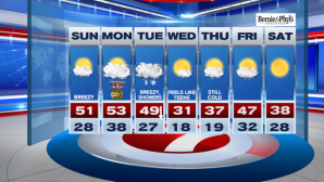
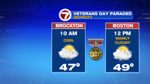
Today and tomorrow are the least of everyone’s worries as temperatures will remain seasonable and dry conditions prevail for the Veterans Day parades and ceremonies going on across the area on Monday. Thank you again to all of our Veterans (as well as their families) for your service and sacrifice.
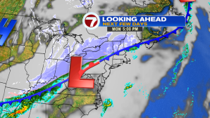
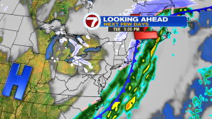
Tuesday, starts off with clouds and a few rain showers, before transitioning to snow by midday. Expect some slick road conditions especially Tuesday evening and through the overnight as temperatures take a nose dive. As far as how much snow we could see, it really depends on the timing, and since we start off well above the freezing mark on Tuesday, it will be tough for the first snowflakes to stick.

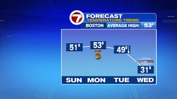
Rollercoaster temperatures over the next several days, too.
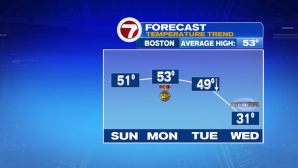
We go from the 50s today and tomorrow to 30s by Tuesday afternoon. The high of 49 on Tuesday happens early in the day before the cold front swings through, ushering in a bitter blast of cold Canadian air for Tuesday night into Wednesday.
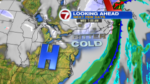
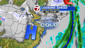
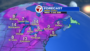
Not only that, but we’re tracking gusty winds out of the northwest, bringing dangerously cold wind chills into early Wednesday. Expect wind chills in the single digits Wednesday morning, only improving to the teens by the afternoon.

High temperatures on Wednesday will struggle to make it into the low 30s. It will still be cold on Thursday before warming up into the 40s by the end of the work week. Next Saturday looks to be sun-filled, but cold again with highs into the upper 30s.