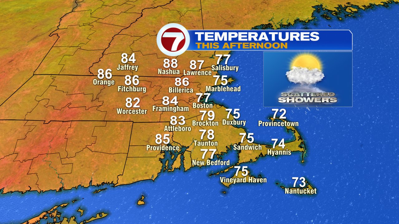
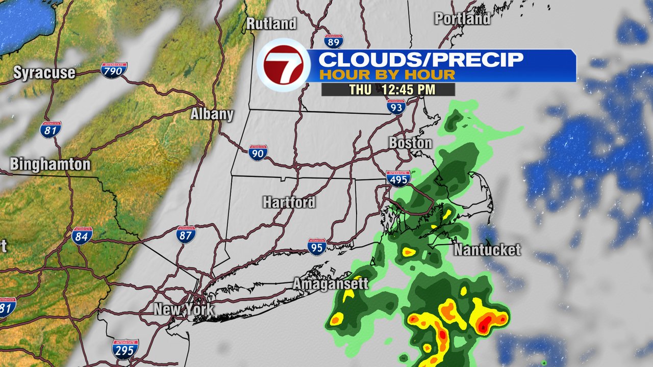
Mostly cloudy skies and patchy fog kick off this Thursday morning as the overall cooler pattern prevails the next several days. Cooler, relative to the high heat that we just had, but not all that cold. In fact, temps today run in the mid to upper 80s near and northwest of 495. We’ll hold closer to 80 around the Boston metro area and run in the 70s along the coast. It’ll be coolest across Southeast Mass, where some midday showers likely fall as well. The highest chance for showers will be around midday (11am-2pm) there.
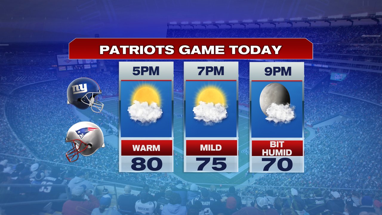
Heading to Gillette tonight to take in the first preseason game? The weather looks good for that with temps running in the mid 70s around kickoff as it’ll be a bit muggy, but at least we’ll have dry skies.
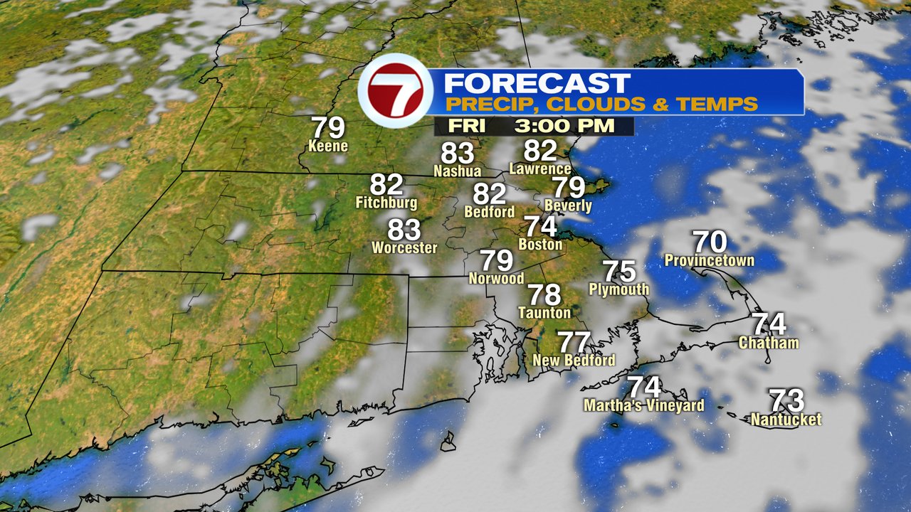
Friday, through the weekend looks mainly dry and comfortable with temps in the 70s to low 80s. A few isolated showers are possible Friday and Saturday, but again, much of the time rain free. Sunday looks brighter and a bit warmer.
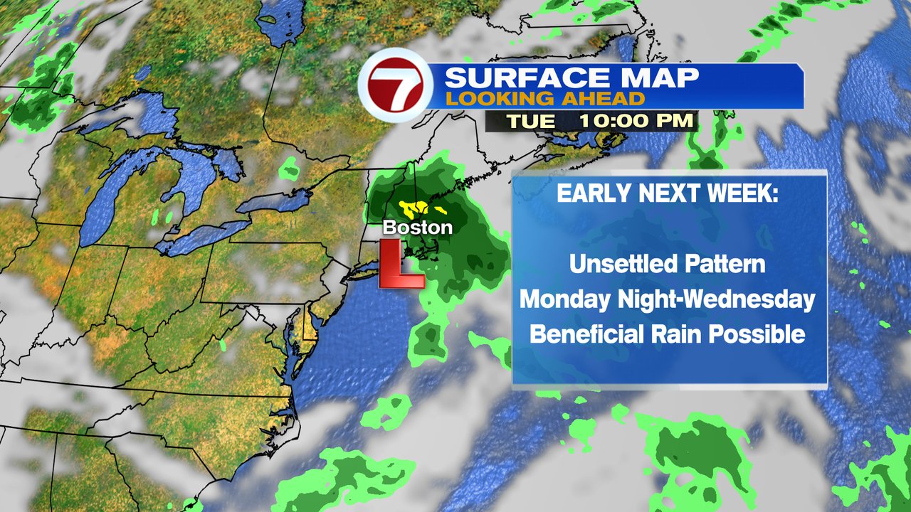
Early to mid wee next week, Monday Night – Wednesday, will feature the chance for some widespread rain across the region as an area of low pressure slowly moves from the mid-Atlantic toward New England.