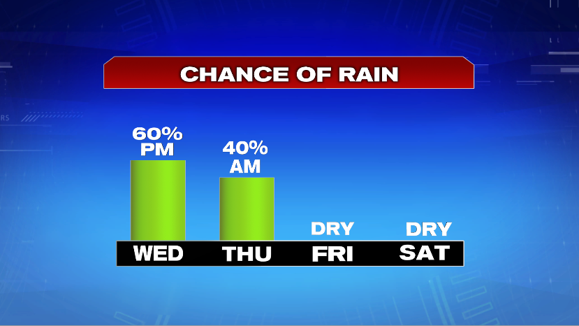
7Weather- It’s mainly dry tonight and Wednesday morning, and then rain chance increase Wednesday afternoon.
NEXT TWO DAYS:
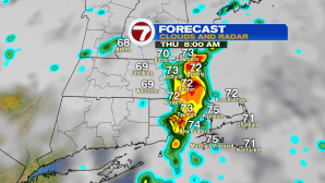
We wake up to temperatures in the upper 60s and 70s, and under mostly cloudy skies.
A few showers/storms could begin to pop-up after 2 PM for Southern New Hampshire and Western Mass.
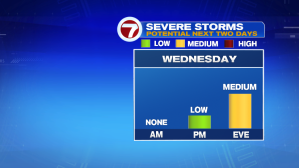
We have the potential to see strong to severe storms in the late afternoon and evening, but only if skies clear up, and temperatures jump into the mid 80s.
This will allow the atmosphere to become unstable. If it all lines up, Boston and SE Mass will likely get a strong line of storms that develops in the late evening and into the overnight hours.
The main threats with these storms are gusty winds and torrential rainfall. The tornado risk is low, but it’s not zero.
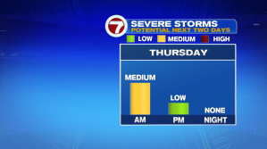
There could be another line of storms Thursday morning, keeping our chance of strong storms in the “medium” category.
Most of the activity is done with by mid-day Thursday, and we might actually see some sun late in the afternoon.
A cold front pushes through, clearing things up to end the week and into the weekend. Friday and the weekend are looking good, weather-wise.