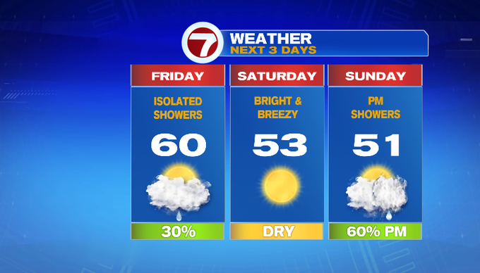
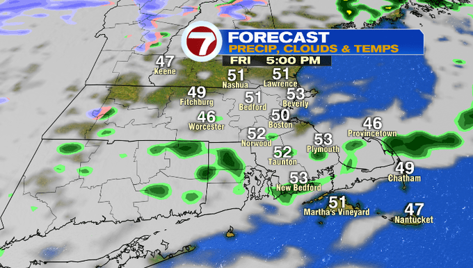
After pockets of heavy rain and a few stronger thunderstorms with gusty winds overnight, we have a couple rounds of showers passing through the region for the Friday morning commute.
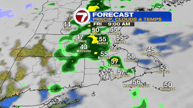
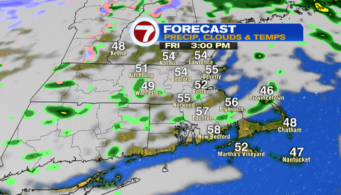
It is a warm start and temperatures will likely vary in the mid 50s to around 60° this afternoon with some peeks of sun at times, otherwise mostly cloudy with an isolated shower in the afternoon mainly south of the Pike.
The clouds will gradually clear tonight as temperatures fall back into the 30s overnight. After a colder start to Saturday, temperatures bounce back into the low 50s under sun-filled skies. It will be breezy yet seasonable for the first half of the weekend.
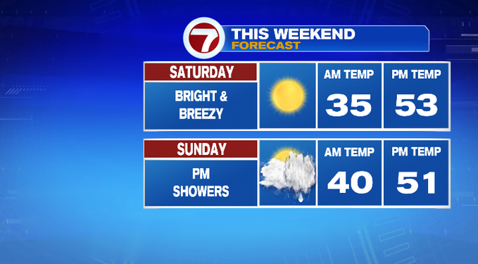
Sunday features a low pressure system that slides south of southern New England and will bring more clouds and afternoon showers.
For the next work week, Monday and Tuesday are quiet and dry. The shower chances hold off until Wednesday and those scattered showers stick around for Thursday.
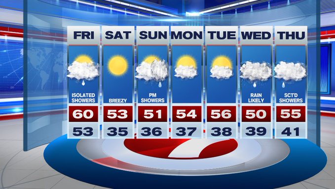
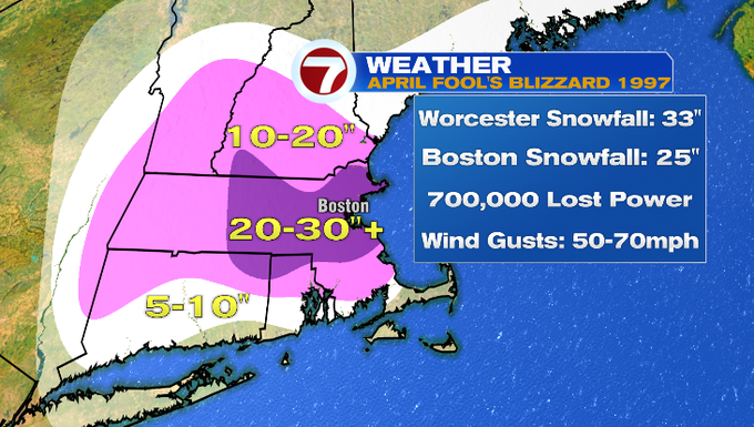
Since it is April Fool’s Day, we couldn’t submit the weather blog without mentioning the April Fool’s Day Blizzard of 1997. To this day, that is the snowiest April on record because of that storm and makes it that much memorable 25 years later. Thankfully we’re not tracking any snow in that 7-day forecast.