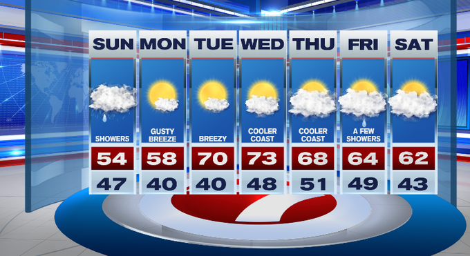
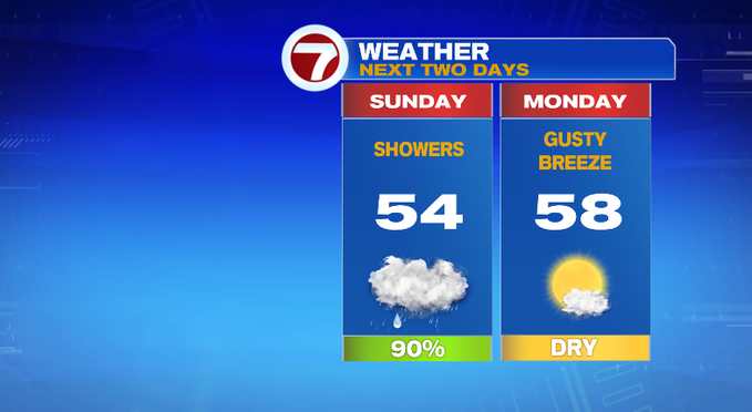
Wet weather returns for our Sunday, tapering as we approach dinner time from west to east. Highs today will not be nearly as warm as yesterday, in fact, temperatures will likely be below normal this afternoon compared to highs yesterday that were over 10-degrees above normal (what a difference!).
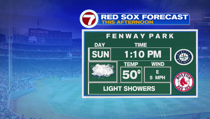
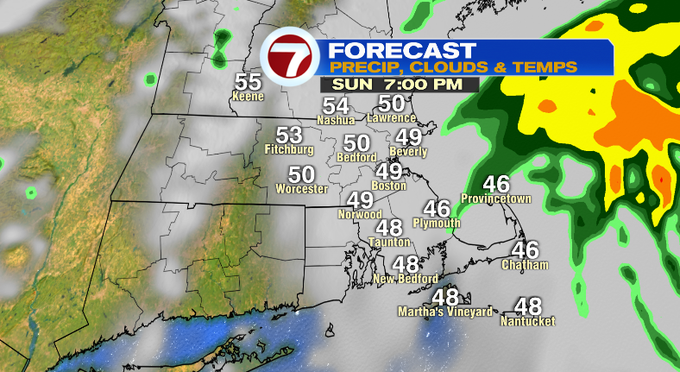
At Fenway, the rain jacket will be needed with light showers for the game and temperatures around 50°.
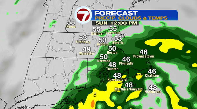
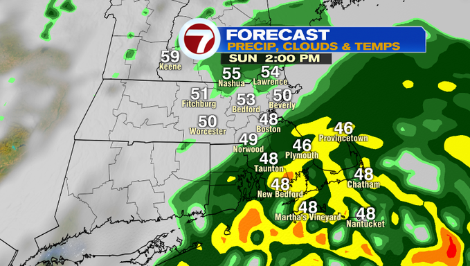
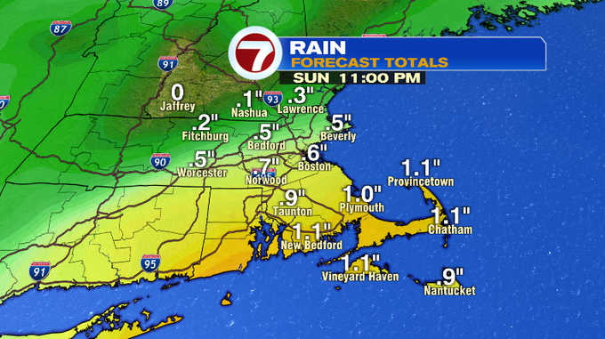
Steady to moderate rain is expected for the South Coast and the Cape and Islands, closer to the system that is passing just south of New England. Areas farther north, mainly light showers that will only amount to a quarter of an inch. Boston and areas south and east a half an inch to an inch of rainfall is expected.
Showers fill in across the region by late morning, starting to taper to the west by mid-afternoon as the showers shift from west to east by dinner time. By sunset (around 7:30PM), most of the showers will be off the coastline and we’ll see mainly cloudy skies.
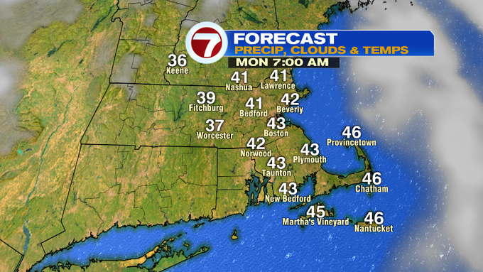
This is followed by a gradual clearing of the skies overnight, with some areas of patchy fog. Temperatures overnight dip to near 40°.
The sunshine returns to kick off the work week, but we’re still going to be seeing a gusty breeze Monday with highs into the upper 50s.
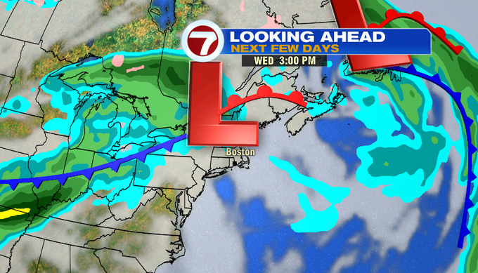
Tuesday we warm-up to 70° under mostly sunny skies. Wednesday brings a few more clouds and a chance for a spot shower late, with highs into the low 70s.
Cooler to round out the week, but still above normal with highs into the 60s Thursday and Friday with both days featuring a chance for a few showers, but we’re not tracking washouts.