Today marked the first day of astronomical winter and overall it was pretty nice! We all know that December can throw many things our way… bitter cold, frigid wind chills, blizzard conditions. None of those were the case today with sunshine, a gentle southwest wind, and temperatures in the lower 40s! Not bad! That will change overnight and early tomorrow as some wintry weather returns.

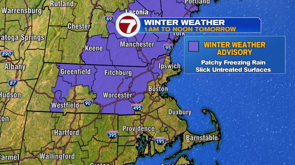
The storm right now is over the Carolinas and most of it will head out to sea. We are just on the fringe of that storm, but as that fringe moves into colder temperatures we’ll bring the risk of freezing rain to the forecast overnight and early Wednesday. So yes, it’s technically bringing winter weather, but it’s not snow that maybe many of us are hoping for. In fact, it’s probably the worst possibility of snow or rain or the icy mix. We have a winter weather advisory issued for the area for most of the overnight and early Wednesday morning.
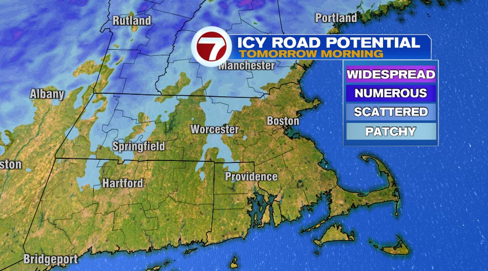
While patchy freezing drizzle and light freezing rain is possible everywhere in the purple shaded areas, it’s most likely to hang on the longest in the blue shaded area below. Of course with that potential holding on longer, ice build up will be more likely. Everyone should be careful out the door and on the roads tomorrow but especially outside of 495. That is where untreated roads, bridges, and overpasses will be especially slick. That also means your front steps and sidewalks! Be careful when you’re walking too.
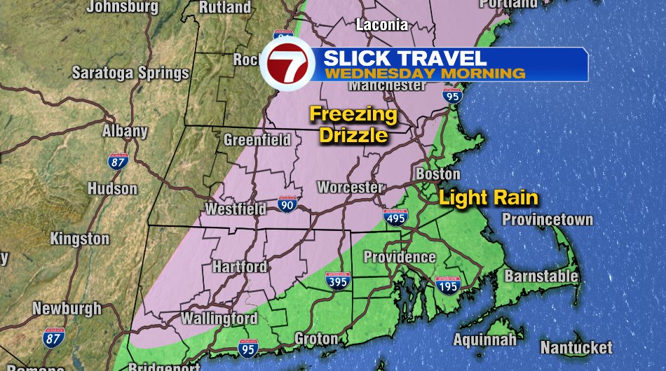
I want to reiterate though, that there will be freezing rain and drizzle outside of the blue contour above. Everywhere in pink below will see at least a little freezing rain overnight, even if it flips to rain by the time you step outside.
Here is a rough timeline of the rain/freezing rain below:
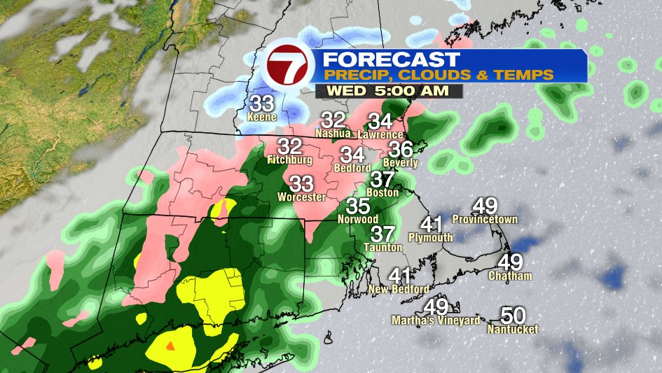
Notice by 5am a large area is seeing at least the potential of a little ice build up
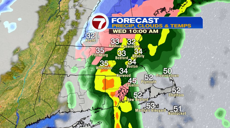
As we go through the morning, more and more of us will see that flip over to rain. However, I’d especially watch the hillier terrain in northern Worcester county and southern New Hampshire where the cold air often gets lodged in place. It may last a freezing precipitation for a few more hours there.
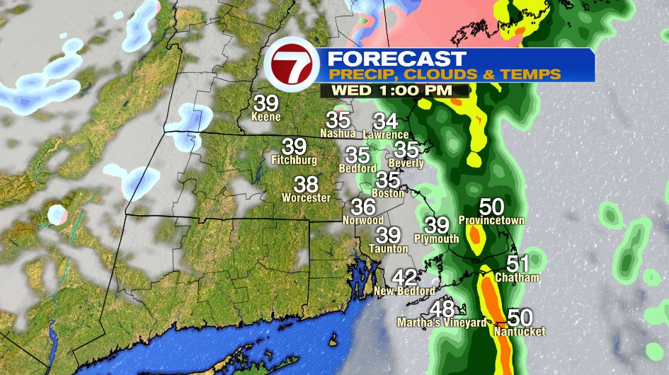
By noon/1pm, the rain is gone and we’ll actually finish the day with a little sunshine.
If you have travel plans for Christmas, tomorrow morning is probably the worst time of the week to do it. If your plans are flexible, I’d wait until tomorrow afternoon. Otherwise Thursday looks fantastic for travelling.
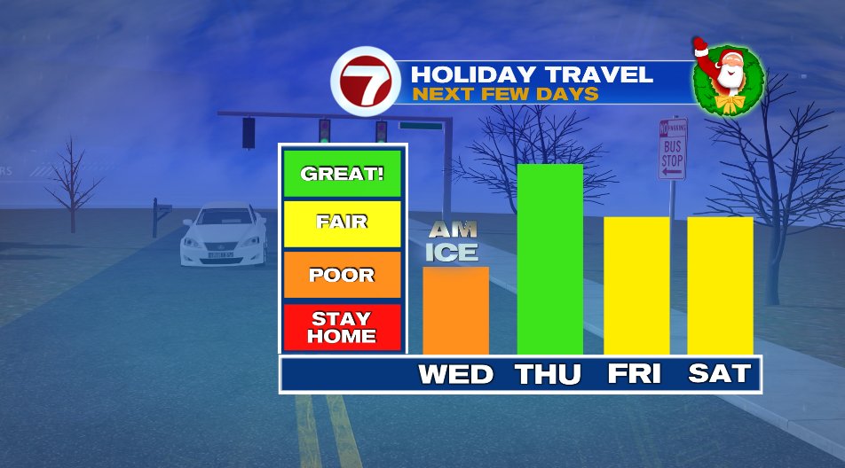
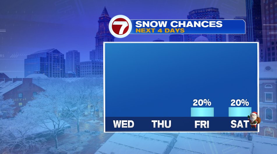
Friday and Saturday will bring a few snow showers (maybe mixed with raindrops Saturday). Nothing looks heavy or overwhelming but it may slow down the roads a bit then. So what does that mean for a white Christmas?! Well… I wouldn’t hold my breath or get my hopes up by the chances are not zero. A low chance for a dusting of snow is possible Thursday night/Friday and again on Saturday.