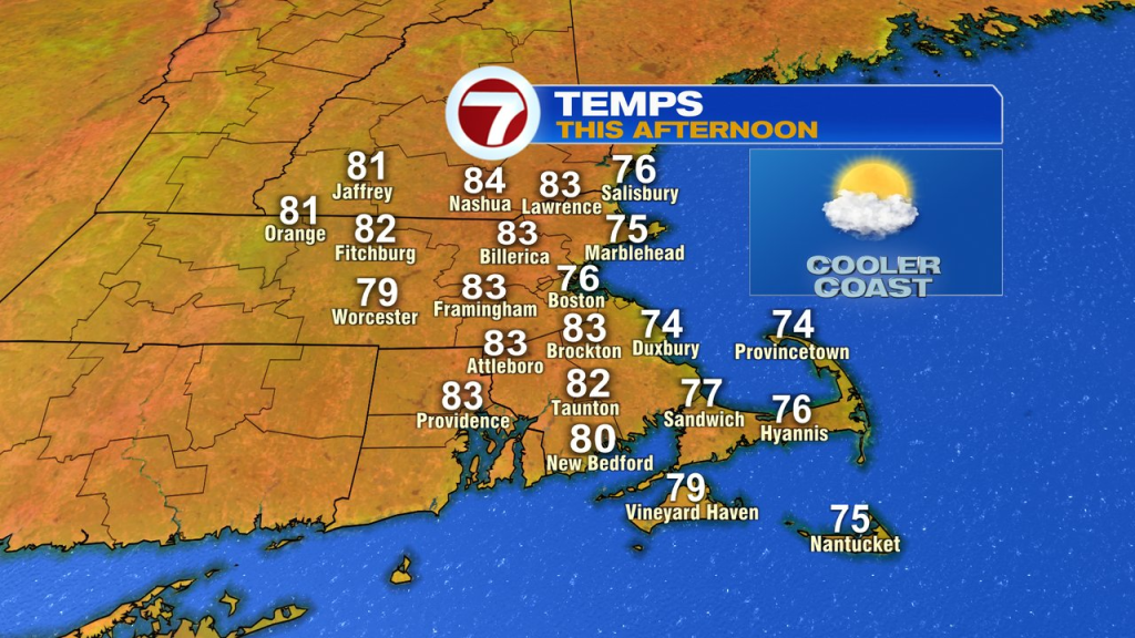
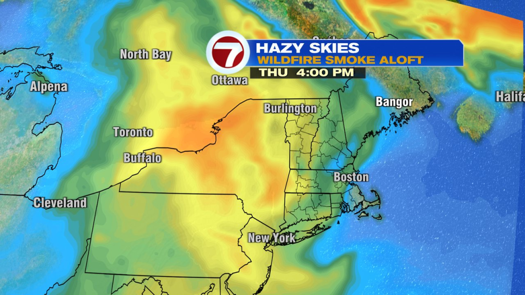
The combo of highs clouds and smoke in the air yesterday obscured the sunshine quite a bit through the day, with highs running in the mid 70s at the coast and near 80 inland. Today, the temps run close to that again (a degree or two higher), but will be brighter overall.
Any patchy fog this morning burns off and clouds tend to thin out this afternoon. In addition, the smoke aloft thins out too. That’ll allow for sunshine to be in the mix. Just like the last couple of days, the best shot of a passing shower/storm will be the higher terrain of western NH, VT and western MA. That leaves much of the area dry. Dew points drop into the low to mid 50s as well, allowing for a very comfortable feel to the air.
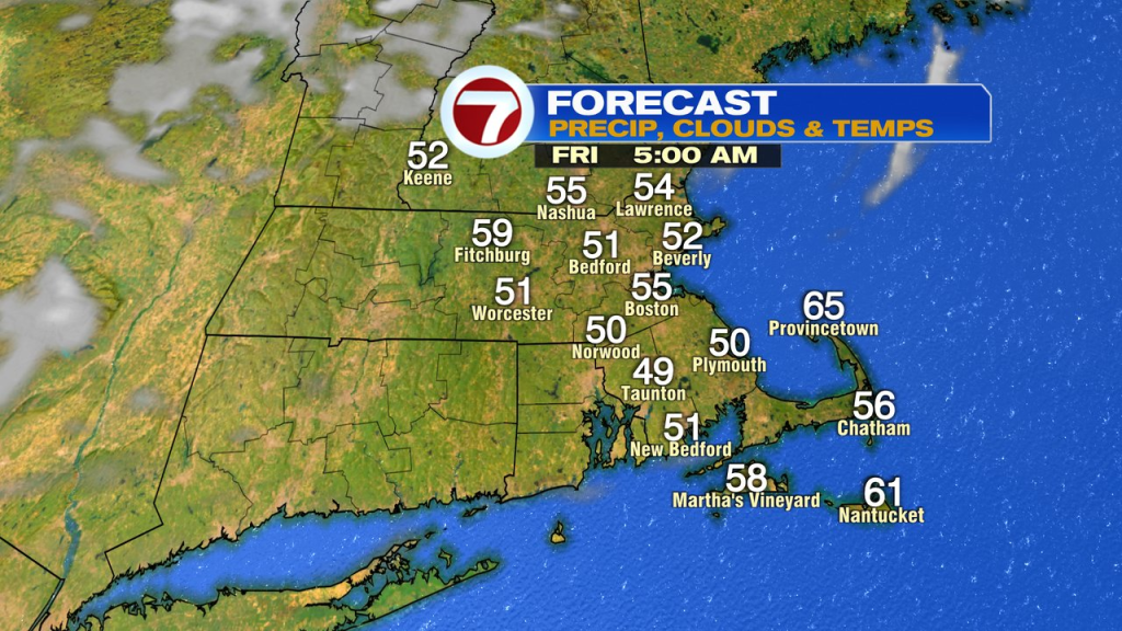
A bit of a chill in the air tonight and early tomorrow as lows drop into the low to mid 50s. The bounce back is nice though with low humidity and highs in the upper 70s coast to mid 80s inland tomorrow.
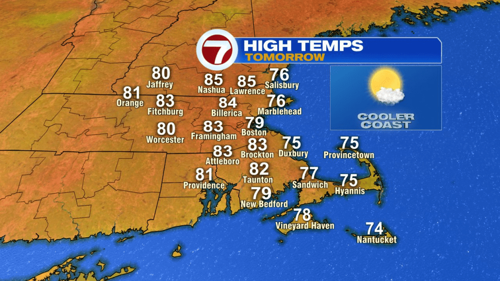
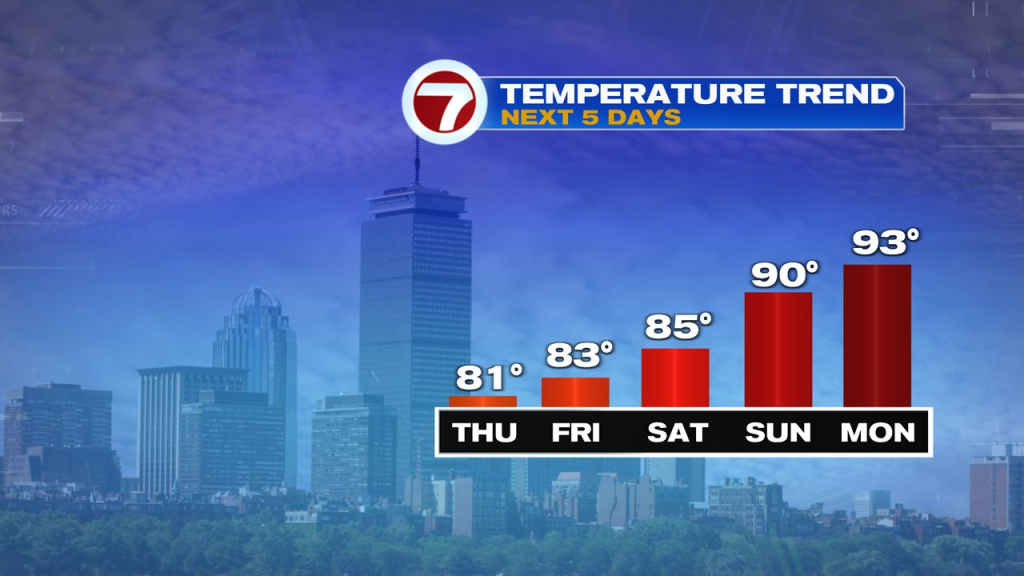
Great pool/beach weather settles in over the weekend. Highs push to 85 inland Saturday and near 90 Sunday. It’ll be a bit cooler at the coast. Humidity is still low Saturday and bounces up a bit Sunday.

Early to mid week next week will be hot and humid with highs in the 90s. Storm chances are limited, with just an isolated storm possible Tuesday and a few scattered storms Wednesday afternoon.