The weather will be all over the place this morning as we track a mix of snow and rain across the area. The best chance to see the flakes will be along and north of the Pike, with drops most likely across Southeast Mass. While the storm won’t amount to much, spotty coatings across MetroWest are likely with the best chance to pick up an 1″ of snow across northern MA and southern NH. Watch out for a few slick spots on untreated surfaces northwest of I-95 this morning. Rain and snow showers ends for most by 10am, aside from a leftover passing shower through late morning for Southeast Mass.


This afternoon looks good… a bit breezy, but with some sun breaking back out, highs will jump up into the low to mid 40s. Tomorrow is solid too, mid to upper 40s with some sunshine and a bit of a breeze.


We’ll track rain in here for Saturday, but it’s gone by Sunday.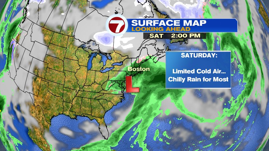
The next chance for rain/ice and snow comes Tuesday into Wednesday morning. Snow is most likely across northern Mass, points north, with the best rain chance the farther south you go. Too far out for rain/snow lines/specifics, but something worthy of keeping an eye on. Ski Country will do well with this one though, as it’ll be all snow up there. Also, our rainstorm Saturday is mostly a miss for Ski Country, although a few rain/snow showers could get up that way.

Have a good day.
@clamberton7 – https://twitter.com/clamberton7?lang=en