The cold is back in place, though not as cold as the bitterly cold stretch (almost two weeks!) that we just made it through. With that said, temps were still around 10-15 degrees below seasonal averages today. It’s another cold night ahead of us too. With mainly clear skies inland, some of those coldest spots N&W of 495 may make it below zero. Generally speaking, overnight lows will be 3-20°. Yes, that’s a large range in temps – but you’ll find those teens for lows where we keep some cloud cover in place tonight; along the coastline, the Cape and the islands.
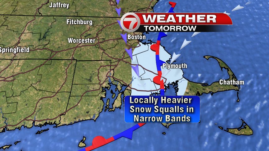
Some flurries may break out into the very early hours of tomorrow morning, and that will be the beginning of the snow we have in store for tomorrow. This round of snow though, is really focused along the coastline and for SE Mass. Locally heavier snow showers/squalls are mostly likely along the South Shore, where some towns can pick up 1-3″ of fluff. Intensity and amounts can vary quite a bit over short distances in these types of set-ups, but below is a general idea of the coastal front that will push in. West of that coastal front, temps will be in the teens; east of it, near 30.
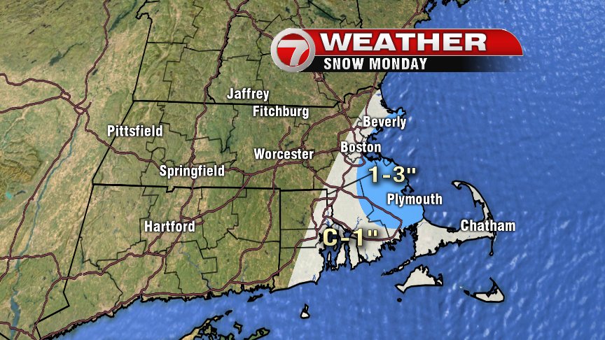
Tuesday is a “seasonable” winter’s day, with highs in the low to mid 30s under partly cloudy skies. It’s overnight Tuesday and into Wednesday morning that we’re tracking another threat of snow – and this round looks to be more widespread. Below is my first stab at a snowfall forecast for Wednesday… We’ll watch for the rain/snow line too and fine tune this forecast the next couple of days, but at least damaging winds and coastal flooding is not an issue this go around.

The rest of the week looks quiet, with a warming trend in store for the weekend. We’re all focused on next Sunday afternoon at Gillette, and for now that forecast looks mild!!! How does low 50s sound for tailgating and kick-off? GO PATS!
