Heavy rain and heavy snow greet us out the door this morning. Although the highest snow totals will add up above 1000 feet in elevation across Worcester County, even across the lower terrain, heavy, wet snow has been in the mix and will mix in at times through mid to late morning. By noon, it’s leftover showers of rain or snow left, but at that time, most of the accumulations will be over and done.

As temperatures run 33-36 out near 495 and just inside it, the battle of rain and snow will go back and forth this morning for a few hours. When precip is heaviest, colder air makes its way down to the surface, and it flips to snow. That’s why even along 495, a slushy coating to a couple inches are possible, especially on cold surfaces. The 8″ totals in Worcester county will be reserved for the highest terrain locations. Princeton already has 4″ early this morning, and may end up near that 8″ amount.
Rain and snow showers linger into tonight.

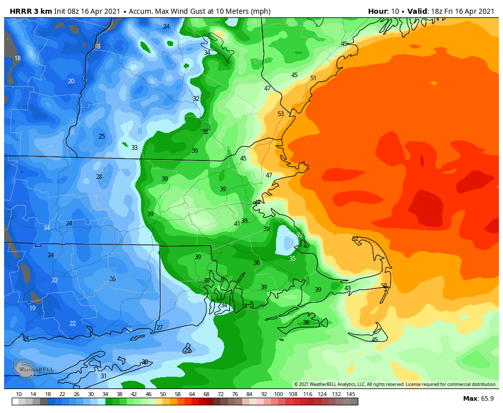
1-2″ of rain will fall, which will be beneficial. What won’t be beneficial is the wind as it cranks up. Gusts to 45-55mph will be felt along the coast, strongest across Cape Ann.
While it won’t be the prettiest weekend, we’ll see some improvements at temps run near 50. A bit below it Saturday and above it Sunday. A few scattered showers linger Saturday, with just a leftover sprinkle Sunday. Snow, what snow? It’ll be a distant memory by Tuesday as highs hit 70 again!
