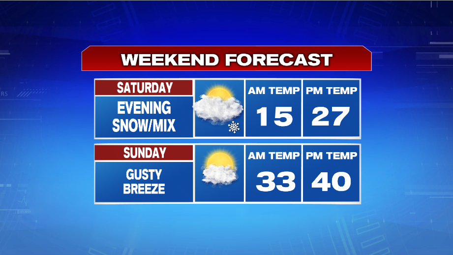
7Weather- Winter is back! Most of the daylight hours are dry Saturday, and then light snow moves in around sunset.
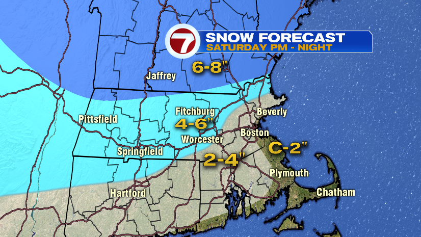
The highest snow totals will be in southern New Hampshire, where the precipitation stays as snow the entire event. 4-6″ are expected right along I-495, and north of the Pike. Snow changes to a mix and then eventually rain from south to north. This will limit snow totals south of the Pike, and along the coast.
Here’s a list of expected snowfall across the area:
- -Boston: ~2″
- -Worcester: 4-5″
- -Fitchburg: 5-6″
- -Bridgewater: 2-3″
- -Framingham: 3-4″
- -Lawrence: 5-6″
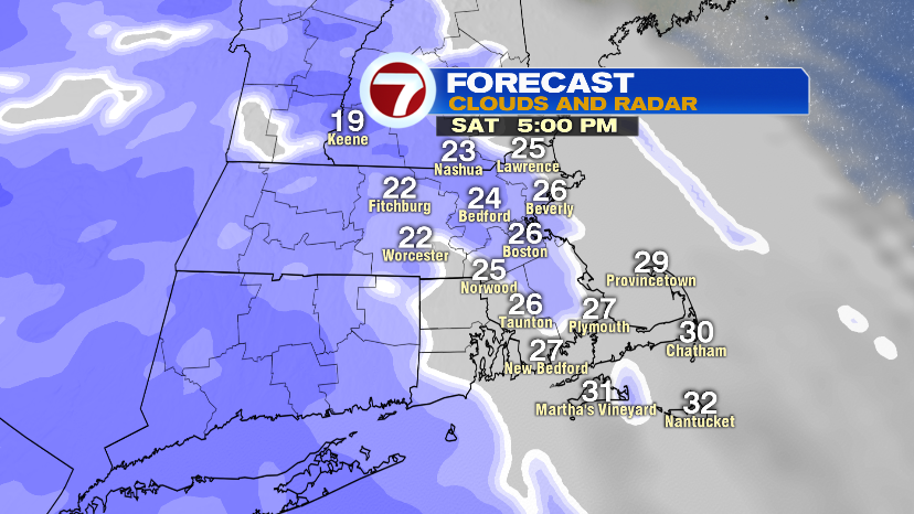
Light snow moves into Worcester County and southern New Hampshire between 4-5 PM, and between 5-6 PM in the Merrimack Valley, Boston, and southeast Massachusetts.
A period of steady, heavier snow is expected between 8-11 PM. Most towns get the majority of their snow accumulation during this window. The changeover to a mix/rain begins around midnight, and then most of the precipitation moves out between 3-4 AM.


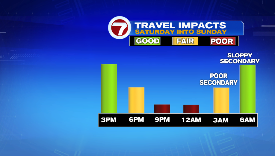
Roads will become snow covered by 9PM, and travel will be poor during the burst of heavier snow. Things slowly improve by 3 AM, and then we’re left with slushy roads by 6 AM Sunday.
Sunday will have gusty winds. Highs reach into the low 40s, but the wind will make it feel cold. The day starts cloudy, and then there will be some sun in the afternoon. There is also the potential for snow squalls around sunset.