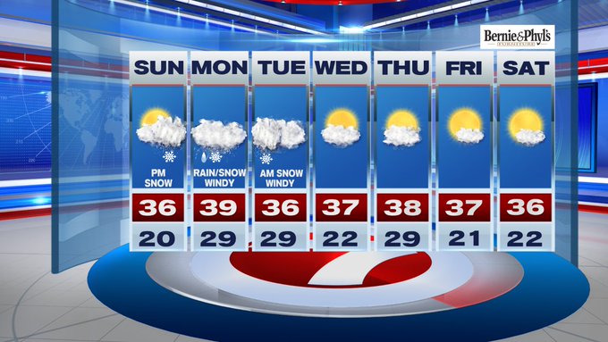
A long duration storm will bring a thump of snow before changing to a wintry mix to sleet in Boston to rain within the 95-corridor into Monday morning’s commute.

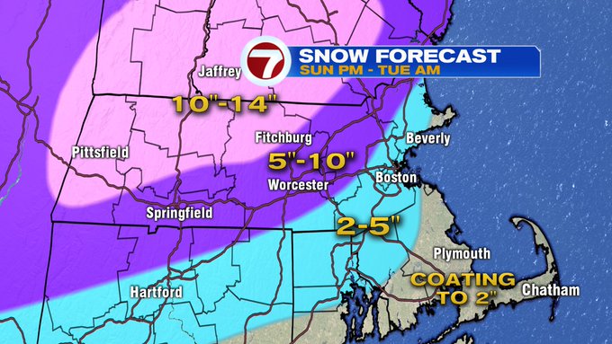
A Winter Storm Warning has been expanded to include areas just northwest of the 95-corridor and will go into effect at 11am Sunday morning and remain in effect through Tuesday morning.
A Winter Weather Advisory includes the immediate coastline (Boston, North Shore, Cape Ann, Gloucester, Quincy, and Hull) through Tuesday morning with snow changing to a wintry mix to rain making for tricky travel over the next 48 to 72 hours.
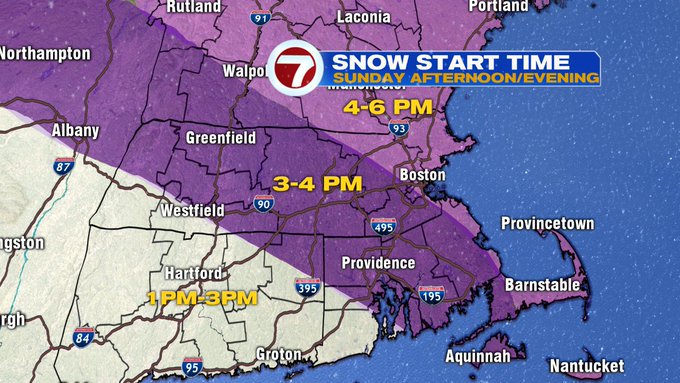
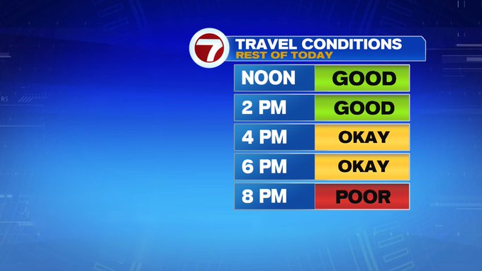
For those in interior southern New England (those included in the Winter Storm Warning), will likely see mainly snow with this system, with some wintry mix to sleet possible. The initial thump of snow begins later this afternoon, between 3-4pm for Worcester County, between 5-7pm for eastern MA and Boston.

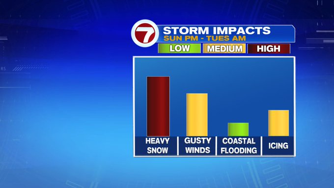
As this system evolves just to the south of New England and continues to hug the southern New England coastline, the winds will shift – with gusts from 35-45 mph possible, especially at the coast.
Once they shift to out of the east-northeast, we have that ocean influence (water temperatures is in the upper 40s), and that will push that rain/snow line farther inland (at least back towards 495), which will make for lower snowfall totals along the coast and make for some slick travel at times.
We see lighter snow for the higher elevations inland Monday afternoon before the winds shift to out of the north Monday night into Tuesday and the rain/snow line will retreat to the coast again.

With the backside of the system on Tuesday morning, we expect another burst of snow, especially for those within the 495-corridor. It’s still a tricky forecast for the placement of the heaviest snow bands, but with the slightest movement farther east and out to sea, the bulk of the heaviest snow could be just east of the Outer Cape, or a movement farther west and closer to the coast, could mean more snow for eastern MA. We will continue to monitor the movement of this system from start to finish.
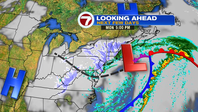


The good news is that after this system finally moves out by Tuesday afternoon, we are dry and seasonable through the end of the work week.