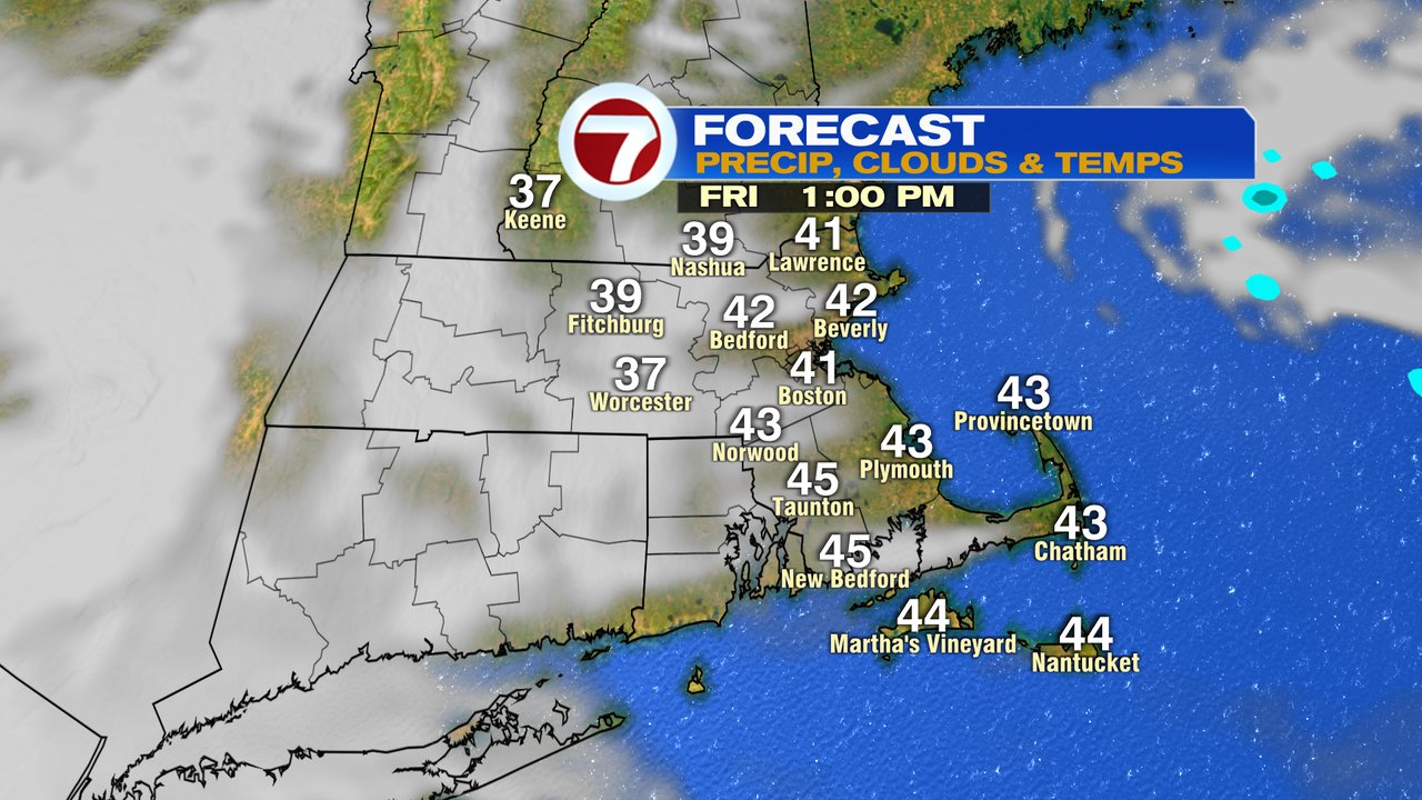
We’re waking up to quiet weather this Friday morning, although be mindful off patchy black ice if your town is at or below 32 degrees. This afternoon, we’ll warm up to near 40 with a mix of sun and clouds. Clouds win out this evening, and we’ll track rain aftern midnight tonight.
That rain will be locally heavy after midnight, especially from 4am-Noon. Initially, it’ll start off as some snow across far northern Worcester County and southwestern New Hampshire, but even there, the flip to rain happens fast.
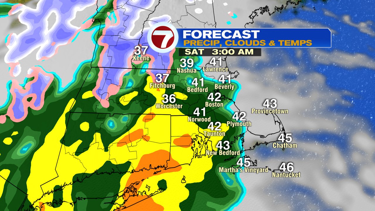
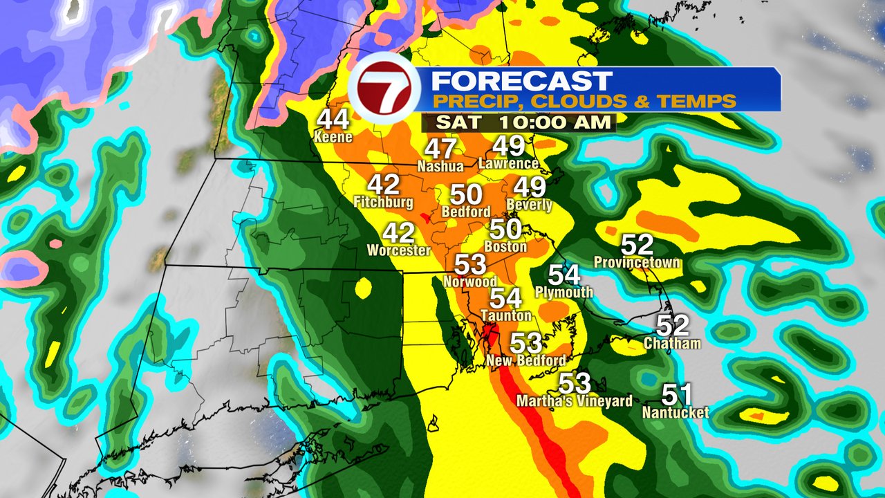
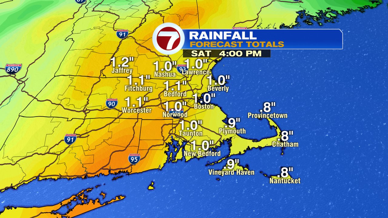
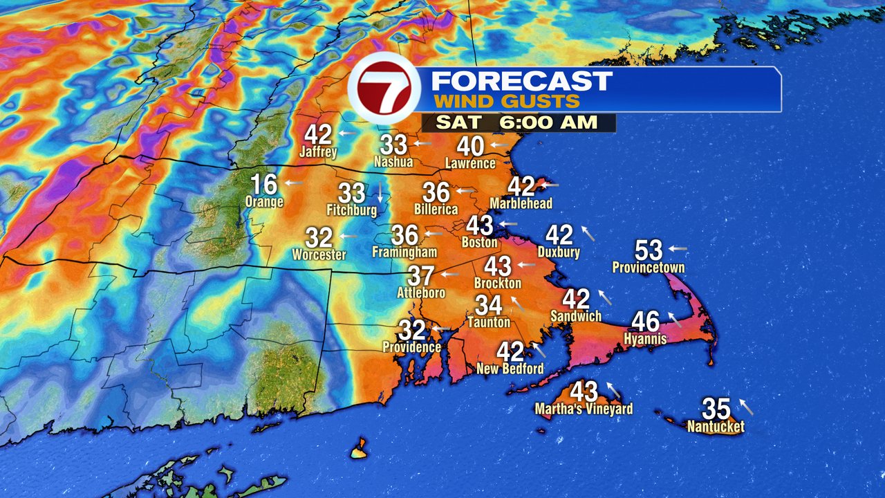
Rain is heavy tomorrow morning as gusty southeasterly winds kick in. Gusts will be strongest at the coast, gusting 40-50mph. Rain totals add up to 1-1.5″ with most of it falling between 6am and noon. Rain tapers to a few isolated leftover showers by the afternoon.
Up north, it’ll be a heavy, wet snow above 2000 feet, so ski resorts in VT, northern NH and ME should do ok with this.

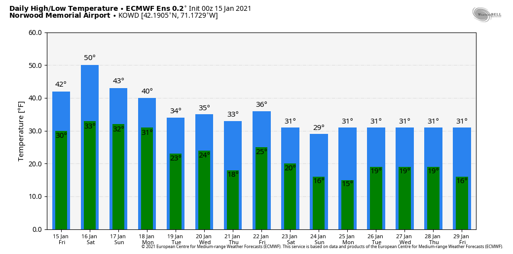
Longer range, the forecast does look colder here. Whether it leads to a snowstorm remains to been scene, but indications are of a colder pattern 8-15 days out.