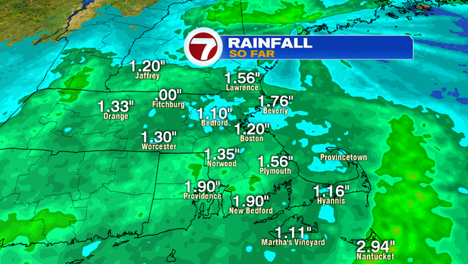
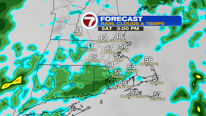
The rain overnight and into this morning, dropped nearly two inches of rainfall across the region. Expect fog and cloud cover to linger through most of the day with some spotty rain showers on and off through this evening (these not nearly as heavy or as widespread as early this morning). This is another reason why the Flood Watch has been peeled back for some.

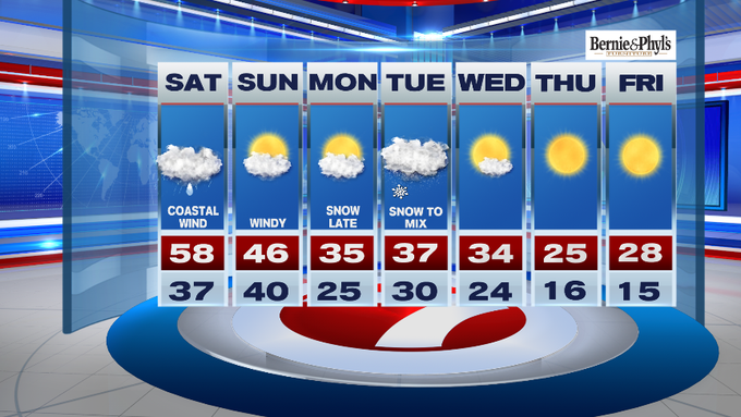
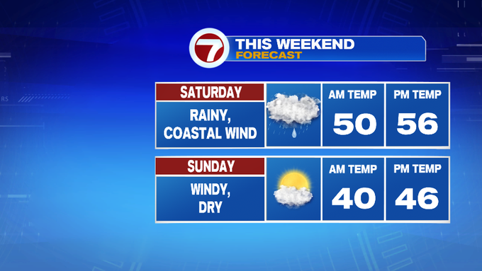
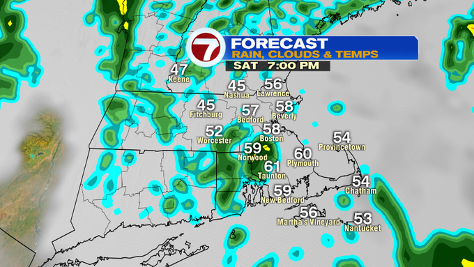
Temperatures this afternoon will remain in the 50s for most, with a few spots around 60, which is unseasonably warm for this time of year.
Overnight, temperatures only slip back into the mid to upper 30s to low 40s as skies gradually clear.
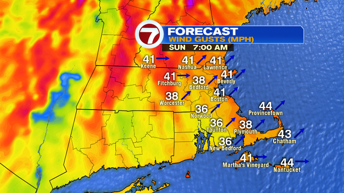
Sunday features glimpses of sunshine under partly cloudy skies with highs into the mid to upper 40s, with a westerly wind gusty at times up to 40 mph.
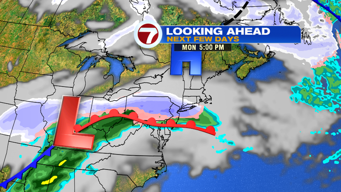
Monday is mainly dry, as we monitor the next system that will be knocking on our doorsteps late Monday night into Tuesday. This system will bring accumulating snow to start, followed by a wintry mix around the Mass Pike, with snow to mainly rain for those in SE MA and the Cape and Islands.

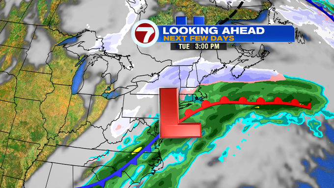

After a messy mix for Tuesday, the rest of the week looks fair, but much colder with highs by Thursday and Friday into the 20s and lows into the teens!