

Another chilly night is in the books with temps near/below freezing for inland locations early this morning. Along the coast, it’s a bit milder, especially Southeast Mass, where some patchy sprinkles/light showers have backed in.

These same locations will see some spotty light showers through the day, although rain totals are low, generally only a few hundredths of an inch. Cloudiest skies today run near and east of I-95, with the brightest skies northwest of Boston. Highs max out in the lower to middle 50s.

Tomorrow will be mostly cloudy with highs in the low 50s and occasionally a few spotty showers.
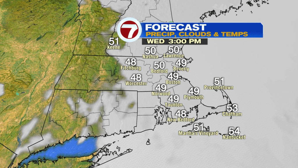
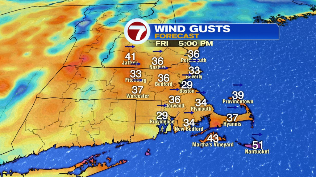
Thursday into Thursday night, the rain chance goes up for all, as scattered daytime showers turn to a widespread rain by Thursday evening. With embedded downpours, 1-2″ of rain is possible with gusts of wind 25-40mph, strongest near the south coast.
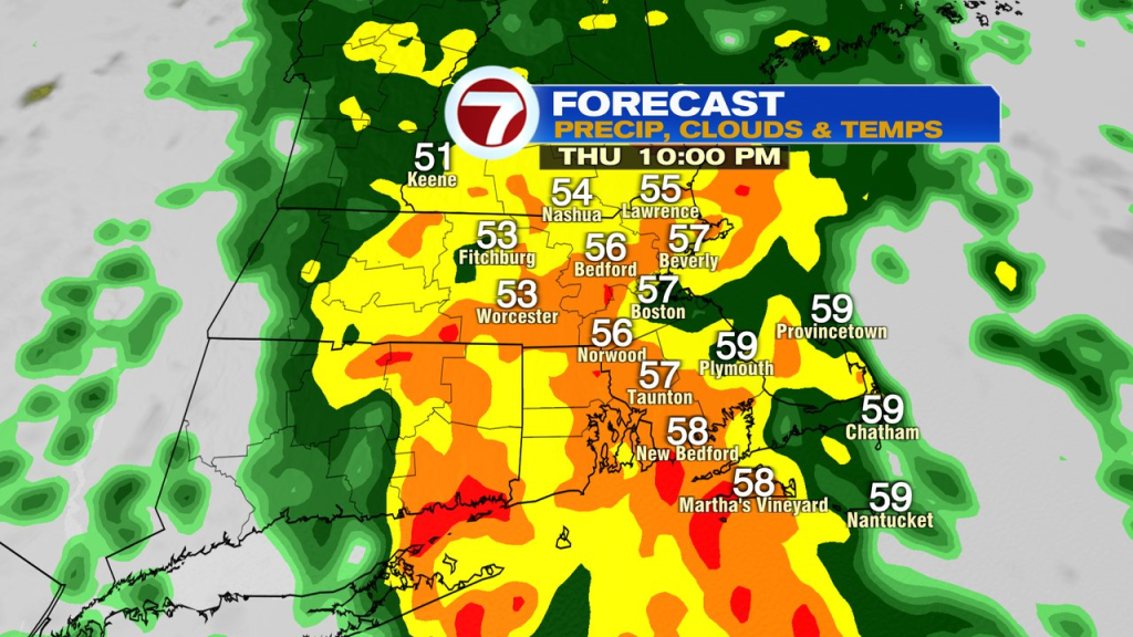
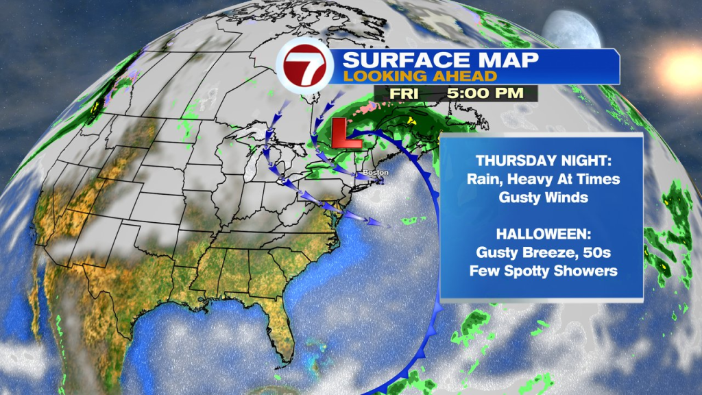
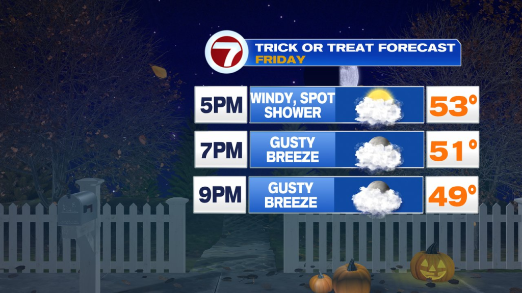
The timing of the storm right now appears to favor an early exit Friday morning, allowing for drier air to start punching in. With that said, on the back side of the storm, it’ll still be breezy with a few spotty instability showers leftover. At the moment, the Trick or Treat forecast is for westerly winds to gust 25-40mph, temps in the low 50s and an isolated leftover shower. While not perfect, it at least looks like we’ll be far removed from the height of the storm, which moves through Thursday night. Winds will be gusty, so keep that in mind for all those Halloween decorations you have outside, and hold on to your witches hat!
The weekend is dry, although a gusty wind starts it Saturday. Both days are seasonable for early November with highs in the low to mid 50s. Clocks go back 1hr Sunday morning.