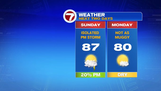
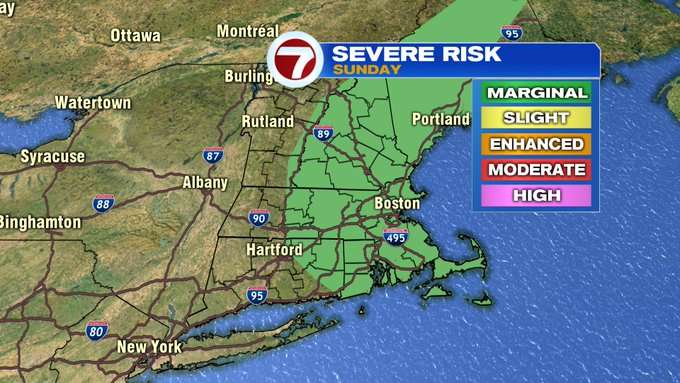
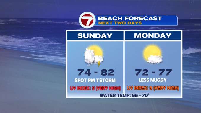
The difference between yesterday’s weather and today’s forecast is the fact that we have a chance for some isolated thunderstorms this afternoon. There is a potential for a few of these storms to become strong to severe, so it is imperative to remain weather aware for your outdoor plans on this holiday weekend.
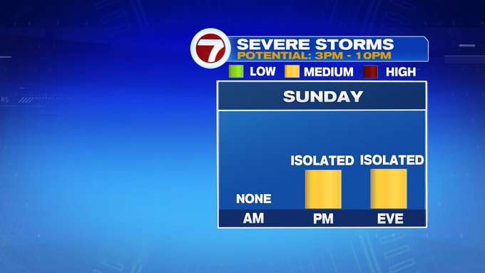
As for timing, expect a few storms to pop up around 3PM and continuing through 6PM just south of the Pike and into SE MA.
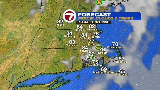
These wind down and then another area of concern is southern NH and NE MA just after sunset between 8:30PM to 10PM.

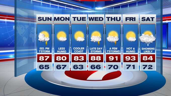
Many will not see a storm, and most of the daytime hours remain dry for our Sunday, just a few spots see a thunderstorm. The reason for the storm potential is a cold front diving southward from Canada and northern New England.

Behind this front, temperatures are seasonable Monday and Tuesday and also less muggy to start the week. That doesn’t stick around for the second half of the week as the heat and humidity build back in for Thursday and Friday with highs into the low 90s.


Scattered rain is in the forecast for next Saturday as a system meanders just south of New England.
That same system that we’re watching for next weekend’s wet weather is also being watched by the National Hurricane Center for some tropical characteristics. Right now that probability is low over the next 5 days, but we could see some tropical-like humidity and downpours on the outer fringes of that system (whether or not it becomes a storm).
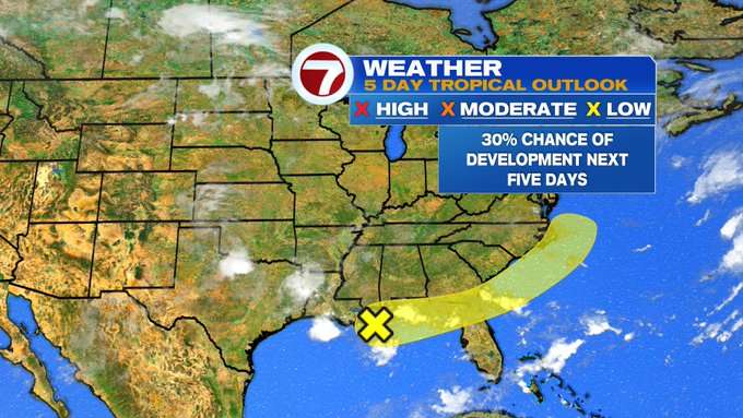
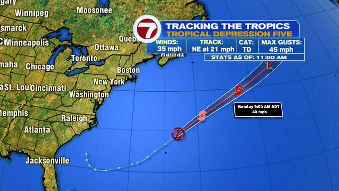
Speaking of named storms, Tropical Depression Five which passed just north of Bermuda earlier this morning will continue its trek away from New England, but could become Tropical Storm Edouard later today when sustained winds reach >39 MPH.