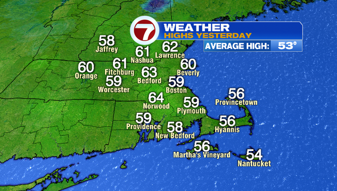
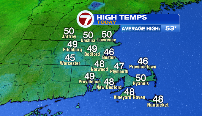
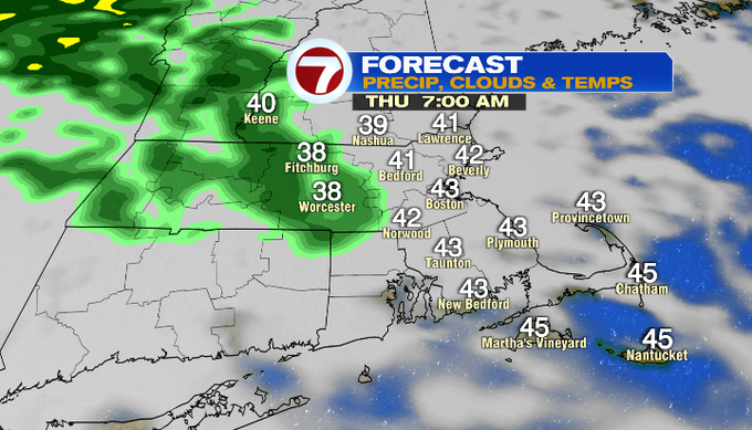
What a difference a day makes! Yesterday, we had a mix of sun and clouds and highs in the upper 50s to low 60s. Today, it was rainy with overcast skies and highs in the 40s to around 50° with a east-northeast wind that made it feel even cooler.
Tonight, we’ll have a few passing sprinkles, otherwise mainly cloudy with some areas of patchy fog. Overnight lows will slip into upper 30s to low 40s.
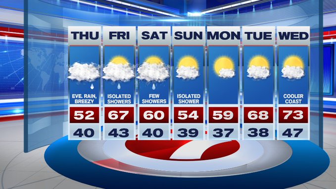
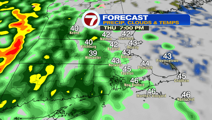
Tomorrow, similar to today, we’ll have the overcast skies, but the shower activity will be spotty during the day, turning widespread after sunset tomorrow evening. Highs tomorrow will be in the upper 40s to mid 50s.
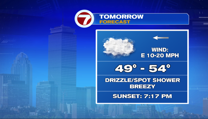
As far as timing of the rain, we’ll have a few showers early tomorrow morning, but much of the daylight hours will be mainly dry.
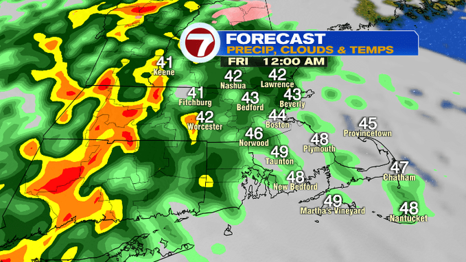
By tomorrow evening around sunset, showers start to spread in, but the heaviest rain holds off until after midnight.
That line of oranges and reds indicate the heavier downpours, which begin to slide in from west to east from midnight to 4am Friday.
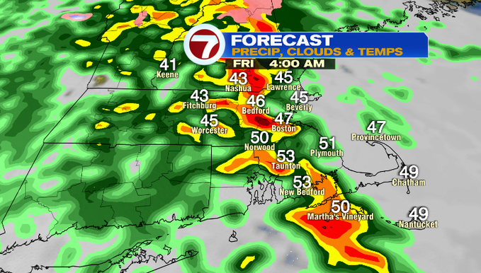
The heaviest of the rain should move off the coast by the Friday morning commute, but you’ll likely have to watch out for ponding on the roadways.
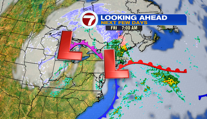
As for the rest of Friday, we’re looking at some isolated showers through the day, but not a complete washout. We could even see a few glimpses of the sun, allowing those temperatures to warm up into the mid to upper 60s.
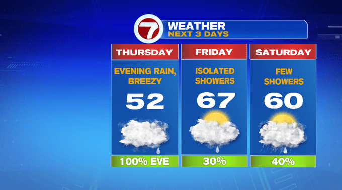
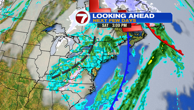
Looking ahead to the weekend, Saturday features a few showers as the low pressures that are bringing the rain to us tomorrow will meander to our north.
Sunday features a spot shower chance, with highs into the mid 50s which is nearly seasonable for this time of year.
For the next work week, we have a warm up through midweek that features upper 60s Tuesday, low 70s by Wednesday!