
7Weather-The next two days are mainly dry, and then a wintry mix moves in early Thursday morning.
Tuesday may start will some sun, but then clouds move in by mid-morning. There could be a few sprinkles throughout the day, and highs reach into the low and mid 40s.
A high pressure system north of us could bring in some peeks of sun Wednesday. A spot shower is possible in the morning, and temperatures reach into the low 40s.

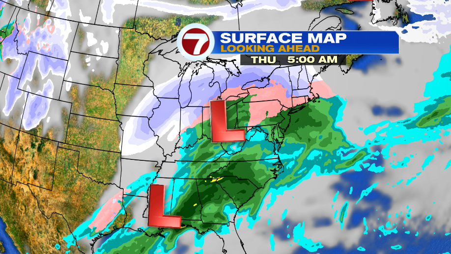
Things start to get active early Thursday morning. Light snow is expected ahead of a low pressure system, but it won’t amount to much. As of now it looks like 1-3″ of snow north and west of I-495, and 1″ or less for Boston, before transitioning into a wintry mix. The snow will only last a few hours, ending during the second half of the commute. Plan on giving yourself extra time.
The precipitation transitions from a wintry mix to plain rain by mid-day. There will light showers through sunset.

There’s a short break from rain Thursday evening, and then periods of heavy rain develop early Friday morning. The heavy stuff continues through the morning, and then spotty showers linger in the afternoon with a few wet snowflakes mixed in.
