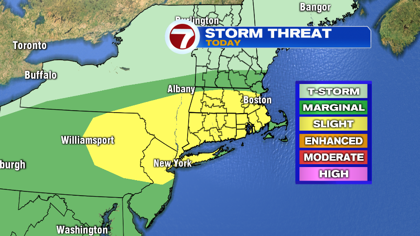
Temps soar to near 90 this afternoon, this time, with high humidity too. Scattered storms develop mid to late afternoon too, providing torrential rains and strong wind gusts where they do hit. While one or two of these storms may reach severe limits with damaging wind gusts, a more widespread issue with these storms will be the downpours. With added water vapor to the atmosphere thanks to remnant moisture from Barry, the atmosphere is juiced to provide a lot of rain in a short amount of time. A few towns could locally pick up a quick 2-3″ or rain, producing poor drainage/street flooding, while other towns only pick up a 0.25-0.50″ of rain.
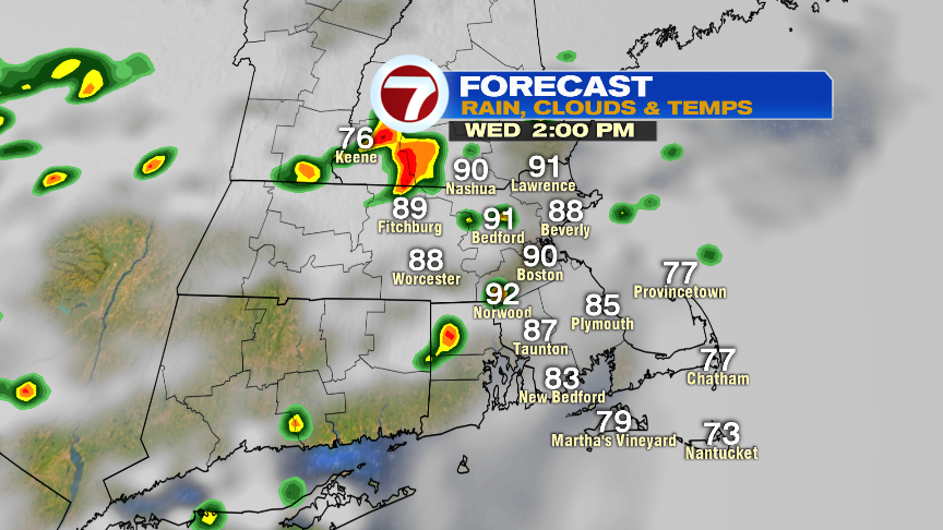
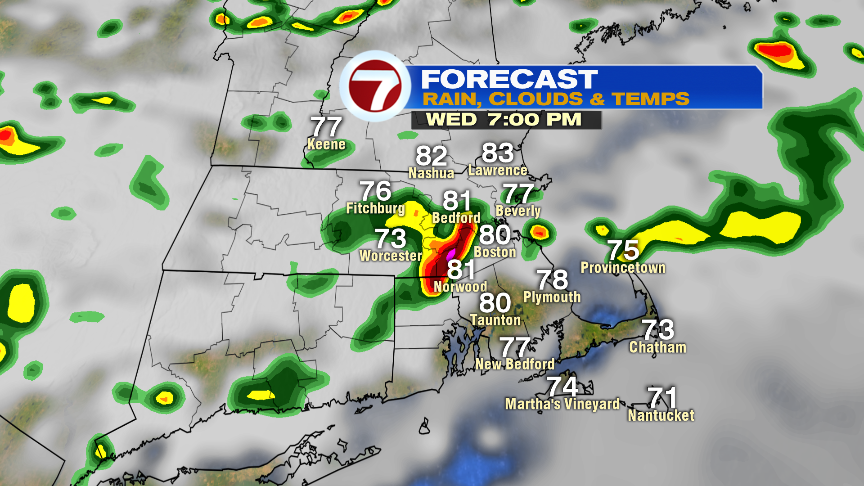
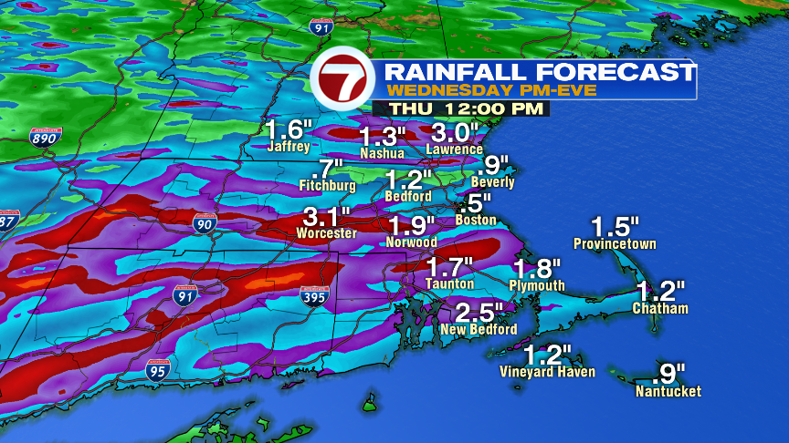
While the graphic below is not meant to be exact, it does show the general idea of how variable rainfall totals will be with these storms.
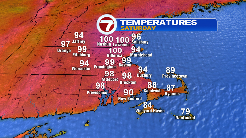
Over the weekend, it’s all about the heat. The last time Boston hit 100 was July 22, 2011 with a reading of 103. If we get all day sun, we’ll hit 100 on Saturday. If some morning clouds are around, the numbers will hold into the mid to upper 90s. Very hot and very humid none the less.